Menu Close

Category: Adventure Runs

Running the Sanpitch mountain range top end-to-end

range

The Sanpitch Mountain Range is just south of the Wasatch Mountains.  Perhaps you have looked over to these mountains as your drive south on I-15 between Nephi and Scipio.  I’ve looked up there wondering if you could run along the top of them. The Sanpitch Range is about 40 miles long and its highest point is Salt Creek Peak (9,997 feet).  The range was named after an Indian leader, who was the leader of the Sanpits that resided in Sanpete Valley during the mid-1800s.

After an adventure exploring the Sanpitch three weeks earlier, I became determined to attempt to run the mountain range end to end, a run of more than 50 miles.  There wasn’t much information online about the mountain range top, which is mostly just visited by hunters and ATVers. I planned out my route using topographic maps and hoped that the trails and roads still existed.

Quad Squaw Peak

Squaw-Peak

Somehow years ago I got into my head that it was cool to run repeats of high peaks.  I do recall probably in 2004, seeing a guy run up and down Mount Timpanogos twice in a day. I was very impressed.  But he only went up to the saddle and back twice, not the summit. I convinced myself that this was not quite right, that you needed to go from trailhead to summit and back, then repeat.

My crazy repeats started on Timpanogos, first two, then three, then four, and finally five summits on August 18-19, 2006.  I’m still waiting for someone to break that record, or even tie it, but it still stands nearly ten years later.  It seems like every month I meet someone and the conversation starts, “Are you the guy who…”  I think, “oh no, here it comes again.”   I get embarrassed and reply, “Yes, I’m that guy.”

I like repeats because they are on a consistent trail. You return to your car every few hours to resupply and continue on.  It also is a tough mental exercise that seems to help develop mental strength to continue on in races when I face trials.

Golden Spike Adventure Run – 51 miles

quarter

The first transcontinental railroad was completed near the Great Salt Lake in Utah, at Promontory Summit, on May 10, 1869. It was the main line railroad across the country until around 1904 when a new line was cut across the Great Salt Lake and bypassed Promontory.  The original historic route continued to be used for passenger traffic for many more years.  In 1942 the tracks were abandoned as the rails were needed to support the war effort during World War II.  Today in this remote area, the railway grade is still clearly visible and runnable.  I had always wanted to run on this historic railroad bed.  I finally made the trip and ended up running about 32 miles on it.

Run around the Onaqui Mountains – 48 miles

IMG_0249 (1024x708) (640x443)

I guess I have a strange obsession with running around mountains and mountain ranges.  Most people like to bag mountains by climbing to the top.  I like to bag mountains by running around them.  This Saturday I bagged another mountain range, the Onaqui Mountains in the west desert of Utah.  These mountains lie south of the Stansbury Mountains (Deseret Peak) and north of the Pony Express Trail.

This loopy obsession began on May 2004 when I ran around the mountain behind my home, Lake Mountain, a loop of about 32 miles.  That felt like an amazing accomplishment at that time.  Since then I’ve probably run around it nearly 15 times.   After that, for many of my solo adventure runs, I’ve chosen to run around a mountain or an entire mountain range.  My entire list is at the bottom of this article.

Remote run in San Rafael Swell

IMG_0238 (817x651) (640x510)

The San Rafael Swell is about 2,000 square miles of public land in Central Utah that is known for its scenic sandstone formations, deep canyons, and expansive panoramas.  The entire area has been lifted up and turned, leaving an angled reef displaying amazing rock formations, domes of sandstone, and rugged ridgelines. The area is harsh in the summer and is often overlooked to visit except for off-road vehicle enthusiasts and horseback riders.

A Wilderness Study Area has been established in the Swell and this has been somewhat successful in keeping the ATVs out of pristine canyon areas and high plateaus, leaving areas of solitude.   I was interested in exploring the Sids Mountain Wilderness Study area, a very remote area in what is known as the Little Grand Canyon of Utah.  Late winter is an ideal time to run in the area because of the spring-like temperatures, some flowing water and lingering snow patches.

Cathedral Valley Loop – 47 miles

1 (768x528)

Cathedral Valley is one of the great remote areas of Utah that receives very few visitors.  In 1945 the first superintendent of what was then Capitol Reef National Monument, christened this area of fantastically eroded cliffs, sandstone monoliths and panoramic views, as Cathedral Valley. To him, the scene seemed downright Gothic. Compared to the more popular Waterpocket Fold area to the south in Capitol Reef National Park, not many people choose to make this trip.  It usually requires a high-clearance vehicle and at times a 4WD vehicle.

During most of the year, a 64-mile loop (including a paved-highway connector) can be driven to view this spectacular area.  Last year (2015) I made a brief visit to Cathedral Valley and recorded this video.  This year, I decided that I would try to run the entire loop.  Instead of running the highway to connect the ends of the road, I would use a remote 4WD road (0146) to complete the loop.  This would make a loop of about 43 miles, most of it on fast maintained dirt road.  Surely no one had ever attempted this before and I would discover another epic long run.  With some sight-seeing detours along the way, my run would be 47.2 miles.

41-mile run to a Christmas party

“Why drive if you can run?”

I am currently training for Across the Years, a fixed-time race on Dec 28th where you try to run as many miles as you can during a fixed period of time.  I entered the 48-hour race again this year.  For me, effective training leading into the race involves high mileage on mostly flat terrain.  Treadmill miles also helps, increasing foot speed.

So, my challenge is to keep motivation up and boredom down doing this training. I recently bought a good incline treadmill which is more convenient that using our neighborhood rec center with poor treadmills that seem to always break down often.  I’ve also grown weary of reactions as people come in, seeing me on “their treadmill.”

oval (640x474)

As weather gets poor another option I’ve used recently is to run at the Olympic Oval in Kearns, Utah.  That is the site of the 2002 Olympics speed skating events. There is a 442 meter running track around it. One day recently I ran 140 laps for nearly 39 miles in about seven hours. It was cool watching the USA teams train, including speed skating (with gold medalist Shani Davis) and short track teams. Some China team members also were training there. I mostly had the entire track to myself during that time.

This weekend, we had our annual extended family Christmas Party at 12:30 p.m. on Saturday in Midway, Utah (near Park City).   Wanting to still have a long run to finish off the week, my son-in-law joked that I should just run to the party.  To me, it wasn’t a crazy suggestion.  I looked at the route options and discovered it would be about 41 miles along familiar roads and trails.  It didn’t take long for me to decide I would do it.

Run Around Utah Lake – 84 miles

lake

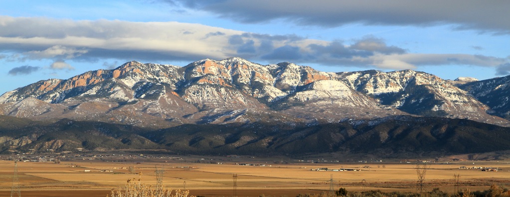
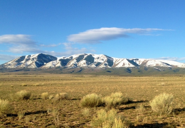
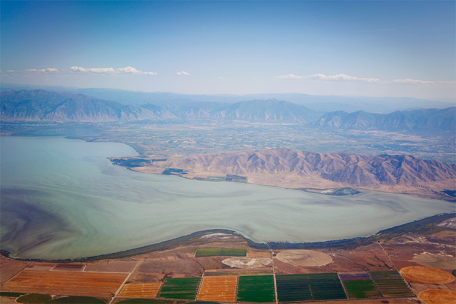
Utah Lake is the largest freshwater lake in Utah.  Many rivers, streams, and creeks flow into it and there is only one outlet near my home, the Jordan River.   It is 12 miles across at its widest point and about 21 miles long, with an additional seven miles of soggy farm land near its inlet.  Archaeology finds indicate that there have been settlements near the lake and river as far back as 3,000 years.  Mormon settlers established the first modern settlement in 1849. In the 1800s the fish in the lake was overharvested and restocked with non-native species.  Pollution has been a problem over the years as raw sewage was dumped into the lake as late as 1967.  Some pollution problems still remain.  The lake is very shallow with the maximum depth about 14 feet with the average about 10 feet deep.

Each year hundreds of cyclists ride all the way around Utah Lake using a 100-mile route for a “century” ride.  There is no established trail that runs near the shores of the lake, so roads are used.  Most of the route around the lake is rural farm land with the exception of about ten miles on the east side through the Provo-Orem metropolitan area.

In 2013 I got the idea of running all the way around Utah Lake in a day and was the first to accomplish that on November 15, 2013, using a route of about 82 miles. See video of that adventure.

This year I was anxious to repeat the long adventure.  I had recently signed up for Across the Years 48-hour run (Dec 28th) and needed some good, long, flat training.  I chose December 5th to run around the lake again.  I knew it would be colder.  In 2013 I cut out a couple miles by running on railroad tracks in certain sections, but I knew I shouldn’t do that, so this time I chose a route that would be about 84 miles.  The west side of the lake is pretty straight-forward with only one road to take you south, but on the east side with all the roads and towns, you can choose various routes.  This time I let Google Maps decide much of it but still included a mile of trail that hugs the lake at its widest point to avoid a bunch of urban roads and stay on the lake side of I-15.

Grand Canyon Double Crossing #15

map

Nine years ago, in 2006, I accomplished a quad crossing of the Grand Canyon (R2R2R2R2R).  This has only been accomplished by six runners and no one has accomplished it twice.  I was interested in trying to do it again.  The total distance is about 88 miles and involves about 25,000 feet of climbing along the way.

It had been two years since I had run in the canyon.  I typically enjoy running there on Thanksgiving weekend when temperatures are cool (and some years it is pretty frigid).  But for this long run I decided to go a week earlier when it would be a bit warmer.

After staying overnight in Kanab, I headed to the North Rim.  As I drove through the meadows near the park entrance the temperature dipped to 16 degrees but at the trailhead it was a “warmer” 23 degrees.  I made my preparations, and was on that trail at 6:03 a.m., running down the very familiar trail in the dark. This was my 31st time on the North Kaibab trail (going in either direction) so I knew every section and turn very well.  There was some slick snow/ice for the first mile but nothing dangerous because that section doesn’t have cliffs to the side.  I did trip and fall three times during that first couple miles but the falls were minor.  I was frustrated that as I get older, my balance and skill seems to be decreasing, but as dawn arrived, the increased light helped.

Uinta Mountains adventure

20150829_075204 (640x459)I made a return trip to the Uinta Mountains for another very long Saturday run.  Dry August weather makes it an ideal time to experience the high mountains away from the valley heat.  I hoped for to do a long loop of about 50-miles and decided to start very early in order to give myself plenty of time on the rugged slow trails.

I arrived at Moon Lake on Friday evening and decided to just rest at the trailhead in my car for a few hours.  At 11:53 p.m. I was away on my nocturnal adventure.  A nearly full moon was out to cast light on the hills around me.  For the first 16 miles, I would be running in forest up Lake Fork, starting at 8,000 feet.  Getting off trail in the dark was not a real worry because the horse-worn trail was very distinct and easy to follow. I had run 16 miles last week in Lake Fork and knew what to expect on this mostly boulder-free trail.

Uinta Mountains Loop


sign

The Uinta Mountain range is the highest in Utah. Much of it is protected by Wilderness area. I enjoy running up in the high Uintas because of its remoteness and rugged beauty.  Most hikers and runners who go to the Uintas, only go to the heavily traffic areas, Mirror Lake area on the far west, or Henry Fork in order to summit Kings Peak, the highest peak in Utah.  However, they are missing much more beautiful sections, better trails, and more interesting peaks that are usually only seen by backpackers or horseback riders.

Weather is always a challenge. The Uintas are usually subject to significant afternoon and evening thunderstorms that can be very scary if you are high up.  Finding key times when the weather is calm allows for much safer and more enjoyable periods to explore the high mountain region. This past week was such a time so I made plans for a new long run.

map3

When you consider the Uintas trails, think boulders. Most of the trails run north/south up and down the drainages and the trails consist of imbedded boulders, obstacles for running, that have been exposed by runoff and years of horse traffic.  In contrast, the Highline Trail runs east/west near the center spine of the range and crosses over many high passes along the way. I’ve run the Highline Trail end-to-end two times (once solo) but it requires convincing someone to help you shuttle a car or drop you off at the far end, a service that takes about eight hours.  My family is now smart and declines when I ask for that shuttle help.

Running the high ridges in the Wasatch Back

I enjoy running on high ridges.  As I drive places in my car, my eyes are always drawn up to the tops of high flat ridges and I wonder if they can be run.  When you drive through the Wasatch Back, there are many such ridges that indeed can be run and usually only get attention by hunters, ATVers, and snowmobilers.  One such area had been on my list to explore — the ridges between Soldier Summit (Spanish Fork Canyon) and Strawberry Reservoir.  Years ago I had run Strawberry Ridge but I knew there were many others to explore.

Early Saturday morning, I drove up Spanish Fork Canyon and parked just east of Soldier Summit at the first road on the north side.  There is a Forest Service kiosk there but only a general map for information.  I began my run at about 3:45 a.m., running up the road that follows the Left Fork of the White River, starting a clockwise loop, hoping for about a 50-mile run.