

July 19-20, 2008
I made a return trip to run the Tahoe Rim Trail 100. Back in 2006, this was my 4th 100-mile finish. This year I had my sights set higher, hoping for my 18th 100-mile finish and to do it in less than 25 hours.
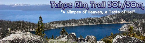
This beautiful course is laid out on state park and state forest land, climbing ridges overlooking beautiful Lake Tahoe and various reservoirs. The surface is mostly very runnable, soft single track. There is about 19,500 feet of climbs, aided by many switchbacks. Most of the course runs between 7,000-9,000 feet elevation. The race website says, “This event is run in some of the high elevation alpine and sub-alpine regions of the magnificent Sierra Nevada Mountains. It begins and ends at the Spooner Lake State Park, which is at 7,000 feet. The highest point on both courses is just below the 9,214 foot Snow Valley Peak (which also provides one of the best views on the course). The low point on both courses is at the bottom of the now “infamous” Red House Loop (A Taste of Hell) at approximately 6800 feet.”