

![]()
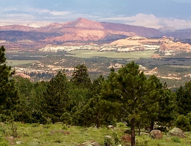
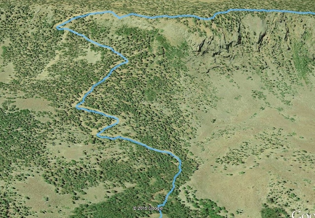
I ran the very challenging Capitol Reef 100. This 100-mile course runs on the Aquarius Plateau which rises about 6,000 feet above Capitol Reef National Park which is off to the east. The Aquarius Plateau is the highest plateau in North America and covers more than 900 square miles. Little did I know how tough this race would be for me. I had hoped for a 27-hour finish, but I tossed away that hope about 25 miles into the race. What makes this race so tough is the altitude (all but 12 miles above 9,000 feet), boulder-ridden trails, and constant route-finding (even with good markings).
I’ve run many adventures in nearby Capitol Reef National Park so I have a great fondness for the region. I have driven the highway below the Aquarius Plateau, have seen the trailhead signs for the Great Western Trail, and have always wanted to experience the trail in this section of Utah.This was my chance. My experience was unforgettable.
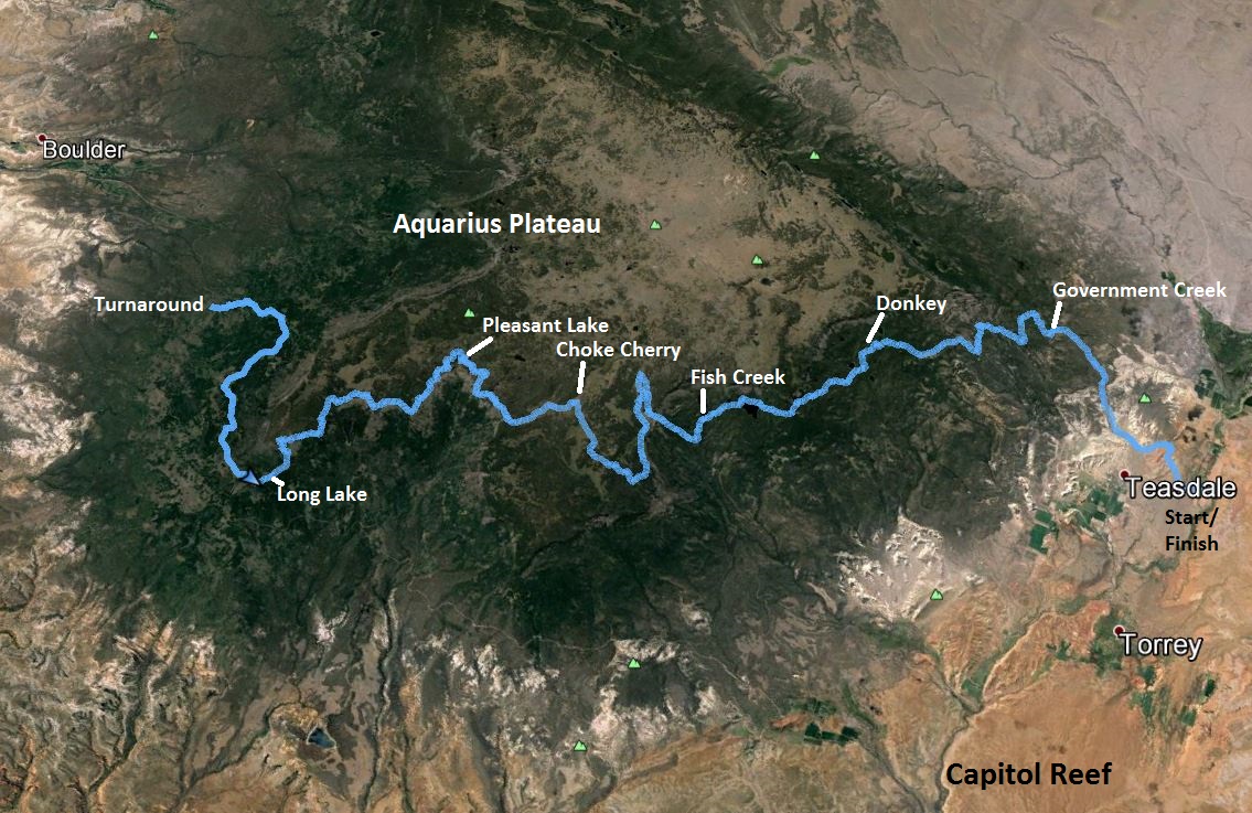
I did a little exploring the day before the race and obtained an appreciation of just how remote this course would be. Race Director, Matt Gunn, explained at the race briefing how difficult it was to reach most of the aid stations by vehicle. He described boulders in the roads and trails that couldn’t be appreciated until experienced. We would be running on trails that have had very little human traffic. The 100-mile course was an out-and-back of the 50-mile course.
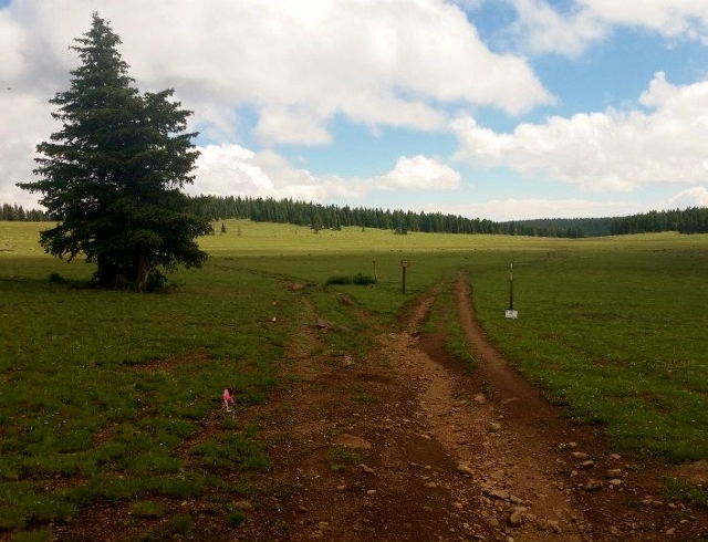
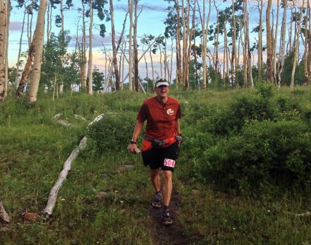
I spent the night at a motel in Torrey, just three miles from the start and slept well for a change. At 6:00 a.m., a small group of 29 100-milers started off together in the early morning light, running up a road toward the plateau high above.
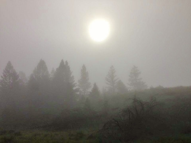
The first low-land three miles took us through winding roads and washes with red rock formations. With the thunderstorms during the night, an eerie fog surrounded us as we cruised up and down various ATV trails. I settled in to a nice pace and ran close to buddy and very experienced runner, Carter Williams. A week earlier, I had conquered one of my most difficult adventure runs, climbing to the top of the highest peaks in my county. I had rested all week, but could still feel some of the effects of that run, so my expectations for a good performance were pretty low. I ran and chatted with Carter for a couple miles and then could no longer keep up.
Once out of the ATV trail area, we ran up a 4WD road that started to climb quickly up the plateau foothills. Quite a few runners passed me. I arrived at Government Creek (mile 6) at 1:15, well ahead of my predicted schedule. I chatted quickly with the kind volunteers who were experiencing their first time helping with an ultra race. They asked me if I had run a 100-miler before and I explained that if successful, this would be my 71st 100-mile finish. I heard gasps and was asked, “that would be more than 7,000 miles?” I nodded, grinned, thanked them and was away again.
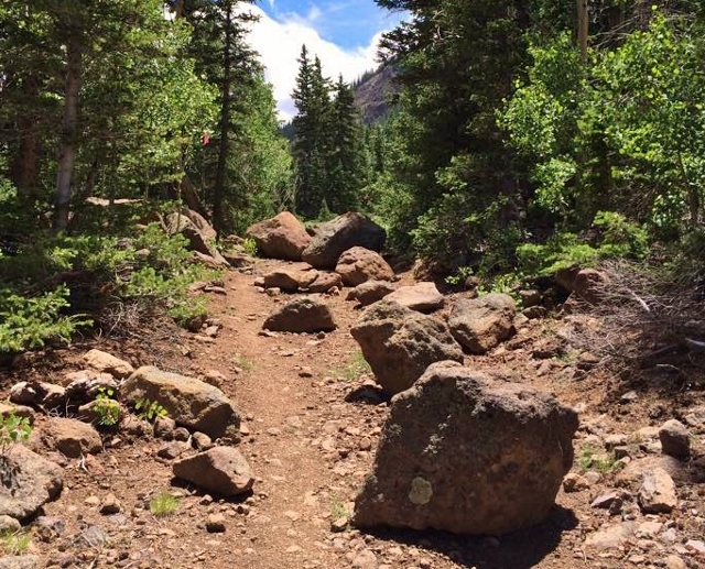
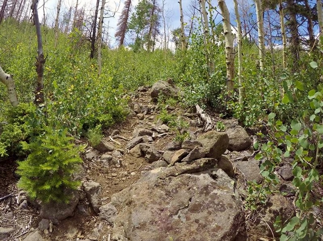
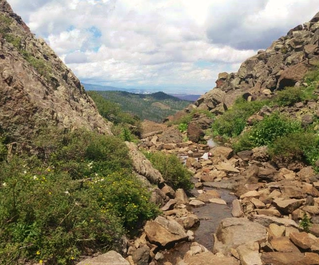
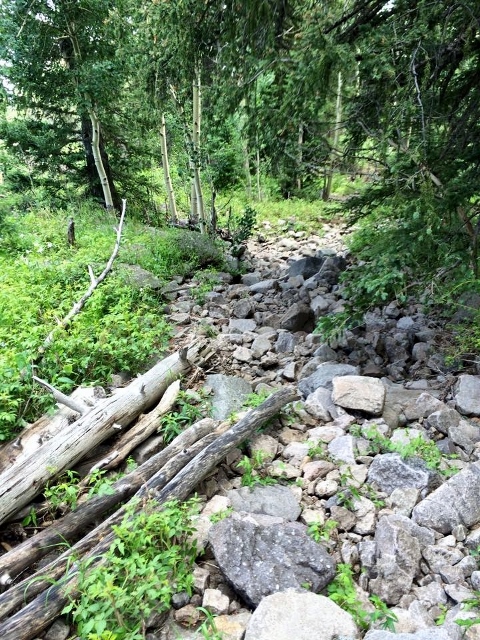
The kind dirt road was gone and we were introduced to the true trails of the Aquarius Plateau. The single-track trail climbed above Government Creek and it started to be riddled with large buried rocks or boulders. They were very similar to the trails in the Uinta Mountains. I have run so many miles in those mountains and I quickly tapped into my memories and started to use the techniques I’ve used there. My stride lengthened to leap over rocks and I worked harder to keep a straight line instead of dodging the obstacles. On the downhills I would treat the boulders more like ski moguls and work to keep my downhill line straight and fast.
We climbed up and over a ridge into yet another drainage that had been ravaged in recent years with fire. The valley was full of young aspens creating bush-filled trail obstacles. Now memories of running such trails in the Ruby Mountains a couple weeks earlier filled my mind and I marveled what great training that was for this race. I passed several runners and pushed ahead in the brush.
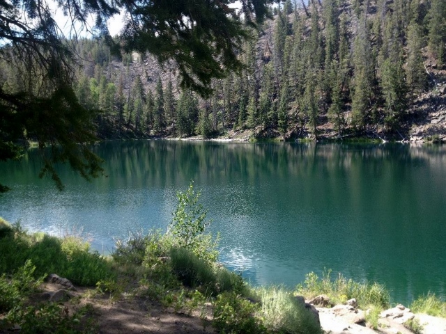
We came to a junction for our first of many lakes, Lost Lake. The sign indicated that we were to visit the lake in an out-and-back, totaling a half mile. I ran to the beautiful lake but was surprised that the runner ahead of me had skipped this section. He was nowhere to be seen. (I know that many others also skipped it). I punched my bib at the turnaround and went back to fight the rest of the young aspens. Such out-and-backs need to be removed from courses like this. It is nice to see the sights, but too many runners get confused or tired and skip them. Oh well, I would end up doing a mile further than many other runners.
The vegetation changed the higher we went. Mosquitos appeared and I regretted not spraying myself. All I could do is try to push my pace harder to get away from the pests. Eventually a nice breeze kept them away. We climbed above 10,000 feet and entered a forested lake region on a broad ledge about 1,000 feet below the top of the plateau.
I reached Donkey Reservoir (mile 13) at 3:23, only 8 minutes behind my hoped-for schedule. We next ran by lake after lake, Green Lake, Blind Lake, Pear Lake, and Beaver Dam Reservoir. At one point we crossed a wide open field and I saw a runner ahead. I set my sights on him and soon caught up and passed him and later other runners. With only 29 runners in the race, we were now getting scattered and I knew it meant solitude without seeing any other runners. That was fine and I enjoyed the peace and quiet. I was running in about 12th place
I arrived at Fish Creek (mile 18.6) at 4:57, still only 11 minutes behind my schedule. But, I discovered that the published distance for this aid station was off and predicted that the course would probably end up being short. (It would be about 3.5 miles short).
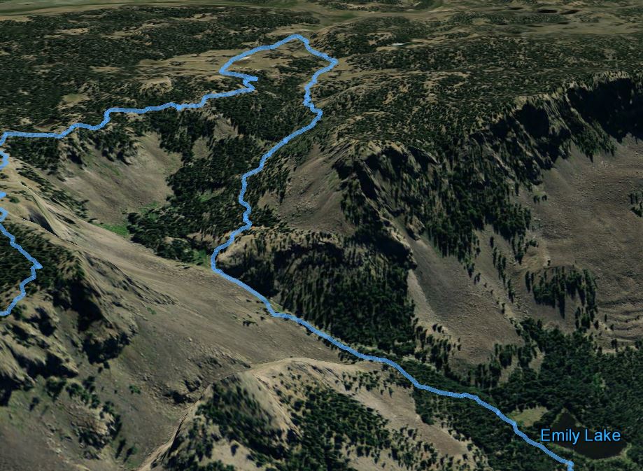
Next up was a huge 2,000-foot climb up along Fish Creek to the top of the plateau to over 11,000 feet. The climb was steep and rough but with some switchbacks. I kept looking down below to see if any runners were on my tail, but there were none to be seen, I was now far ahead.
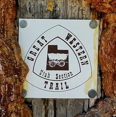
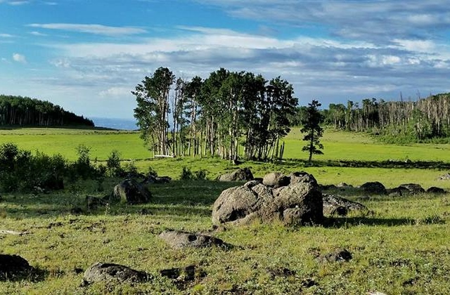
On the top of the plateau, I was introduced to what would be the main challenge of the race. We were now on the Great Western Trail, but the trail receives very little traffic and thus was not much of a trail at all. There however were many cairns, blaze marks on trees, and the route was well-marked with flags for the race.
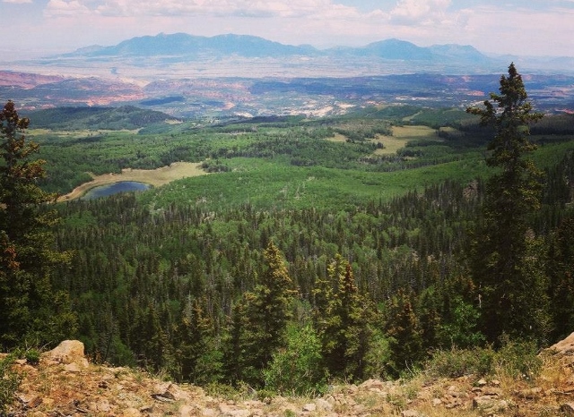
The trail rolled up and down and would take us close to the rim for some spectacular views. As it entered into the forested areas, route-finding really started to be a challenge. We would face three major sections of rim trail that were especially challenging. The trail/route would take sudden turns. If I was trying to run fast, I would always have to screech to a halt, look around me and discover that I needed to turn. This happened over and over again but my skill at staying on the route increased.
To stay on course and to keep your speed up, you needed to look for four things: flagging, cairns, blazes on the trees, and a worn trail. Eventually I noticed patterns. When the trail went close to the rim and visited it, the route would always take a sharp turn away from the rim. Also, very frequently when a large cairn existed, it marked a sharp turn and could be seen in both directions. These navigation clues took a while to get into my head, but as they did, it helped.
To me, the route-finding exercise was great fun and I loved the experience. I knew that my pace was being destroyed because of it, but I quickly threw away my pace goals and just settled in to enjoy the experience of this adventure.
I finally broke out of the forest into meadows. It was refreshing to run in a straight line for a while. I passed two runners who looked like their pace had been beaten down by the trail. I still had a good strong uphill pace and trotted ahead leaving them far behind. A dirt road riddled with boulders took me up and over the top of the plateau where a cold headwind hit me. The temperatures around 11,000 feet were nice and cool. I had a jacket around my waist but never reached for it during the day.
This segment ended up with a nice downhill fast run. Instead of running in the 4WD ruts, I chose to run on the wide open grass slopes. I finally arrived at the Choke Cherry aid station (mile 27.2) where the volunteers were trying to stay warm out of the wind rocking their tent. Another runner was huddled inside.
That last segment was 8.6 miles. I had taken 2:36 to cover that distance and was more than 45 minutes behind my schedule. I no longer ever looked at that schedule. I reached my main drop bag, ate my own food and chatted with the volunteers. They mentioned that other runners were commenting how difficult the trail was and that some had become lost for a while. I had never gone off course once, but certainly had stopped many times to find turns. I asked if the trail started to head down and they said it did. “That means it will get warmer,” I said. The other runner replied, “I hope so.”
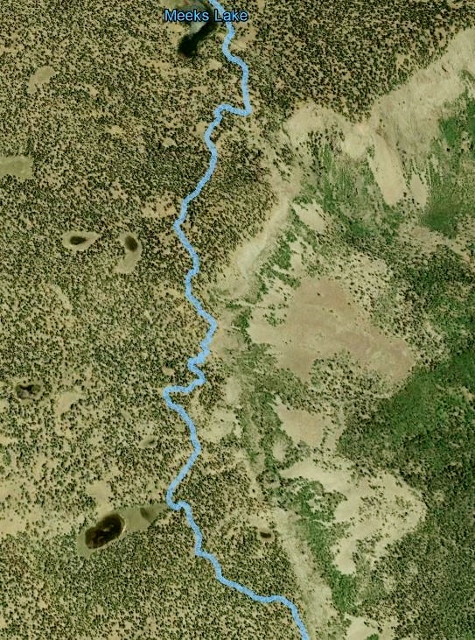
Back on the trail again, I turned up the pace. With the recent passes, I was now in 8th place and would hold on to that placement for the next 50 miles or so. The trail indeed went downhill and for the next two miles was a fun, fast run down open, but rough meadows. That easy running came to an abrupt end, after running by Meeks Lake, as I entered the forest and experienced again the crazy zig-zag trail near the rim. This segment was even harder than the first with very little evidence of human traffic.
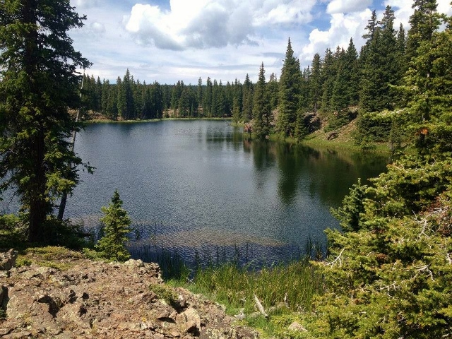
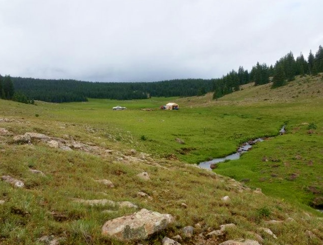
After another 45 minutes of route-finding, I came to Pleasant Lake and heard the sounds of cheery campers. I broke out of the forest and soon arrived at Pleasant Lake aid station (mile 31.8) at 8:56. It was now nearly 3 p.m. My stop was fast and as I left, I noticed another runner arriving which pushed me on faster.
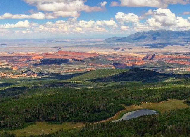
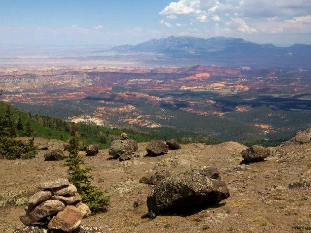
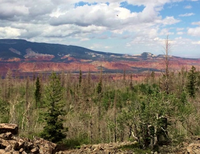
The next segment was a long 8.4 miles. It involved yet another very long zig-zag rim trail that seemed like it would never end. But it did at scenic Browns Point where the views toward Capitol Reef were amazing.
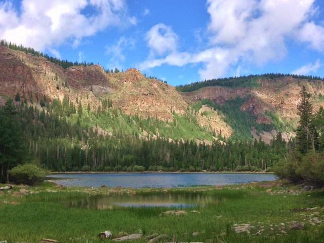
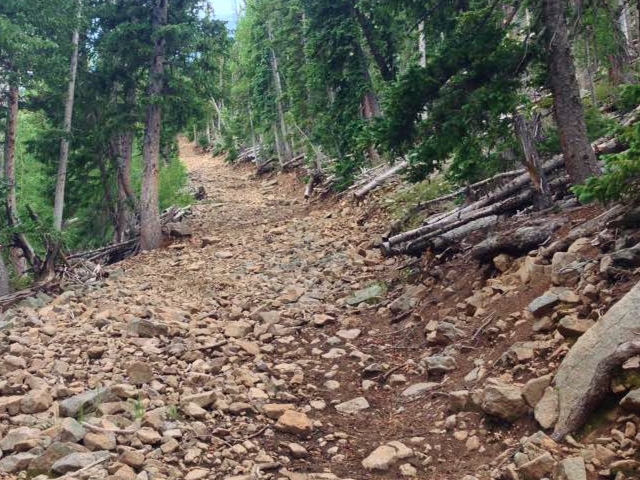
But then I was faced with yet another nightmare. It was the “stock trail.” After taking in the amazing sight at Browns Point, I looked at the trail heading down and couldn’t believe my eyes. This very wide, extremely rocky and steep trail descends 1,000 feet and is used to get cattle up on the plateau. This was the craziest trail I had ever seen during a race. It was amazing and very hard. Peter van Horn later called it, “the waterfall of rocks.” You could find routes through the rocks that humans had used that were a little less rocky and I tried to keep up some resemblance of speed by using those. Finally the horror was over and I ran on a soft dirt road (without rock!) around Long Lake to the aid station.
I arrived at Long Lake aid station (mile 40.2) at 11:32. I knew it would be impossible to return to this aid station before dark, so I took with me a head lamp, not yet using the green light so I could still carry two water bottles as I descended to the hotter turnaround. My feet were starting to bother me and I took one shoe off expecting to see dirt in the shoe or socks, but there was none. I would just have to cope with the expected hot spots and possible blisters forming due to the terrible uneven running surface for so many hours.
On the way again, I ran across wide open fields again, fenced off for the cattle. In about four miles, the two front-runners for the 100 came toward me. They were about eight miles ahead of me and running well. It was nice to see others on the trail after hours of solitude.
The trail became even more rugged as it entered thick brush on a steep descent toward Chriss Lake and the turnaround. I was indeed still in 8th place and none of the runners ahead of me dropped out at the turnaround. Carter Williams was the next runner ahead of me, but was about three miles ahead. We stopped briefly to chat about our miseries.
I reached Chriss Lake trailhead, the turnaround (mile 48.2) at 13:41. Yes, the course was short, but I was glad because it seemed to be very, very long. I had hoped to cover the first half two hours faster, but that just wasn’t in the cards for me. I made a very quick stop, anxious to see runners behind me coming toward the turnaround.
I grinded my way up the steep bushy trail and found out that the next runners were about 1.5 miles behind me. Others appeared including Sam Jewkes who was doing well, about four miles behind. Tony Christensen appeared, running hard, about six miles behind and then Michael Cummings as it was getting dark, about 8 miles behind me. Michael said he was calling it quits. I was somewhat envious. A few other scattered runners moving slowly would bring up the rear. The furthest out would be a runner about 30 miles behind me who complained about being lost and going around in circles in the forest for a very long time.
I arrived back at Long Lake (mile 56.2) at 16:35 (10:35 p.m.). I put on another layer for the night but was alarmed that I had no gloves at this stop. I grabbed some spare socks to use as gloves until my next bag 16.4 miles away. I was ready to face the blasted stock trail in the dark. As I climbed, I just put my head down and grinded it out as fast as I could. I was very surprised when I reached to top because it came sooner than expected. From the view point I could see lights of runners below and I flashed my green light toward them.
My thoughtswent to the 50-milers who would start their race at the turnaround at 6:30 a.m. I had nearly an eleven hour head-start on them. Could I finish before any of them caught up? I was now moving so slowly that I began to wonder. I entered the first zig-zag rim trail section and discovered that it was easier at night with the reflective flags but harder to pick out the cairns.
This 8.4-mile section was too long for this point in the race. It became colder and colder. Frost appeared. Socks were on my hands for gloves. I knew I needed to push harder to generate heat. I had three layers on, including a wind breaker, but that wasn’t enough. I had been tending my stomach very carefully, but because my pace slowed down so much, I nearly ran out of food in my pockets. My stomach started its usual rebellion and I slowed even more and I became even colder. I discovered that if I stopped completely, there was less of a breeze and I warmed up a little.
I was becoming miserable. Hypothermic symptoms arrived and I started to stumble slowly along. I counted off the miles and couldn’t wait for the next aid station to appear and save me. I finally returned to Pleasant Lake aid station (mile 69.2) at 20:08 (2:08 a.m.). Those 8.4 miles had taken me 3:33.
“What do you need?” asked the kind volunteers. “I need to get warm, and fast!” For the next 28 minutes I stood next to the propane heater. My stomach went south and I did all I knew to help it. I had fears of staying there for hours. I discovered that if I stood, rather than sit, the stomach started to recover. I asked how far the next segment was, and they said six miles (really 4.6). I groaned and didn’t think I could battle the cold without another layer which was at the next aid station. But the volunteer saved me. He took a nice warm hoody off and gave it to me. This could work.
As I left, three runners behind me were approaching the aid station. As I got moving again, I started to feel warm again but with a tender stomach. My pace was good and soon I could even take off the hoody for a awhile until it dropped below freezing again. Then drowsiness hit me and I really slowed down. Finally climbing up wide open fields, I saw runner lights behind me. It was amazing how that woke me up and I pushed hard all the way to the next aid station.
I arrived at Choke Cherry aid station (mile 69.2) at 22:40 (4:40 a.m.). Now with a drop bag full of clothes, I didn’t take any with me because dawn would appear soon. I knew further down the road, heat would be the issue to battle. I stayed there 9 minutes and as I left the runners behind arrived. It seemed like they took very long stops and each time I pushed a lead of more than a mile.
Dawn arrived as I reached the high point of the course. Drowsiness hit again and this time I stopped to close my eyes and rest for five minutes. That did the trick and I moved on. In the dawn light, the rim trail zig-zags were tough to navigate. The pink flags no longer reflected and the cairns were hard to see in the early light. The massive descent along Fish Creek was very painful. My feet were rebelling and blisters under prevention tape had formed and hurt like crazy. I carefully picked my way down and arrived at Fish Creek aid station (mile 77.8) at 26:11 (8:11 a.m.). The last 21 miles had taken me about ten hours to cover.
I knew that I still had about 19 miles to go and it seemed to be so far away. I pictured in my mind friends running the 50-miler who were now chasing me. My lead over then was now less than 20 miles. Would they catch me? As I sat at the aid station a young runner behind arrived. I knew I would lose my 8th place. As I climbed above the lakes below, he passed me moving strong. I did my best and arrived back at Donkey Reservoir aid station (mile 83.4) at 29:02 (11:02 a.m.). The final section involved a very hot dirt road climb that was oppressive to me.
I stayed 11 minutes and the volunteers were very helpful. The word was that there had been massive drops, at least half of the 100-milers didn’t continue past the turnaround. Another runner passed me in a couple miles and I now was in 10th place. I wondered if I was close to being in last place now. I was experiencing terrible big-toe pain that was now making me slowly limp. This wasn’t working at all. Would I need to quit at the next aid station with only six miles to go?
I stopped and solved the problem. My toe was swelling and the tape around it was now much too tight. I took off the tape and the pain went away. I was back in the game and could run fast again. I knew I would be able to catch the runner ahead but was disappointed when I discovered that he skipped doing the out-and-back. That bothered me, but I did as I should, although tempted to skip it too.
A couple very fast running 50K runners passed me. At first I thought they were the 50-mile leaders but I checked my watch and considered that impossible on this course. I kept trying to catch up to the runner ahead who cut the course, but just couldn’t.
It became hotter and hotter in the burned-out section. I was alarmed to discover that I was getting low on water and started to ration it. Dehydration started to hit me and finally heat exhaustion symptoms. I wasn’t sweating and my respiration was way too fast. Finally I came to Government Creek, dipped in my bottle and nearly fell down from dizziness. I still went through all of that water before arriving at the aid station.
I arrived at Government Creek aid station (mile 90.4) at 31:30 (1:30 p.m.). I was in terrible shape. The rookie volunteers there were concerned but didn’t know what to do. One ran to the creek and drenched my hat into it. I had the other bring me cup after cup of Coke. I also drank chocolate milk for more calories. Finally after a 15-minute stop I felt alive again but I feared the next hot four-mile downhill stretch to the next water station.
Those four miles were terrible. I pushed the pace as hard as I could but would have to stop many times in some cooler shade to calm down my systems. I started to even doubt that I could finish, hoping that someone would drive by on the road to take me to the finish. The sunlight was oppressive and I didn’t have sun glasses with me. I checked my symptoms, had started to sweat again and didn’t feel dizzy, so I pushed on. Clouds eventually came to my rescue and I felt a little better. I ran by a creek and almost took a big detour to go soak in it, but with just three miles to go, I continued on.
My final problems was two terrible blisters on my right foot. The final rolling ATV section was agony on my feet. I now kept looking behind me, sure that Phil Lowry and the other 50-milers would catch me before the finish came. A couple 50K runners came by who were encouraging. I reached the final water station and drenched myself in the cool water.
The last two miles was a death march of limping. I now knew I would finish for sure but that finish line just wouldn’t come soon enough. It finally appeared and kind friends cheered my finish. I did it! I finished in a very slow 33:53:41, for 10th place, in one of my most painful finishes. A total of 16 runners finished. I did reach the finish before any of the 50-milers arrived.
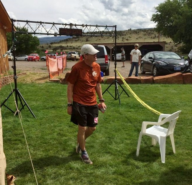
I couldn’t stop and talk at the finish. I limped quickly to my car and blasted the air conditioning on me to bring down my body temperature and cool my hot, sore feet. About 15 minutes later I felt much better and returned to the finish to claim my buckle. All my drop bags and been delivered to the finish. I tried to talk with people for a while but the sunshine started to make me feel very sick, so I returned to my car and decided to just drive straight home. That also was an endurance feat, but I was back home in less than 2.5 hours.
Wow! That was quite a race. It was my 8th 100-mile finish for 2015 so far and my 71st career finish. I rank this up with my toughest 100s. With every challenge combined, altitude, route-finding, freezing cold, blazing hot, and let’s not forget the millions of boulders, this course was brutal. But I did it! Would I do it again? Probably not. Running the 50-mile course would be plenty and enjoyable. Doing it twice turned into survival mode for the last 30 miles.
Thank you for the write up and pictures. I finished in 33:57 and felt as if I was in survival mode as well. Gorgeous country but you used the right word–brutal. Congrats on # 71.
Excellent race report Davey. Thank you for sharing, those rocky trails looked brutal! What shoes did you wear?
What an amazing area for this race. Thank you for sharing, the photos are excellent. I’m planning to get out and see the Utah National Parks using the http://www.chimani.com guide apps. Really looking forward to it!