

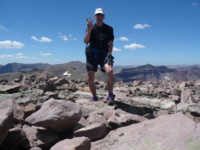
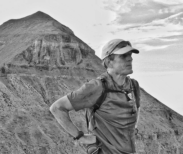
Early on during my running career (12 years as of 2015), the activity of “Peak Bagging” got my attention. Usually that involves attempting to summit a large set of peaks over time, months or years. But my approach somehow evolved into something different – trying to bag a set of peaks in one day or close to one day, in one stretch.
Back in 2003 I was inspired when I read a newspaper article highlighting Craig Lloyd’s adventure bagging the three highest peaks in Utah in one day, coined “The Triple Crown.” I had two reactions. 1. “How cool is that?” Secondly, “he did it wrong.” In my twisted way of thinking, for bagging consecutive peaks it needed to start and finish from an established trailhead, not from a base camp. Thus later in 2008, on my 50th birthday, I became the first person to “do it right” and accomplish the Utah Triple Crown from the trailhead. Many others would follow and would crush my time.
My version of peak bagging further evolved. On Mount Timpanogos I brought attention to the activity of doing “Timp repeats.” A few others had accomplished double Timps (running from the trailhead to summit and back – twice.) I went further, a triple, then a quad, and finally in one truly mind-twisted day, a quint. Others followed, several doing triples, and one doing a quad.
But then I returned to trying to bag a set of peaks in a day. Would it be possible to bag the three highest Wasatch Mountain peaks in a day? It could be done, and I discovered had been done before by Jared Campbell: Nebo, Timpanogos, and South Timpanogos. Because of the far distance from Mount Nebo to Mount Timpanogos, this involves driving between trailheads. Yes, I checked to see what it would take to only run, but the distance is extreme with miles of pavement running. No, for this kind of peak bagging, driving between trailheads is needed.
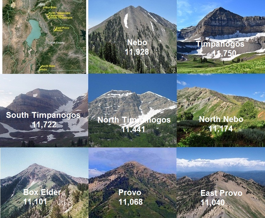
What do I use for classifying a “peak?” I like to use the 300-foot prominence rule between peaks. There must be at least 300 feet of loss and gain between the peaks. If instead 200 feet is used, it tends to include unnamed “bumps” on ridges that don’t look much like peaks, so I’ve stuck with 300 feet.
On September 13, 2013, I accomplished my first “Wasatch Triple Crown” in a slow but determined 16:27. It involved bagging both North Timp and South Timp in the fog. What I was really trying to do is to bag the highest six, but I fell short of that goal. (I also later discovered that Bomber Peak didn’t fit my 300-foot rule.)
Still determined, just one week later, I accomplished my original goal and bagged the five highest Wasatch Peaks in one day, 21:33. I thought I had reached my limits in the consecutive peak bagging department.
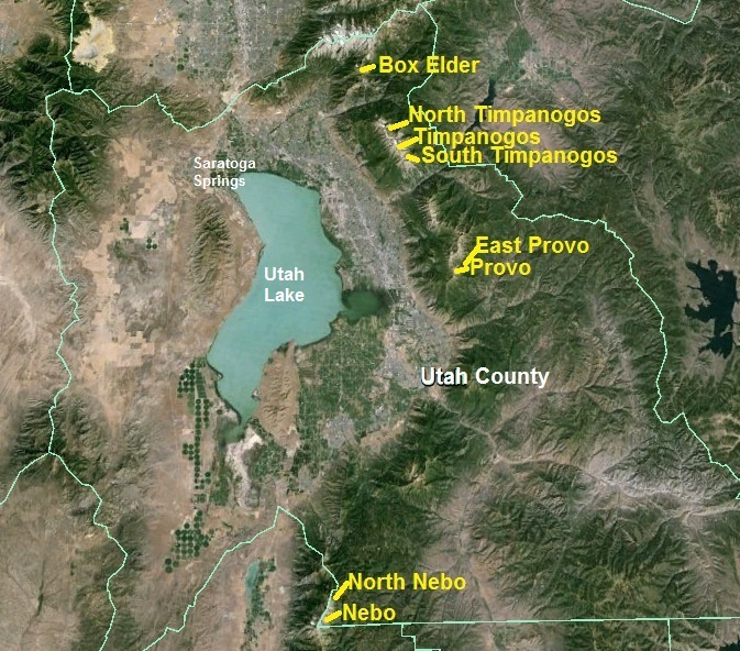
I next considered, would it be possible to bag the highest six peaks in Utah County in a day? As I looked closer, why not do all eight peaks in Utah County that are above 11,000 feet? The goal stuck in my mind. I knew it would be very tough, with about 20,000 feet of climbing, but I believed it could be done, and by me. On July 4, 2014 I made my attempt. Fireworks were firing off all evening below me in the valleys inspiring me on. But I came up short and only bagged five peaks. I learned a ton and still believed that it could be done.
Note: As I researched the peaks and tried to figure out the county lines, it appeared that both Lone Peak and South Nebo are on county lines, but on lists of peaks associated with counties, these weren’t included in the Utah County list. So, for this quest I decided that my list would not include those two peaks.
A year passed and I made my second attempt on July 3, 2015. Using all the experience from the past year, I made careful plans to compress the time it would take and to do the most difficult sections during daylight. I announced my plans on Facebook to help me not quit, and invited others along if wanted to further motivate me when times got tough.
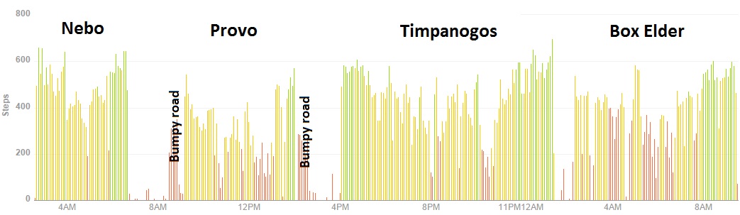
I camped for the night at the Mount Nebo trailhead. It was peaceful. I made a campfire and relaxed during the early evening. Everything I planned for was ready. After a few hours of sleep, I arose at 1:45 a.m., broke camp, taped my feet as usual for a very long run, arranged my portable aid station including cooler for all my food, stuffed my pockets, and filled my bottles. Finally at 2:40 a.m. I started my watches and was away on this brutally tough quest, to summit the highest eight peaks in Utah County.
Climbing up Mount Nebo, the highest of the eight, in the dark was no problem. This was my sixth time to summit that peak and I knew the trail well. Doing the ridge lines in the dark are a little “sketchy” but I quickly scrambled across them and arrived at the summit according the schedule in 2:12.
On the way back, I bagged “North Peak” also known as North Nebo, arriving at dawn, at the 3:10 mark. As I ran back down to my car, I was greeted by Gretchen Walla and several other runners heading up the mountain. They were very kind and encouraging. I arrived back at my car at 4:02 (6:42 a.m.). I was seven minutes ahead of last year’s pace.
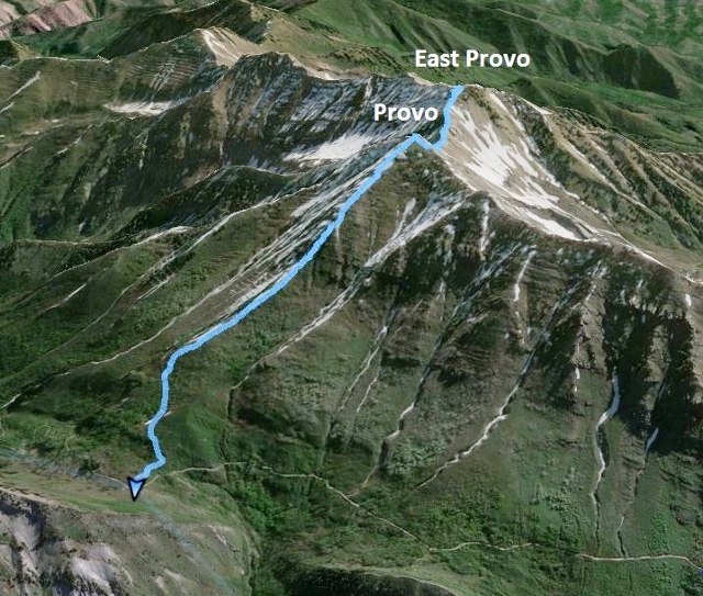
Next up was a long two-hour drive to the next trailhead, Provo Peak. This involved a long drive across the cities and a bumpy drive up the Squaw Peak road to what is considered the trailhead for Provo Peak. Along the way I rested, ate plenty, and applied sunscreen for the day. With the long drives between trailheads I would eat much better than during a 100-mile race. I feasted on Subway Subs, burritos, and cold Gingerale. Finally arriving, I left my vehicle and started the steep climb at 6:30 (9:10 a.m.).
The trail up Provo Peak is steep and straight, without very many switchbacks, and is very exposed and hot. But my timing was good. There was still some morning shade and the temperature was still pleasant. My legs pushed hard up the slope.
I soon saw a group of four hikers ahead and I set my sights to catch them. I chuckled as I noticed that they all saw me and started pushing their pace much harder. (It turned out to be Will Wickert and friends. They had backpacked up Slate Canyon the previous day. When they saw me coming, Will had indeed told the others that they couldn’t let me pass them.) I passed them one by one, but their leader matched my pace pretty well and stayed ahead. The result of that race was that as I reached the top their group was scattered down the slope and they all were pretty exhausted.
I reached the Provo Peak summit at 7:50 (10:30 a.m.) for a 1:20 ascent.
I snapped pictures, ate and heard two of their group commenting about East Provo peak in the distance. I said “Yep, pretty scary to get to” and then without further comments surprised them as I started to descend down the very steep slope toward my next peak.
Last year, I really struggled to get to and from East Provo Peak. With further research the consensus seemed to indicate that the ridge line is fastest but I questioned if I had the skill and guts to stay on that track with all the class III obstacles. The peak was only 0.9 mile away and I hoped to get there in an hour. The hiking group watched me carefully as I descended down the difficult slope. The east Provo Peak slope is indeed steep and slippery, but much faster and easier than what was ahead.
I reached the ridge between the two peaks and without hesitation started to climb along the first group of rocky cliffs to get by. I know my observers above thought I was crazy to be doing this alone. I also felt uncomfortable. I reached a scary section with high cliffs on either side, and just a few inches of ridge top. I started across but then stopped, not feeling good about it and backed off. I couldn’t do it, at least alone. I retraced my route back to the slope and considered the alternative. Instead, I would need to traverse down and make my way around the rocky cliffs on steep scree slopes. That was my choice and I followed evidence of others doing the same.
My progress was slow and frustrating but I knew I could do it. Falling on this slope wouldn’t involve death, but would involve cuts, bruises, and possible broken bones. I was careful and with much experience on similar slopes, progressed ahead. Once around the first cliff obstacle I was faced with the next. I would be successful on some, but on a couple others just didn’t have the skill and strength at this point of pull myself up some rock faces. So I made a couple more slow scree slope detours. My hand became scraped up and I wished that I would have brought my gloves for all this hand climbing.
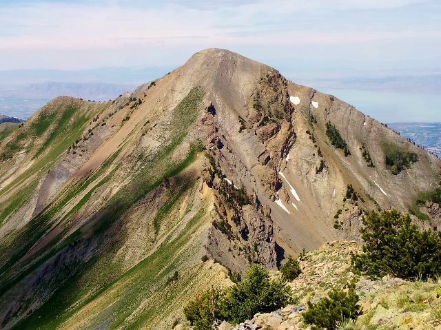
Finally on the Provo East slope, I scrambled my way up to the summit. I reached there at 9:02 (11:42 a.m.). It had taken me 1:12 to reach it. I felt shaken from the several scary episodes, but I knew my only option ahead was to return and face the fears again. I vowed that this would be my last time on this summit, so I better finish this quest. I wouldn’t be attempting it again.
My return trip to Provo Peak was better. I knew some better route options and went across a couple ridge line areas that I had thought I needed to bypass. But, with all the stress and fatigue, my progress was slower. I arrived back at 10:30 (1:10 p.m.), with a 1:28 return trip. I was so glad to get this most difficult section of my quest behind me.
I knew I was now more than an hour behind my predicted schedule. As I descended down the now hot slope, I stopped to text those who wanted to run with me at Timpanogos, that I was 1:15 behind and wouldn’t arrived until about 3:45 p.m. The heat on the exposed slope made me go through almost all my water. I drank 2/3rds of what I brought on that final hot descent.
I surprised a family who was descending from the peak with two young children. I complemented them hiking this difficult trail. They wondered where I had come from, not seeing me at the top. Their trip up and down would take them longer than my trip up and down to both of the peaks.
I arrived back at my vehicle at 11:28 (2:08 p.m.) feeling pretty exhausted. My feet were beat up pretty bad from moving around in my shoes on the steep slopes. I looked at my GPS watch and chuckled that it recorded that so far I had only traveled 14.0 miles in 9:01 of running time. That sounds pathetically slow, but I knew that it was actually pretty fast for these first four peaks. Four peaks, halfway there.
I grabbed food and drink from my cooler and started the bumpy ride back down into Provo Canyon. On the way to avoid another vehicle, branches from a tree put a scratch end-to-end on the side of my Ford Escape. My wife wasn’t pleased when she saw it the next day. “Think of it as a racing stripe” was my reply which didn’t go over very well.
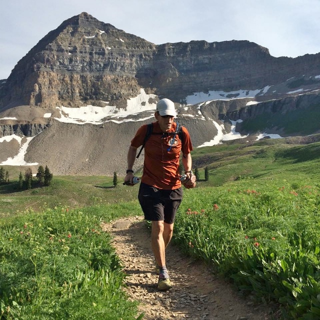
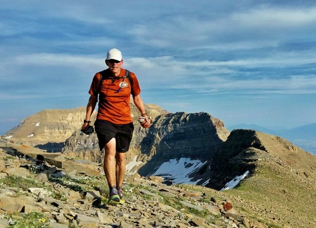
I arrived at the Timpooneke trailhead at about 3:45 p.m. Kendall Wimmer and Mathew Van Horn were there ready to run with me. I needed to take another 20 minutes to fix my feet and grab the things I needed for the next very long segment. Next ahead was to summit three peaks, North Timpanogos, Timpanogos, and South Timpanogos. I was now an amazing 5:22 ahead of my last year’s pace. I had bought back a ton of time by driving all the way to the Provo Peak trailhead instead of running to it. I also accomplished the trip to and from East Provo Peak much faster.
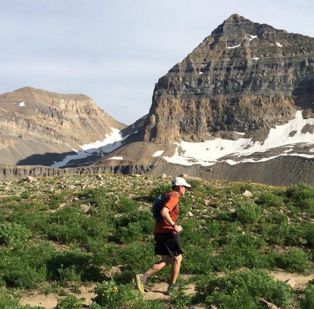
It was great to have Kendall and Matt along with me. They greatly lifted my spirits. On the way up I apologized for my slow pace (even though we passed by many hikers). With the difficulty I had faced so far, it felt like I was on mile 40 rather than mile 15.
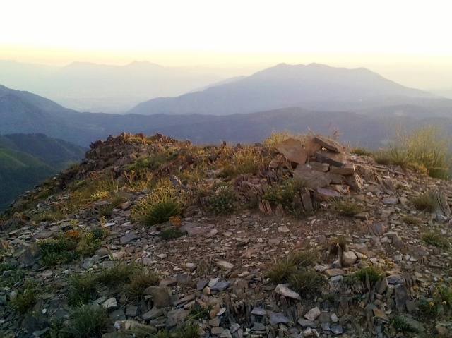
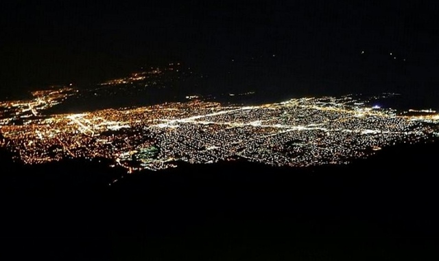
The Timpanogos Basin had started to explode in wild flowers in only the past week. In the late afternoon the beauty up there was striking.
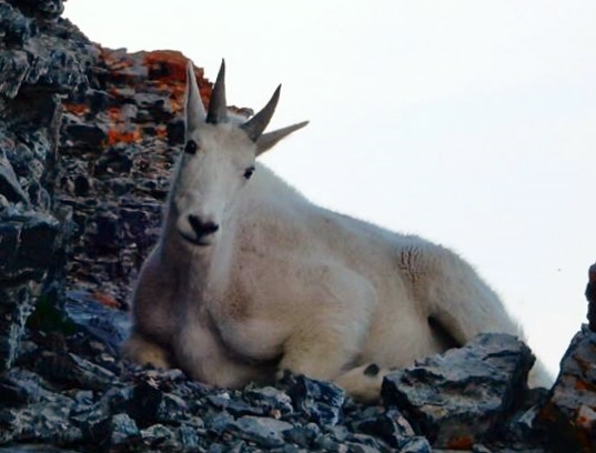
On the shelf below the saddle, Kendall, a little ahead, stopped and motioned me quietly to come over to him. There around a rock face was an amazing mountain goat. What a sight!
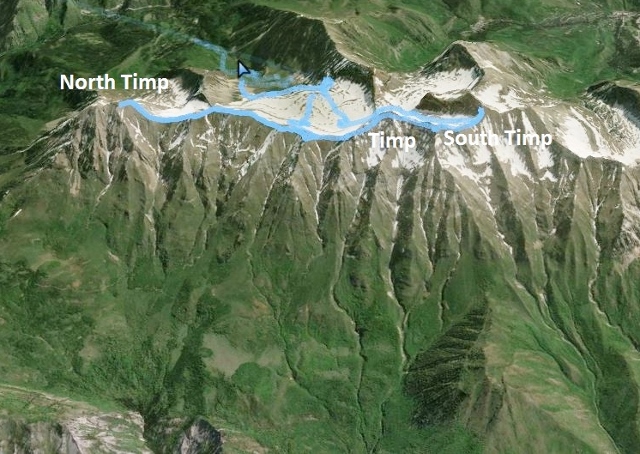
It took us 2:38 to reach the saddle from the trailhead, a discouraging slow pace. Next up was to run the Timpanogos ridge line to North Timp, two miles away and back. Last year I did this section alone in the dark and the faint trail was very hard to stick with. My progress was so slow that by the time I returned to the saddle it was dawn and I knew I couldn’t continue on. My goal this year was to do the entire out-and-back in the daylight. With the help from Matt and Kendall, I knew I could do it.
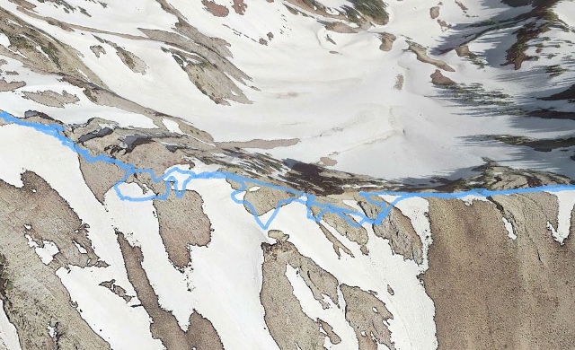
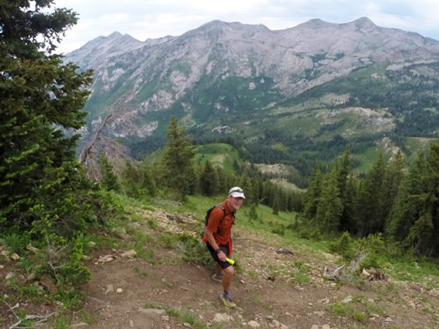
The faint trail or route worn in the scree and through the boulders could be seen much better in the light. This was my fourth time on the trail. It was so nice running on a rolling trail instead of the steep ups and downs that I had run thus far.
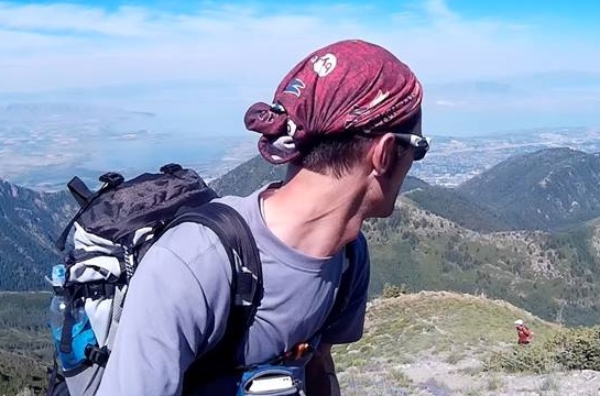
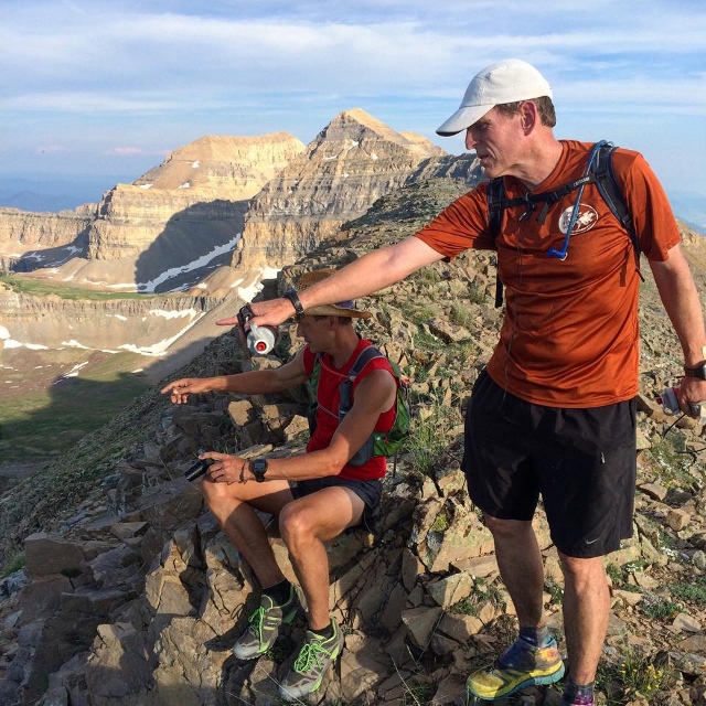
Watching Matt and Kendall run on the ridge was amazing. Kendall usually stuck close to me to help and Matt would run ahead to get photo opportunities. At one point Matt was right with us and went ahead as I stopped for some adjustment. When I looked up again he was far ahead prancing up a rough ridge line with great speed. It really was a sight to see.
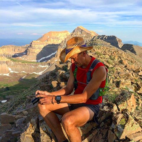
It was great to be with both of these great runners. I have great respect for both of them. Not only are they talented in the mountains, but they have outstanding photography skills. Best of all, I consider them both good friends. I felt embarrassed to be the focus of their lenses.
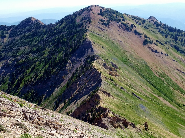
Our progress on the ridge line was good. Kendall had never run on it before and was having a great time. There was so much to see on both sides of the ridge.
Kendall was able to detect the ruins of the bomber far below us below Bomber Peak.
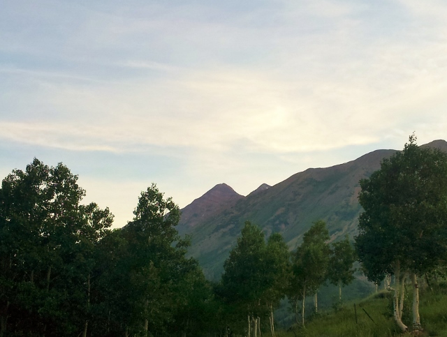
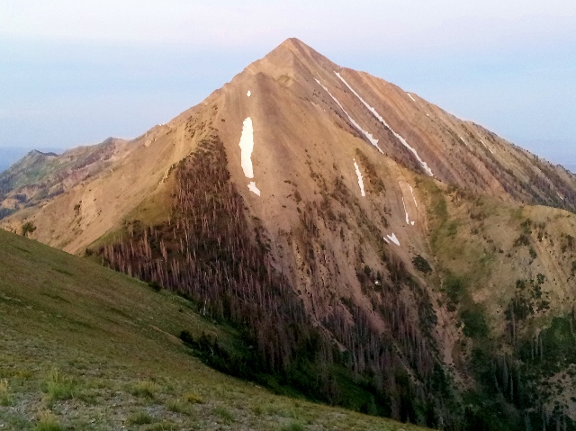
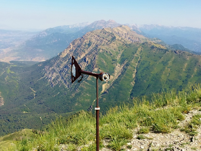
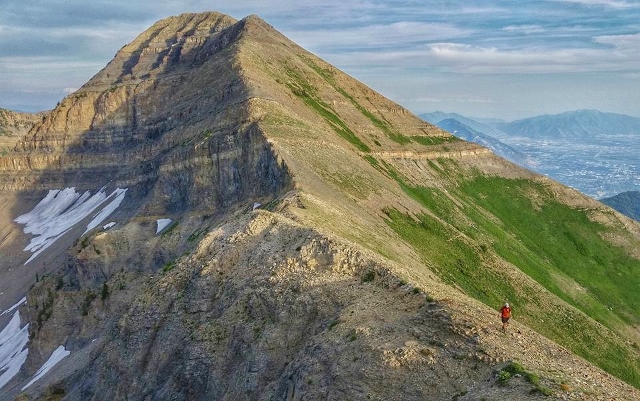
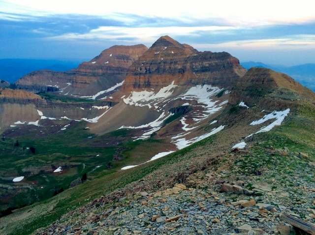
North Timp appeared before us. With all the attention the main summit on Mount Timpanogos gets, few visit this impressive peak.
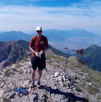
We had to descend several hundred feet and then climb about 550 feet to reach the North Timp summit. We arrived there at 16:55 (7:35 p.m.). It only took us about 1:15 to run the two miles across the ridge line.
At the top, we paused to take in the views and eat up for our return trip to the saddle. Focused in my mind was my goal to return to the saddle before dark. The sun was getting low in the sky. I wanted to get back fast.
I took the lead down the slope of North Timp and pushed the pace pretty hard with Matt following closely behind. Matt pushed on ahead and like a nimble mountain goat scrambled back up Bomber Peak in no time.
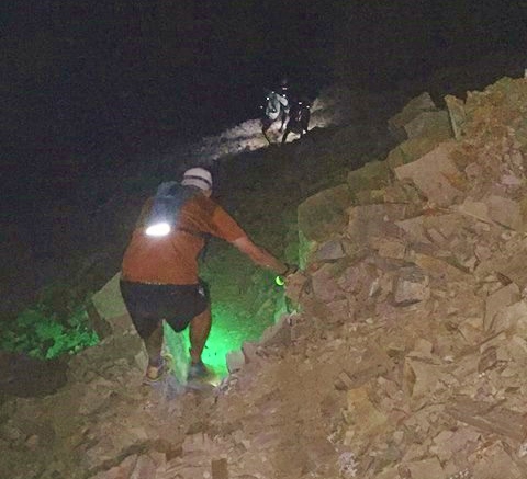
We did a great job to stay on the fastest route and arrived back at the saddle in a faster 1:05. Friends started to arrive, members of the Wasatch Mountain Wranglers who were running Timp tonight. With more friends along I did pretty well keeping up with them on the climb to the main summit. I arrived there at 19:09 (9:49 p.m.). This was my 80th career Timp summit. It was like a party in the cramped summit hut. I stayed less than a minute. I still had a ton of work left and ran on ahead along the ridge trail toward South Timp. Neither Matt or Kendall had run this section before so I took the lead and successfully remembered all the key junctions to take. Others were following us.
At each summit I reached there was always a flock of moths flying around. Those critters sure like the highest places. Up on Timp tonight they were especially bad. On the way to South Timp we went through thick flocks of moths. I would comment, “Moth in the eye.” Turning off the headlamp helped a little, sticking with just the handheld light.
The trip up South Timp is steep and rocky, but I knew what to expect. Kendall and Matt went on ahead and eventually the runners behind caught up and passed before the summit. I arrived at the summit of South Provo Peak at 19:56 (10:36 p.m.). Everyone was sitting around the summit having a great time. I sat down with them, but quickly got on my feet again. I couldn’t stop and have fun. I needed to focus on my goal which was starting to feel achievable. I was somewhat delirious and asked the group to point the right way down. I didn’t want to make the same mistake I did on my first summit there, when I descended down the wrong ridge in the fog.
I descended carefully down the loose rock. After 20 hours of running, I tend to worry. As the other runners approached I worried that they would send rocks down on my head and I worried that I would do the same to those below me. I tried to stay away from them, or let them pass.
As I approached the top of the “glacier” it was fun to watch the others with their lights begin a very long slide down the mountain. Kendall kindly waited for me. With all my trips up this mountain, I had never slid down the glacier and was somewhat apprehensive. But Kendall stuck with me and it was great fun to make the slide.
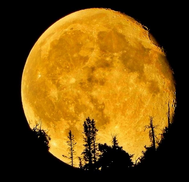
My progress across the Timp Basin in the dark was slow but Matt and Kendall would run ahead and then play with their photography. Descending back to the trailhead, Kendall took an amazing picture of the moon from near the rock slide area. He stopped both me and Matt to show us what he had captured. It really did capture the wonderful night feeling high in the mountains with friends.
Other friends caught up with us descending. I was so focused, that I didn’t say much, but enjoyed listening to the conversation behind me as I led the way, being pushed by the others. With a half mile to go, I turned on the jets to sub-10-minute pace, finishing the Timp segment feeling great.
We arrived back at the Timpooneke trailhead at 22:45 (1:25 a.m.). It had been great fun running with Kendall and Matt for the past nine hours. They both offered to help me further at my car, but I explained that I needed to quickly get to my last trailhead, Box Elder. I didn’t want to party with the others. I didn’t want to think about quitting. I had one more summit ahead
All was quiet at the Box Elder trailhead. I was now on my own again. I felt pretty thrashed but knew I had to finish this. I first tried to take a short nap in the car, but sleep didn’t come. I finally said to myself, “Let’s get this done!” I gathered my things, deciding not to fix my feet again, pushed out the door and was on the trail at 23:37 (2:17 a.m.). I had felt chilled, more from fatigue than cool temperatures, so I took a long sleeve shirt with me just in case.
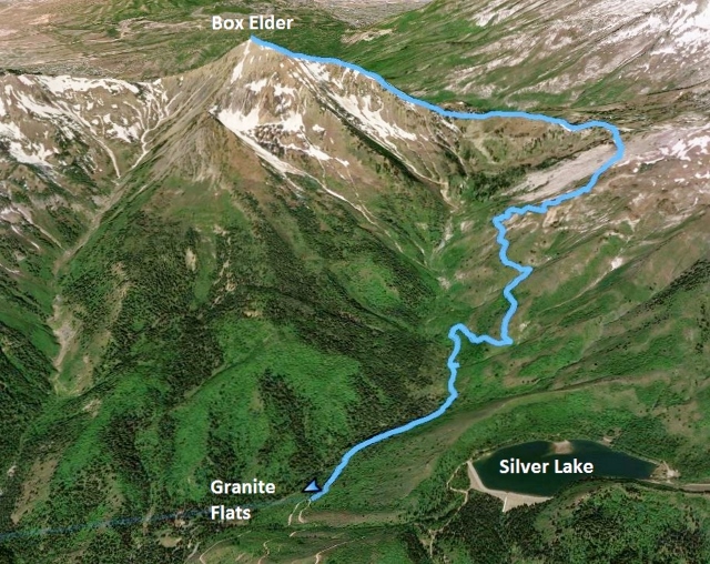
I knew that the 5.2-mile trip up to the summit would be long and hard. It was. It was lonely, dark, and the trail ahead seemed like it would never arrive at the top. I kept thinking how satisfying it would be to finally arrive to the top. With every step I was getting closer.
I eventually was hit by terrible drowsiness. I tried all my usual tricks but couldn’t shake the sleepy feelings and started to stumble along slowly. Finally I stopped, and laid down on the trail, turning off my light. Some sleep eventually came. It was probably only a minute or two, but that always pulls me out of it. I got up and continued on. My stop had been for 15 minutes.
As I crossed the pass over to the main mountain slope, rain started to fall from the sky. This caught me by surprise, not seeing any rain in the forecast. But it fell on me, chilled me, wetted me down, but quickly passed by. I finally reached the steep main mountain slope. I had been up on Box Elder one time before, so knew what to expect and didn’t take any wrong routes.
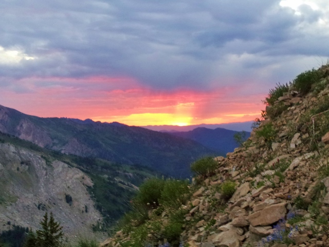
Dawn arrived as I was progressing up the steep slope. My worry now was water. I had brought with me about three bottles worth, but it was getting low. I went into ration mode but my mouth would get terribly dry from my laboring breathing. I eventually started to feel pretty sick. I scanned the slopes above but saw no snow fields along the way. What was I going to do? This was not good. I sipped some more and continued on slowly up. I just hoped that I wouldn’t pass out a few hundred feet below the summit.
Right after watching a herd of about seven mountain goats run away from me, there around a corner on the ridge line to my delight was a small snow field. I was saved! I filled my bottle with the remaining water from my camelback and then filled both with snow. The slush tasted so good and I started immediately to feel better. With a snowball in hand to eat, I made the final push to the summit.
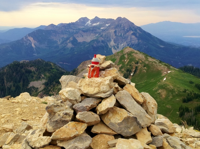
I arrived at Box Elder summit at 28:00 (6:40 a.m.). It had taken me a painfully slow 4:23 to arrive to the top. But I did it! I had climbed all eight mountains in exactly 28 hours. There was no one around to high-five, so I just took a big drink of slush and started to head back down. I was feeling effects of the altitude and fatigue and knew it would be wise to get down lower fast. I refilled again at the snow bank. My poor feet were is pretty poor shape with a couple blisters from sliding around a little in the shoes. There was no thought to stop and fix them. I was ready for this thing to be done. I found a cell signal and texted home that I was almost finished.
About 20 minutes later down the slope, I was surprised to run into another human. He asked my name, knew who I was and what I was doing. It was Jon Peachey. It was great to meet him and to see someone else. He encouraged me on and took a picture.
The lower I got, the warmer it became. This trail is very exposed and hot to the morning sun. The sun peeked out from behind the clouds and felt oppressive. I nearly ran out of water again, but reached a little creek coming off the mountain above. I filled up, and drenched myself in cool water. I only had 1.5 miles left. The finish seemed to never come as I went into “death march” mode. With joy in my heart, my car appeared. I reached the finish at 30:48 (9:28 a.m.). I quickly got in the car and blasted on the air conditioning.
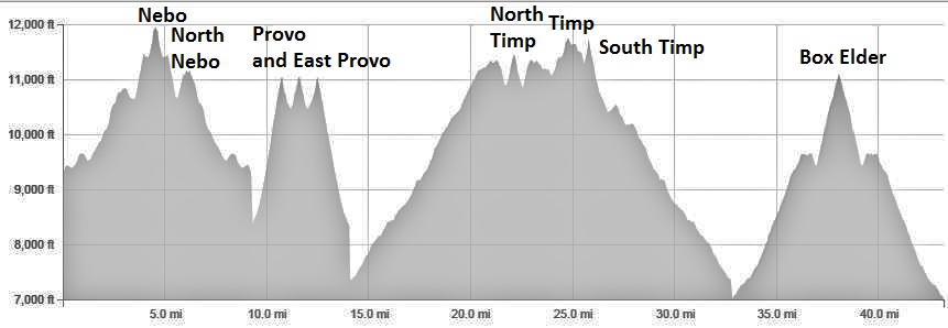
I had accomplished my goal. I summited the eight highest peaks in the county! It took more than day, but I did it in one stretch. My GPS recorded 43.1 miles and about 20,000 feet of climbing, but I knew the effort was similar to running 100 miles on easier terrain. It also indicated I ran for about 25.5 hours and there was another five hours of driving between the trailheads.
Once home, the kind congratulations and pictures arrived on the Internet. The nice comments meant a lot to me. I didn’t do this to impress anyone but myself, but it was nice to get congratulations from others. This was simply a matter of setting a goal and carefully achieving it. Now that it has been reached, I can instead set a goal to never, ever, do that again. I give a special thanks to Kendall Wimmer and Matt Van Horn for running with me for 9 of the 25.5 hours.
Recovery was rough for the next nine hours, typical of 100-mile recovery. But as I listened to the booming July 4th fireworks that evening outside my house, deep sleep finally came for the next 11 hours. By the next day I was feeling pretty great with no sore muscles, just a general lack of energy and loss of appetite. I’ll be ready to run again in a couple days. I’m already thinking about my next adventure which is a sure sign that I’m well down the road of recovery.
| Nebo Trailhead Start | 2:40 AM | |
| Nebo Summit | 2:12 | 4:52 AM |
| North Peak Summit | 3:10 | 5:50 AM |
| Nebo Trailhead end | 4:02 | 6:42 AM |
| Provo Trailhead start | 6:30 | 9:10 AM |
| Provo Summit | 7:50 | 10:30 AM |
| East Provo Summit | 9:02 | 11:42 AM |
| Provo Summit (return) | 10:30 | 1:10 PM |
| Provo Trailhead end | 11:28 | 2:08 PM |
| Timp Trailhead start | 13:25 | 4:05 PM |
| North Timp Summit | 16:55 | 7:35 PM |
| Timp Summit | 19:09 | 9:49 PM |
| South Timp Summit | 19:56 | 10:36 PM |
| Timp Trailhead end | 22:45 | 1:25 AM |
| Box Elder Trailhead Start | 23:37 | 2:17 AM |
| Box Elder Summit | 28:00:00 | 6:40 AM |
| Box Elder Trailhead End | 30:48:00 | 9:28 AM |
Your account was fascinating Dave. I had no sense that someone was running the hills and peaks within view of my home. Fabulous accomplishment!
After having read every word of your adventure, not only am I amazed at the resilience of your spirit and body, but I feel inspired to aim higher in my mountain-climbing goals. I have climbed those mountains many times with the exception of South Nebo and South Provo Peak…feeling many of the same feelings you had about its risk.
Your blog is enjoyable to read and interesting, to say the least. Here’s a “high five” from me…your achievement gives me hope and the desire to try something like this in the future. Great work, I would be interested to know how you trained for this. I want to get back into trail running.
Thanks for the very kind words on the blog. Yes, stay safe up there. Training this year has involved doing at least one long run every week of at least 31 miles. I think I’ve only missed three weeks.
Huge props from one of the “exhausted” Provo Peak guys. You are an inspiration to us all.
Thank you for sharing your awesome and epic stories.
You mention taping your feet several times. I am curious what this looks like for you, how long it lasts, process, kind of tape, etc. Thanks.