

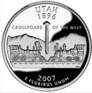
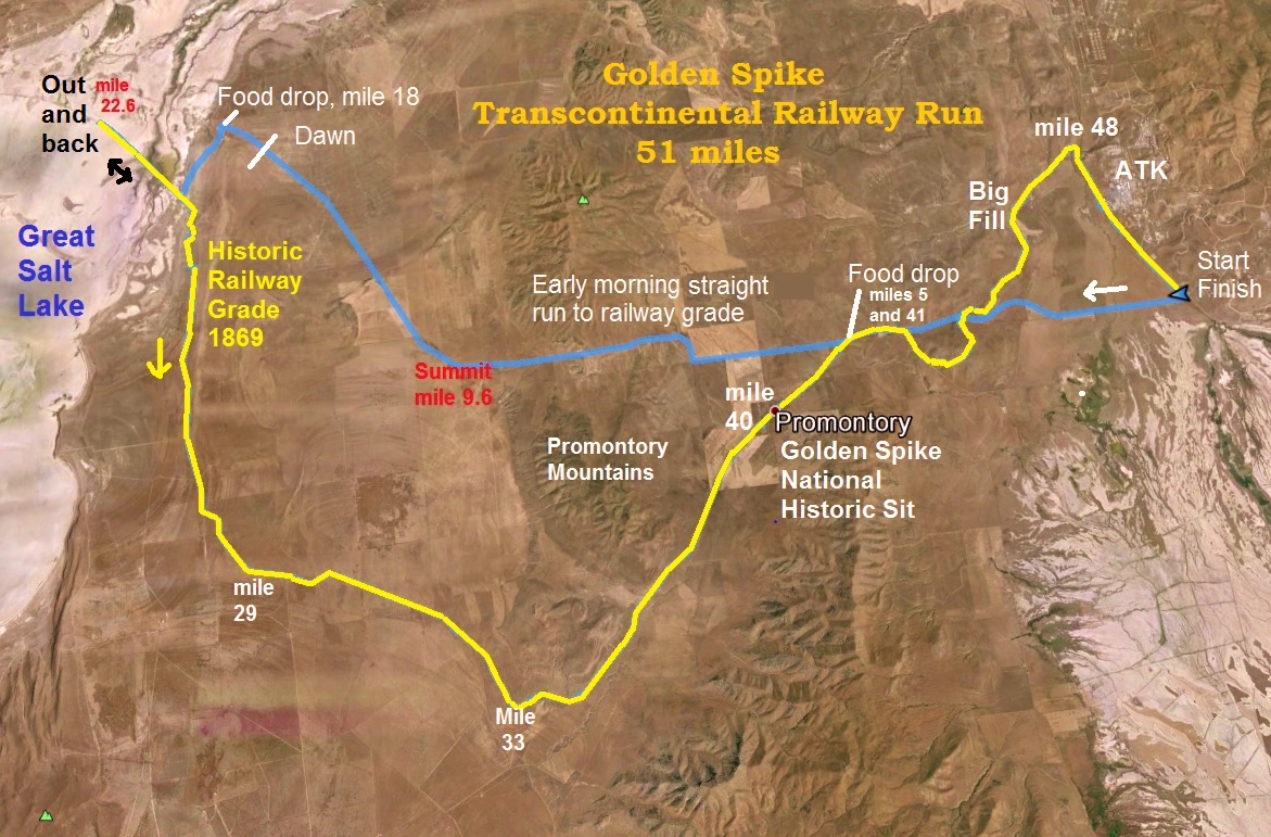
The first transcontinental railroad was completed near the Great Salt Lake in Utah, at Promontory Summit, on May 10, 1869. It was the main line railroad across the country until around 1904 when a new line was cut across the Great Salt Lake and bypassed Promontory. The original historic route continued to be used for passenger traffic for many more years. In 1942 the tracks were abandoned as the rails were needed to support the war effort during World War II. Today in this remote area, the railway grade is still clearly visible and runnable. I had always wanted to run on this historic railroad bed. I finally made the trip and ended up running about 32 miles on it.
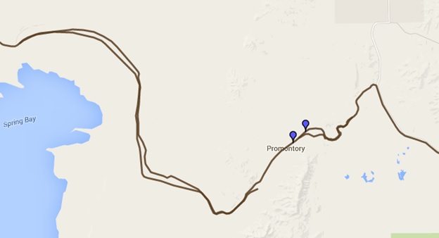
Near Promontory, actually two grades were built roughly parallel to each other. Both the Union Pacific and the Central Pacific had a contract with the government and they were being paid by the mile. Initially, the construction crews didn’t join the railroad grades together and instead passed each other, working in opposite directions. The government had not told them where to stop and cooperate. For about a 250-mile stretch the two grades were constructed within a mile of each other and still exist. The two grades can still be seen from Brigham City to more than 100 miles west of Promontory. I planned to run on sections of both grades.

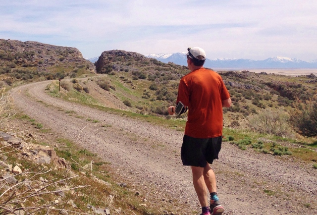
Because I didn’t have anyone crewing me or dropping me off, I planned a loop run. First would be a fast and straight run out to the north end of the Great Salt Lake, and then I would run the railroad grades all the way back to my car. I arrived to the area the afternoon before and drove out on Cedar Springs road to drop off some food and water at what would be my mile 17. I also dropped things off at miles 5/41. I then went to a motel for a short night’s sleep.
The start of my run was on the east end near highway 83, ATK, on the Promontory road. I began running at 3:45 a.m. It was 47 degrees at the start so I ran in shorts, short sleeves and didn’t bring a jacket or gloves, wanting to run light. I had no pack on my back, just two handheld water bottles and some candy and gels in my pocket.
My first 6.4 miles were on pavement, climbing about 800 feet into the Promontory Mountains. My legs warmed up running a 9:09 and 9:32 first two miles. The stars were blazing above me in the sky and a wind was pushing against me from the northeast. I ran into some pockets of cold air, making me regret for a few minutes each time that I didn’t have another layer and gloves, but those cold sections passed quickly. If all went well, I wanted to reach my aid drop at mile 17 by sunrise.
At mile 5.3, I stopped briefly at my drop bag there to drink some Coke and then was on my way. At mile 6.5 the paved road turned south to the Golden Spike visitors’ center. I continued west on a gravel road, Cedar Springs Road. Ahead of me at the pass was an annoying tower with a very bright flashing light that I was heading toward. I reached it at the top of the pass (mile 9.4) after running for 1:49. I had climbed up about 1,000 feet.
Now up and over, I picked up the speed to run down 1,200 feet to my drop bag 7.6 miles ahead. This area is so remote. I never saw any vehicles come by and passed only two ranches with lights. Dawn started to brighten up the sky and I was able to turn off my light at mile 13.1.
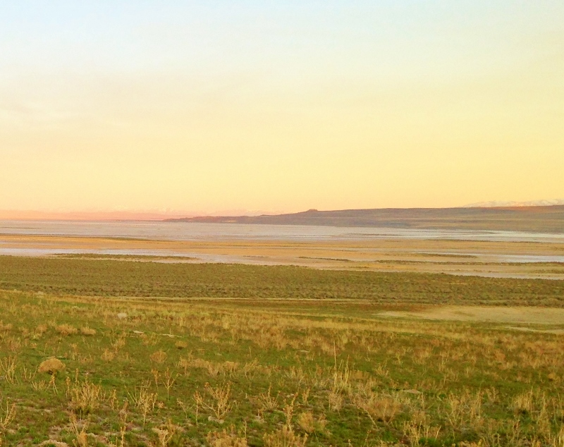
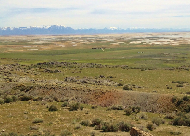
Soon the Great Salt Lake came into view, starting to be brightened up by the sunrise. There wasn’t a tree to be seen and hardly even a bush in the area. I reached my drop bag at mile 17, 3:17 into my run, a little after 7 a.m. I stopped for about ten minutes, eating and drinking well. I would have to run the next 22.6 miles on my two water bottles.
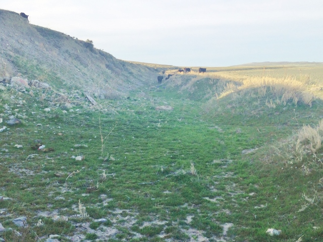
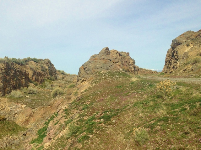
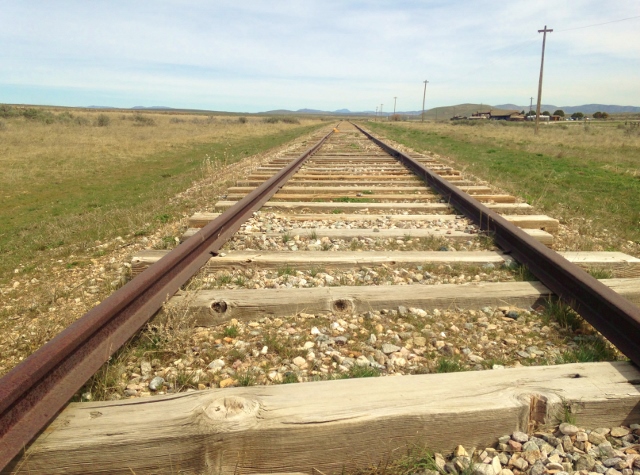
I now headed south, took a side road and in about a mile hit the historic Transcontinental Railroad bed. This was the Central Pacific grade that had rails on it from 1869 until 1942. I decided to run an out and back on it to the northwest. It was amazing to think that I was running on this historic railway grade.
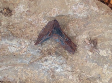
Almost immediately, I looked down and saw something sticking out of the dirt. It was the head of a very old railway spike. Very cool!
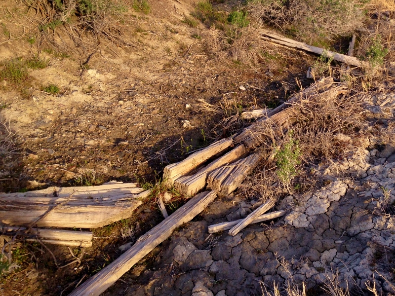
Soon I started to see scattered old railway ties off to the right of the raised grade that was going across the mud flats.
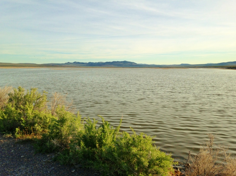
The railway grade traps runoff water from the north from getting to the lake and I ran by little lakes with many geese and other water fowl.
I went around a gate that prevented any vehicles from driving the grade and I could tell that it was just used by cattle and now by me.
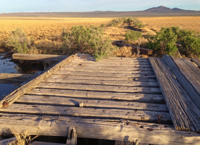
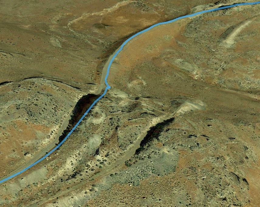
I ran across a couple very old bridges that were last used by a train before 1942.
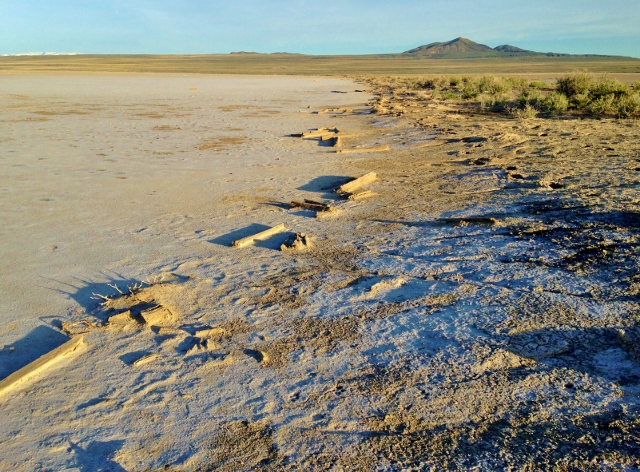
It was amazing to see many ancient railway ties washed up against the grade from times when the lake was higher.
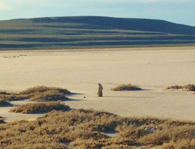
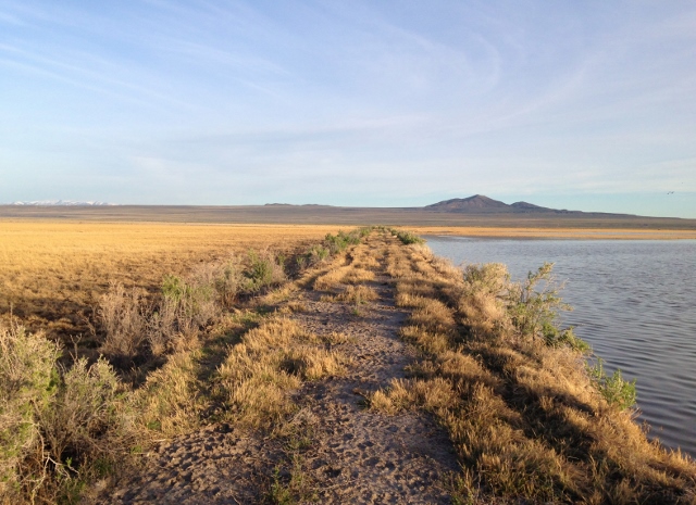
What was really fascinating to see was many pole stumps lining both sides of the grade. Poles initially carried lines for a transcontinental telegraph system in the 1800s and later carried telephone lines. The lines made it possible to coordinate trains going in both directions. All seemed very well preserved out in this very remote area that few people come out to, because I was now two miles away from the road, where very few people have been. It was time to head back. I wish I could continue west but I estimated with this out and back, my planned run would now be more than 50 miles.
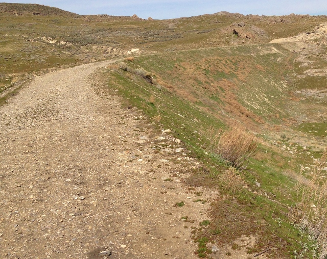
I arrived back at the road at mile 22.7, 4:39 into my run. I had slowed, running 12-minute miles taking in all the sights. On this section, the BLM maintains the Central Pacific (CP) grade as a National Backcountry Byway and for the next eight miles south you can drive on it. The CP grade has been modernized, widened, graveled, with newer culverts put in for drainages.
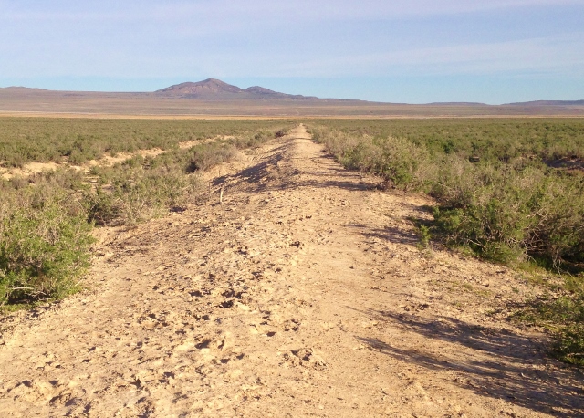
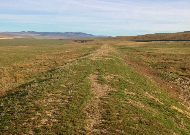
After running less than a mile on this improved dirt road grade, I wanted something more historic, so I headed down west and found the old Union Pacific grade that is now only used by cattle. I ran on it for four miles. The miles of UP grade west of Promontory were never used by trains, rails never laid. It was a wasted effort of hundreds of Chinese labors, some who gave their lives in this hard, long labor each day creating this grade. Now it looked like it was only used by cattle, and hopefully in the future by many runners.
This grade was much more fun to run on compared to the maintained CP grade road. This UP grade is clearly visible, although it has deteriorated in sections with no maintenance. It had some washouts, but has been mostly untouched and is fascinating. Sections were soft and fast.
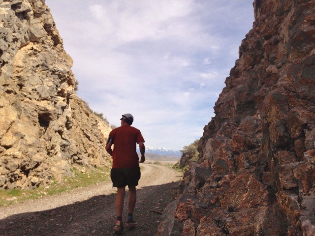
Other sections went through rocky cuts with some obstacles. There were no strewn railway ties or spikes to look for on this grade because no rails were ever put on it. The cuts, mounds, and berms created back around 1869 were fascinating to see and I just couldn’t comprehend all the difficult manual labor that took place.
I enjoyed running on some fast soft sections of the UP grade but eventually left it as I figured out that I was now on the private property of Promontory Ranch. Back on the maintained CP grade, my pace quickened on the smooth dirt road, taking me closer to the canyon that would take me up to Promontory Summit.
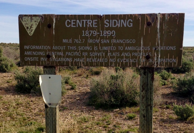
I passed by a sign indicating that I was on mile 762.7 from San Francisco. A railroad siding is an additional track to let another train pass. Sidings were placed on the grade every three to five miles.
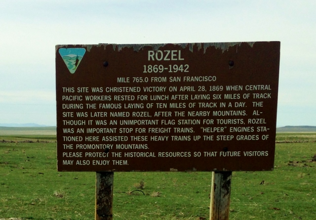
I ran by a sign identifying a place called Rozel. It was intriguing to read that “helper” engines were once stationed here to help the trains get up the mountain. The grade did start to rise, but it was always a gentle climb because in 1862 congress passed an act that required that all grades be no more than 2.2%, or 116 feet per mile. The CP grade left the main road and I next ran on the auto tour. I had it all to myself because the gates were still locked for the winter. I was now at mile 32.3 and I had been running for nearly seven hours.
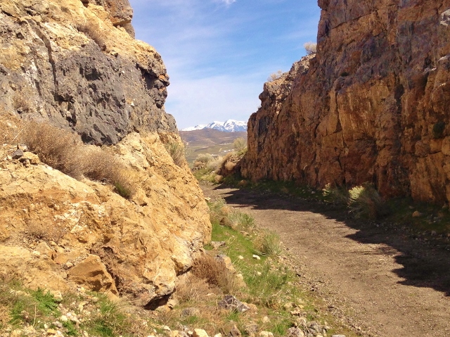
It was both amusing and sad to see the never used UP grade below the CP grade that I was running on. The UP grade below was untouched except by nature, causing it to crumble over time. Culverts for water under the grade could still be seen, put there in 1869. Both grades created side-by-side cuts into rocks and created fills and massive build-ups. I marveled at the massive labor it took in 1869 to build these grades.
One writer recorded how this was done. “I can count five hundred men and one hundred fifty cars drawn by patient mules hauling dirt to grade the permanent track . . . there are plows, scrapers, etc. The mules are well trained; they climb up and down the bank, stop at the right place and wait till their load is dumped, then take their place in the line and go back to get another. They look like ants. The place is black with laborers; they stand as near together as they can shovel. It’s a funny sight to see five hundred shovels going into the air at one time.”
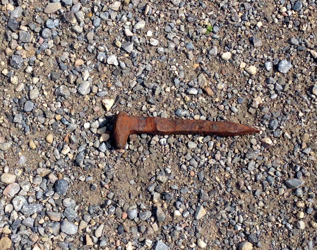
As I ran along, I could see scattered railway ties along this section in the National Historic Site. I was very pleased come upon an old rusted spike. I moved it off the road so it could be seen and enjoyed by others.
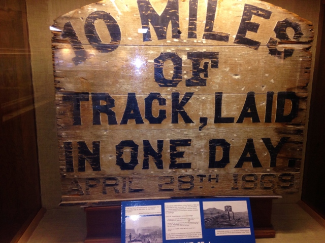
Soon, the Promontory visitors’ center came into view. In April 1869, it was finally decided to join the CP and UP grades at Promontory which was equal distance between each company’s end of track. Their grades had far exceeded their tracks in both directions because they were allowed to work 300 miles ahead of their end-of-track. After grades were carefully smoothed and inspected, the final step was to lay the rails, but this was done hundreds of miles behind those creating the grades.
The final stretches of track were laid and on May 10, 1869, the ceremonial golden spike was driven, opening the line to about ten trains per day.
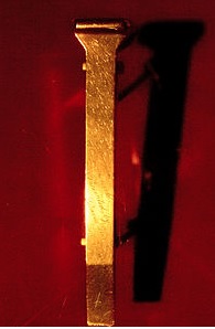
On that day, two locomotives were brought face-to-face and between 500-3,000 people witnessed the driving of the ceremonial golden spike. The spike now is on display at the Cantor Arts Museum at Stanford University. A single word of “done” was sent by telegraph around the country to announce the historic event.
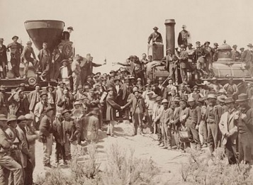
In 1957, Congress established the Golden Spike National Historic Site to preserve the area around Promontory Summit to keep it looking as closely as possible to its appearance in 1869. Each Saturday in the summer two engines are brought fact-to-face to re-enact the Golden Spike ceremony.
As I came closer I came to the track that has been laid near the visitors’ center for those summer re-enactments. I arrived there, mile 39.2 at 8:42 into my run.
I had been out of water for a half hour and was very thirsty. I went into the center, filled my bottles and drank wonderful cold water. I spent about ten minutes looking through the museum, wishing that I had more time to look at everything, but it was time to run again.
Running again, east of Promontory, the grades are not maintained for a mile and were overgrown with bushes making running slow. East of Promontory, the UP grade was railed and used in 1869, but in 1870, the Central Pacific took over this section and moved the rails to their grade. Thus the UP grade east of Promontory, used for only one year, is one of the oldest abandoned railroad still visible in the country.
I ran on the CP grade instead of the UP because massive washes cut and destroyed much of the UP grade in this section. Eventually the CP grade I was running hit a deep gorge that I had to climb down into to get across and then up on the main road where my drop bag was hidden. It was getting pretty warm in the afternoon so I filled my bottles for one last time at mile 41.2.
The grade paralleled the main paved road for a little while and then connected to the East Auto Tour. The well-maintained road on the grade made for some easy running as the grade gently descended toward the valley floor.
The massive cuts that the grade went through were impressive.
The UP grade could still be seen below.
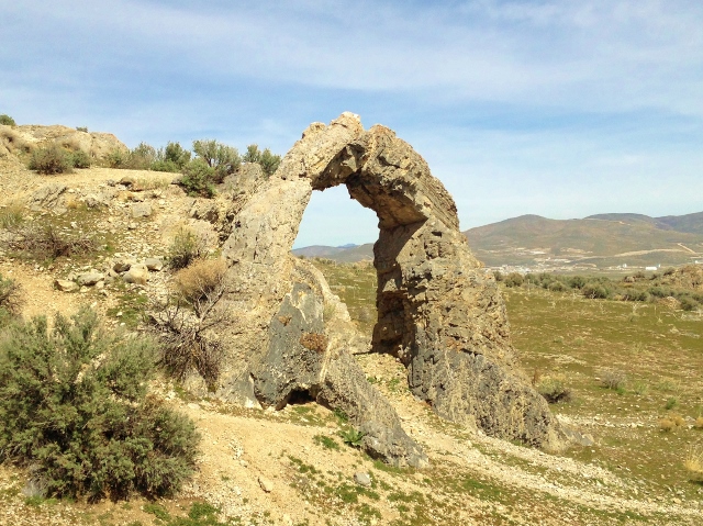
I passed by the Chinese Arch which stands as a memorial to the Chinese who worked for the Central Pacific Railroad.
The grade crossed the main road again and I ran on CP grade, now a walking trail toward Big Fill. As I ran through more huge cuts, I knew my amazing run would soon be over.
I came to the Big Fill. Down below the Union Pacific built a massive wooden bridge across a gorge in just a few months, but the Central Pacific created a much more stable massive fill that took many months to complete.
As I ran over the impressive fill, I could hardly imagine all the effort and earth moved. I could see a big crater on the side of the hill where fill was taken.
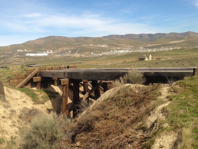
The grade descended to the valley floor near ATK and old bridges could be seen, still in place, probably used and improved by ranches after the railroad left. But across most of the washes and gorges the bridges were long gone and I had to run a detour around.
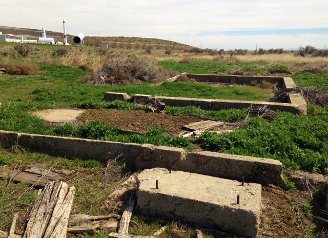
The railroad grades turned south and paralleled highway 83 near ATK. I tried to run on the CP grade but it was now unused, overgrown, with all the bridges gone and washed out in places. Across from ATK, I found long-forgotten foundations of buildings that must have serviced the railroad so long ago. It was really interesting in this section to see what was still there, pretty undisturbed over the ages.
Finally my car came into view, parked where the grades cross the road to Promontory. I finished running 51.4 miles in 11:54. Wow! What an amazing adventure. I never anticipated that it would be so interesting and I looked forward to telling people about it. There is so much history away from the roads traveled by cars. I had taken a step back in time and had been able to witness the amazing creations of people who labored in these remote hills and valleys nearly 150 years.
Love your blog. Post often please.