

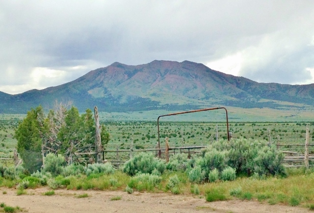
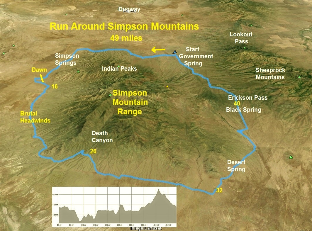
The Simpson Mountains are a mountain range in the remote west desert of Utah that rise nearly 4,000 feet above the desert floor. They are about 13 miles long and ten miles across. These distinctive mountains have been viewed by travelers on the Pony Express and Overland trails since the 1860s. Native American Goshutes inhabited their canyons for centuries. They have a long history and some of it is disturbing.
The mountains are named for explorer Captain James H Simpson, topographical engineer, who was stationed at the army camp, Camp Floyd, in today’s Fairfield, Utah. In 1858 he explored around the mountain range, and in 1859 returned in his work to lay out an overland mail route between Salt Lake City and California. For years I have wanted to explore these mountains more closely and I finally mapped out a course to run completely around them.
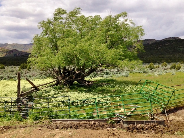
On Friday evening, I arrived at the northeast corner of my circuitous route, establishing my starting location at a corral above dry Government Creek. The corral was at a location once called Government Spring and had been visited by Simpson in 1858.
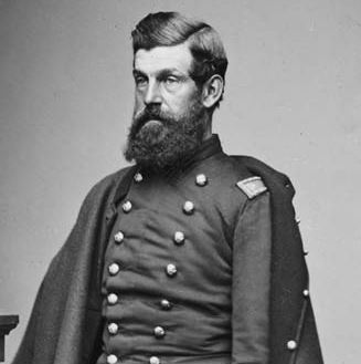
This place was also once the cattle ranch of Orrin Porter Rockwell, famed mountain man, lawman, and pioneer. He had chosen this open location in the 1850s for a ranch because as he said, “For a cattle ranch you want a place where you can track’em out.”
I slept in my car for a few short hours as fierce winds rocked my car but eventually died down. At about 1:00 a.m., I woke up and decided to get ready for my adventure. But once ready, I stepped outside. The wind was ferocious again and I felt rain drops. The hourly weather forecast on my phone called for a 40% chance of rain in the next hour. I decided to wait for a while. But by 2:30 a.m., nothing seemed to change, just wind and some sprinkles so I decided to get my adventure going.
At 2:42 a.m., I pushed myself out of the car and ran down into the dry Government Creek bed, starting my run around the Simpson Mountains in a counter-clockwise direction. I groaned as sprinkling rain immediately started to fall on me and a headwind from the west pressed against me. But as I climbed up out of the creek bed, on the other side, the rain stopped. Clearly this run could be a real character-building exercise.
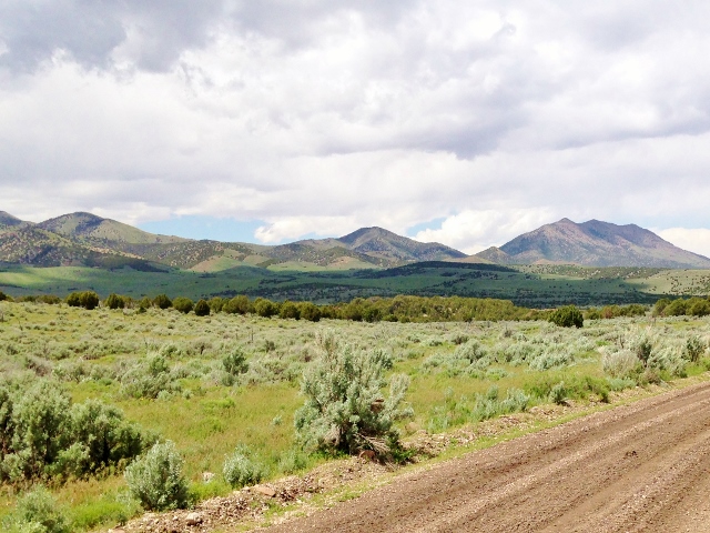
I was traveling light with just two handheld water bottles, a very little pack some food, and wore a long sleeve shirt and shorts The temperature at start was a warm 60 degrees so I decided to not even take a jacket with me. Off to the northwest, I could see the town lights of Dugway, fifteen miles across wide-open Skull Valley. Those lights would help me know my direction of travel.
My first few miles heading west were a bit confusing because I was initially running on some old dirt roads now rarely used, but I linked up with an established road frequented by ATVs. For this adventure, I took my bright green handheld light wish me to help make a good pace on the rough ATV roads. My initial miles were about 11-minute-mile pace.
Despite the constant wind, the night was very pleasant as I visited various draws below the mountain slopes with many junipers and some evidence being used for very remote camping. I covered the north end of the range quickly and at mile 8.4 joined the Pony Express Road at the 1:40 mark.
I now started my long run south journey by running on the wide, graded road up to Simpson Springs. I have run this road many times while running the Pony Express Trail 100. As I headed up toward the historic springs location, in the sky I noticed large, terrible, black clouds ahead of me which sent a feeling of worry through me. The headwind increased.
I arrived at Simpson Springs (mile 10.5) at 2:08 and quickly took shelter in the bathroom. I wondered if I should wait out the storm. I filled my bottles at the new water pump, ate and drank plenty. I knew that I probably wouldn’t find water for another 24 miles on my route. I knew that if I got desperate, there were some springs along the way up the various canyons.
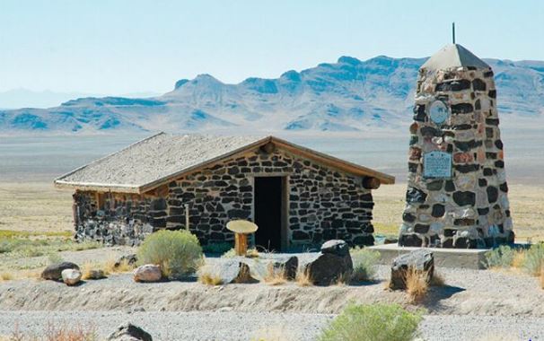
After stopping for 26 minutes, I looked at the ominous clouds and decided to go brave the storm, hoping that most of it would skirt passed me. I ran through the historic Simpson Springs area, which used to be the site of a Pony Express station and later a stage coach station. The Pony Express station has been reconstructed on what is believed to be actual location.
I next left the main road and ran on an established ATV road in the foothills. I rolled up and down and I was having a blast, making good time. Thus far the storm clouds were not raining down on me. At mile 13.7 at 3:15, I took a wrong turn. My notes said “veer right” at a junction but I should have veered left. I ran down a fun trail to the west and realized I was going the wrong way. But I was having so much fun running down, I decided to just continue until I hit the Death Canyon main dirt road. My detour added a mile to my route, but it didn’t bother me, it took me a little further way from the storm hitting the mountain tops.
Dawn arrived and I turned off my light. Now I could really see the storm and it was dropping a lot of rain. I was heading toward it. The headwind became brutal, probably around 30-40 m.p.h. It was so loud against my ears that I couldn’t even hear the music in my headphones. It became colder so I stopped to put on some gloves. My progress going forward was hard and slow, moving at about 14-15 minute-mile pace.
I crossed over dry Indian Creek, a place I had always wanted to visit. I gazed up at the foothills toward a location called Coyote Springs and thought of a very tragic event that took place there in 1863. Some army soldiers who had been staying at Simpson Springs went and massacred an Indian tribe that had their camp at Coyote Springs. They killed all of the men, women, and children. The leader of the tribe, Peahnamp, had been returning to camp when he heard the shots and screams. He was too late to help and barely escaped as the soldiers pursued him. This was such a shameful, tragic event that has been a long-forgotten government atrocity. I felt very sad as I ran by this sacred area.
The fringe of the storm hit me and I became wet, but I felt very lucky to have dodged most of the deluge. In another couple miles, the wet road there made me feel good about the decision in delaying my run earlier. I missed a downpour. (The storm really poured rain on the east side of the range. It dropped nearly an inch of rain there in an hour.)
With the storm raging to the east, the west showed some clear skies. The views to the west were amazing, especially looking down into the ancient river bed where I could see a large green ranch off in the distance. Thoughts went to my late friend, Paul Cannon, who passed away last year. He loved this area. Down in that large remote riverbed was the site of a ranch of his ancestors. I’m glad that I could see it.
At mile 24, at the six-hour mark of my adventure, I needed a rest from the brutal headwind. I left the road and went down into a little wash to sit under a juniper tree. It was so nice to be out of the wind. I ate my breakfast and fixed a toe that was complaining. My stop was for fifteen minutes.
On the road again, I received a break from the wind as the road turned northeast and climbed 500 feet toward the mouth of Death Canyon. (Next time, I could avoid the climb and save a couple miles by running on a faint wagon road along the base of the foothills).
As I came to the mouth of Death Canyon, I thought of other events. First I thought of Indians who had been drowned by a flash flood here, and thus the name, Death Canyon. Second, I thought of another, much more recent government atrocity. Around 1970, Bud Tonioli built a cabin near the mouth of the canyon. Another family also built a cabin nearby. They were enjoyed by family, friends, boy scouts, and game wardens. That cabins gave protection from elements in this very remote area. But in 1990, the head of the BLM in this area, had a stupid belief that the cabins could be used by drug smuggling (they never were) and decided that the cabins needed to be destroyed. The BLM burned down the cabins and also destroyed other historic mining cabins. The BLM was at that time destroying history more than preserving it. Thankfully today the BLM who preserves this area have a much deeper appreciation for history.
I felt sadness as I ran away from the canyon. Death Canyon was also the long-time home of Nephi Anderson who was the caretaker of the Imperial Lead Mine up the canyon. Nephi lived there around 1900 and would spend his idle time trimming the cedar trees and placing rocks around to make his home area beautiful. Evidence of his work can still be seen today and I hope to go run up the canyon on another day.
The weather started to greatly improve and I was relieved to have dodged the storm. The wind was less of the problem as I headed west around the south end of the mountain range. This area was wide open, without trees, with miles of views across barren Skull Valley. To avoid a huge detour away from the mountains, I left the road and instead ran on a faint old wagon road that took me along the base of the foothills. I spied an ATV/horse camp at a corral couple miles away down in the stark Skull Valley desert floor. I wondered why anyone would come this far to camp for the weekend.
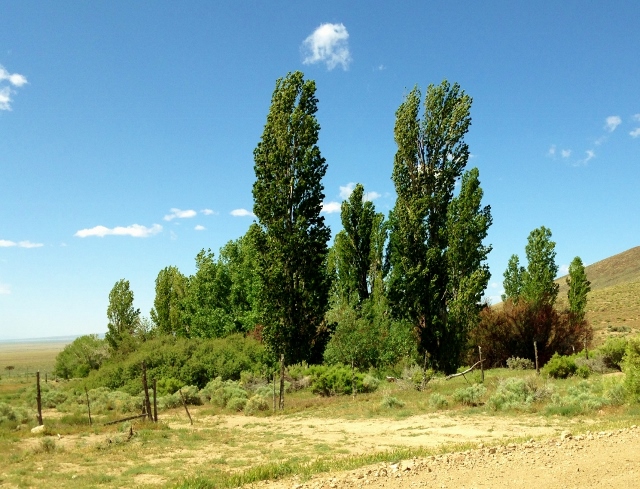
The sun finally came out and I ran with a tailwind, heading north, as I arrived at Desert Spring (mile 33.8) at 8:20 into my run. This spring site was truly an oasis, the only trees around on the stark slopes of the southeast end of the Simpson Mountains. No water was running out of a pipe and I didn’t want to hop a fence to go into the spring area, so I decided to wait to get water at the next spring in five miles. I still had some water left and wasn’t dehydrated. I stopped for ten minutes to eat some early lunch.
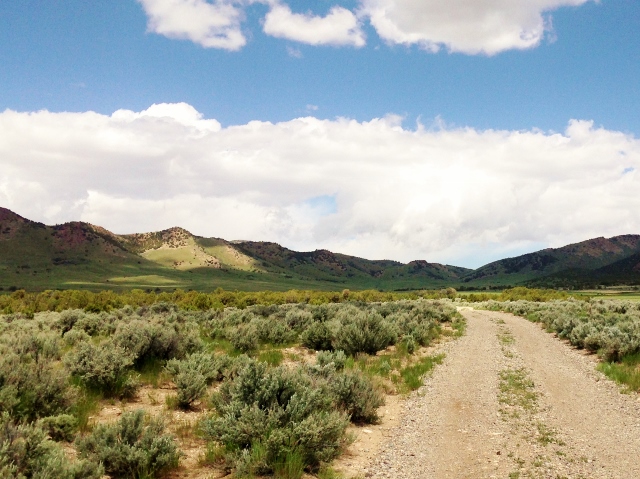
Now it was running a constant uphill, a 1,000-foot climb toward Erikson Pass. I entered a beautiful valley with more and more junipers appearing. Up in the foothills to the north I could see structures from Black Ranch, a beautiful setting for a very remote large ranch. On my right were the high Sheeprock Mountains with snow still on their peaks. As pushed harder to maintain a good uphill pace, coming toward me on the road came a stream of about ten ATVs, the first humans who I had seen along the way. (They would later come back seeing me ten miles further on the road.)
I reached Black Spring (mile 39.5) after running for nearly ten hours. I made a quick stop to replenish my water for the remaining nine miles. The road ahead was very wet and muddy. It had been entirely dry the evening before so that morning storm had really dumped a lot of rain on this side of the mountain. I made it up to Erikson Pass, my highpoint of the run at 6,258 feet. Captain Simpson had passed through here in 1858. He called the next valley that I would be running down into, “Porters Valley”, for Porter Rockwell.
I ran down Porters Valley along Government Creek. I kept gazing up to the beautiful Indian Peaks and green foothills.
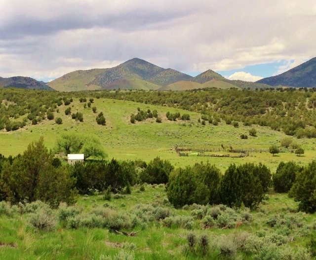
I passed by a deserted ranch house with a corral, down in a beautiful area along Government Creek.
The road was drying out better, the further down I ran and soon my car could be seen in the distance parked by the corral. I wanted to finish in under 12 hours, so I pushed the final couple miles and ended out finishing in 11:56. My adventure was complete! 48.5 miles around the Simpson Mountains. I had climbed about 3,000 feet along the way. I was amazed how well I felt. My legs were still energized and I felt disappointed that my journey ended. It had been an amazing adventure through some interesting remote history.
Nice report. Great pictures. Really enjoyed the historical notes and references. OPR is one of my favorite pioneer personalities and have thoroughly enjoyed Harold Schindler’s well documented book about the “Son of Thunder”. Your reports are really inspiring. Thank you. – Bartman