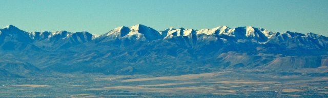
The Oquirrh Mountains is a mountain range that runs north-south for 30 miles on the west side of Salt Lake Valley and Utah County. The mountains have been mined in gold, silver, lead and copper including one of the largest open pit copper mines, Bingham Canyon (Kenicott) mine. In 2015 I traversed the southern portion of this mountain range and had a great adventure. I decided to repeat it this year. (The Northern section includes no trespassing private property sections and is barren of snow this time of year.)
Timing for this adventure is critical because water needs. I had no desire to haul large quantities of water along the way and there are no convenient access points along the way to drop off supplies. The solution is to use snow fields, but the fields shouldn’t be deep enough to obscure the trails along the way. Thus the right time to try this would be around the first day of summer when all the snow hasn’t quite melted off. On the north side of each peak snow fields could still be found.
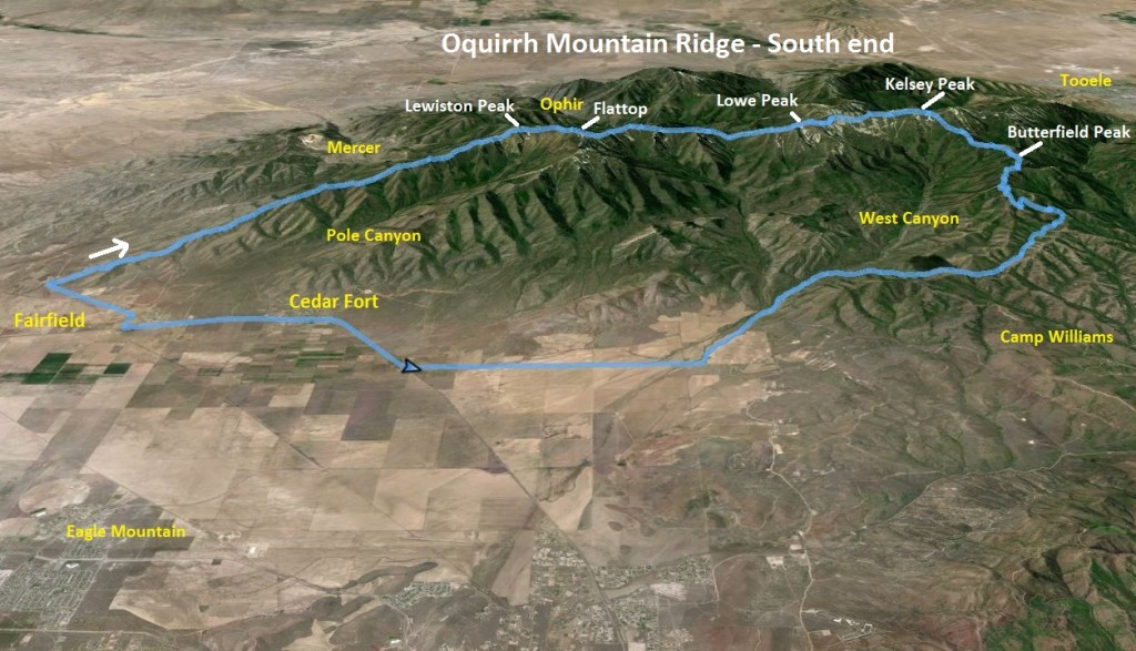
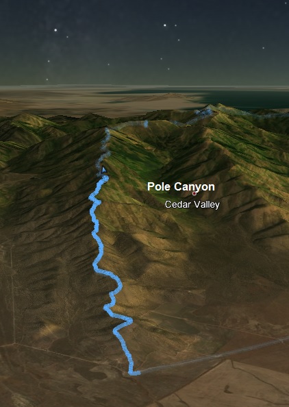
The rules for this traverse that I set for myself were simple. I needed to travel from the desert floor near Fairfield and finish at the furthest Butterfield Peak. Along the way I must summit the named peaks, Lewiston, Flat Top, Lowe, and Kelsey. I could bypass the tops of minor peaks. If instead I stayed on the true ridge the entire time, the adventure would be very slow, rocky, frustrating, probably taking twice the time.
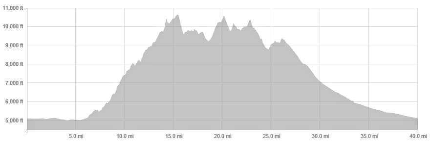
The traverse is about exactly 20 miles. A faint trail exists for 17 miles of the route. A deer trail starts at about mile four (8,000 feet) which runs mostly on the west side of the ridge, jumping over to the east a couple times. If used, and if you can stay on it, it drastically cuts the time of travel down. But other deer trails branch off of it and if you take the wrong ones it can cause significant delays. Losing the trail is easy. Once you reach Flat Top at about mile nine the trail becomes more distinct, used by more humans.
Last year it took me exactly 12 hours to make the 20-mile traverse. Surely I could do it much faster now that I knew what to expect. I was up for the challenge again. I started my adventure at 1:36 a.m. Not only was I doing the traverse, but I was also going to run back to my car through the canyons, making this a total of 40 miles. I parked my car on the north end of Cedar Valley to minimize the number of miles on the desert floor during the hot afternoon. I ran through Cedar Fort, took a wrong turn into a residential area but got back on course and reached my ridge starting point after running 6.5 warmup miles.
(Ridge mile 0, elevation 5119, time 0:0). I left the desert floor and started to ascend up through scattered desert brush. In two tenths of a mile, I connected to an old rarely used double track road that climbed the ridge for a mile. If I stayed on that overgrown road, my pace was much faster. But in the dark it was tough to stay on it. The ridge descended a couple times and in the dark I was always in some doubt if I was going the right way, but I was.
Once the road ended, it was a difficult bushwhack exercise. The trick was to not run on the exact ridge top which was very rocky, but to find a more runnable route on either side. At about ridge mile 3.4 I reached 7,000 feet and had climbed nearly 2,000 feet so far. My ridge time was 1:39 and I was six minutes ahead of last year’s pace. But things really got hard. Last year dawn arrived at this point and I had the light to aid me. This year with the dark, this section was frustratingly slow. I just couldn’t find the fastest routes and would end up going through very rocky sections or would weave through trees, bushes, and spider webs. I lost a bunch of time.
I found the deer trail that starts about 8,000 feet but in the dark it was difficult to stay on it. I took wrong branches that took me too low and would then have to climb steeply to get closer to the ridge top and on the correct trail.
(Ridge mile 6.8, elevation 9,000, time 4:10). By the time I reached 9,000 feet, the dawn light finally arrived and I was able to make better time. But I was now 33 minutes behind last year’s pace when I did a better job picking my route and staying on the trail. Four hours to only cover 6.8 miles, and climbing 4,000 feet.
My first peak, Lewiston Peak was seen ahead. Surly I could make up time and reach it fast, but not so. I forgot that the trail jumps to the other side of the ridge a couple times and I missed one of those jumps going on a slower route. The two sides of the ridge are totally different. The east side contains many trees and brush, the east side is more desert-like and usually the faster side to travel. As I approached the peak, some small snow fields appeared and I stopped to pack snow in my two handheld water bottles that were nearly empty. I also had some water in my camelback. All day I would stop at snow fields to repack. I always wanted to have plenty of water. The snow melted pretty fast in the bottles and the ice cold water tasted great. At times I would run while munching on a snow ball.
I finally reached to top of Lewiston Peak (ridge mile 8.2, elevation 10,411, time 5:11) still 25 minutes behind my last year’s pace. I really thought I could go much faster. But I had totally forgotten how rugged this traverse was with many steep climbs thrown in. Both this year and last, I did this traverse after running a 100-mile race the weekend before which certainly contributed to my slowness. My mile pace so far was: 16:49, 21:20, 25:04, 29:57, 24:53, 26:17, 28:26, and 26:35. Running times were few so far. This was more like a fast hike.
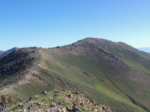
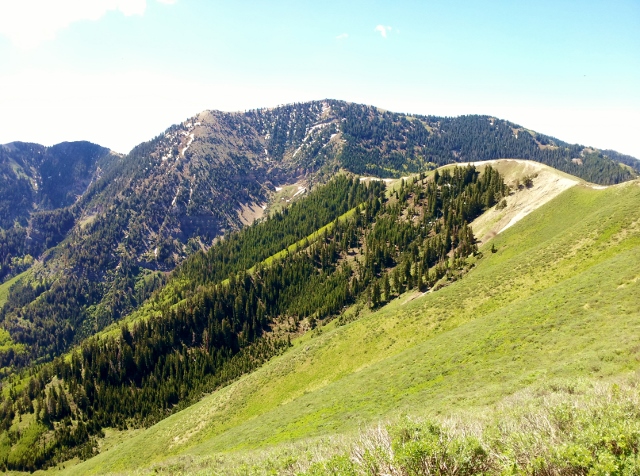
Next up was the highest peak on the ridge, Flat Top, not far from Lewiston Peak. I arrived at Flat Top (ridge mile 9.5, elevation 10,620, time 5:49) now 16 minutes behind last year. I was catching up. On the north side of each peak are forest slopes with dependable snow patches. Last year the snow was still deep but this year there were just patches here and there. I lost the trail on each of the steep descents through the forest but still made good time, picking the trail back up as it approached the next pass ahead.
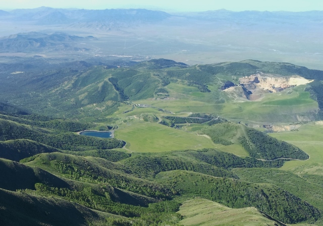
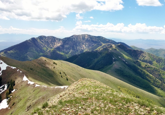
The next peak, Lowe Peak was nearly five miles ahead and the ridge climbed up smaller peaks along the way. The views were amazing looking down into the green valleys on either side of the mountain. The morning was getting warm, but a little breeze and the high altitude keep me cool.
The climb up to the top of Lowe Peak is tough, a 1,100 feet climb in about 1.5 miles. It reminded me of the Bozung Hill climb during Squaw Peak 100. I finally reached the top of this high peak (ridge mile 14.1, elevation 10,589, time 8:24). I arrived just three minutes slower than last year. I finally had caught up.
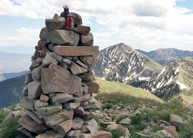
I never saw another human all day on the ridge. On the trail so far I had only seen deer tracks. I did see plenty of deer and it was fun to watch them bound down the slopes to get away from me. I descended steeply down the north slope of Lowe Peak 800 feet and then turned my attention to my last peak, Kelsey Peak off in the distance. I lost the trail at times and took longer routes, but finally climbed up the final steep slope to the summit (ridge mile 16.7, elevation 10,373, time 10:09) with the large cairn at the top. I was now five minutes ahead of last year but I needed to stop for about ten minutes to clean my feet.
On the descent from Kelsey, I stopped at one of the last snow fields to drink from my bottles deeply and refill everything to the brim with snow. I felt well-hydrated but I would have no clean water sources for my long descent back to my car, so this needed to last.
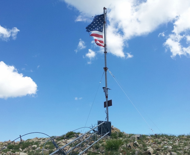
My ridge ending point, the furthest Butterfield Peak with antennas on top came into view and I pushed to descend fast toward it. The trail is very distinct and well-used in this location. West Canyon below was a beautiful green sight and looking back to the south I could see nearly all the peaks I had climbed. The view of the rugged ridge helped me appreciate just how difficult my traverse had been.
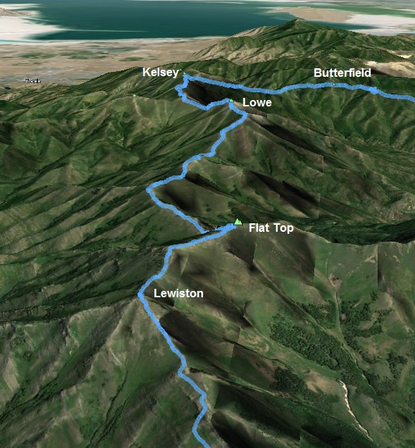
I reached the furthest Butterfield Peak (ridge mile 20.0, elevation 9,290, time 11:42). I had improved my time compared to last year by only 18 minutes. I could probably do it faster if I did the initial ridge miles in the light instead of pre-dawn. But there would be more of a risk running into rattlesnakes on the initial climb. Going north to south would be much faster with 5,000 fewer climbing feet. I believe the trail is also easier to follow in that direction. But I like south to north in order to do the loop.
All that was left was 13.5 of downhill miles back to my car. The biting flies were bad through the canyon and the final miles included oppressive heat. Thankfully there was a stiff wind and my water lasted to the end. I covered the total 40 miles in 16:34 and it felt tougher than running Squaw Peak 50. I climbed about 9,900 feet along the way and most of those feet were pretty steep.
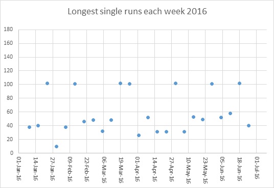
This make 12 consecutive weeks of doing a run of at least 50K (31 miles). It also is 20 consecutive weeks of doing a run of at least 26 miles.