

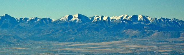
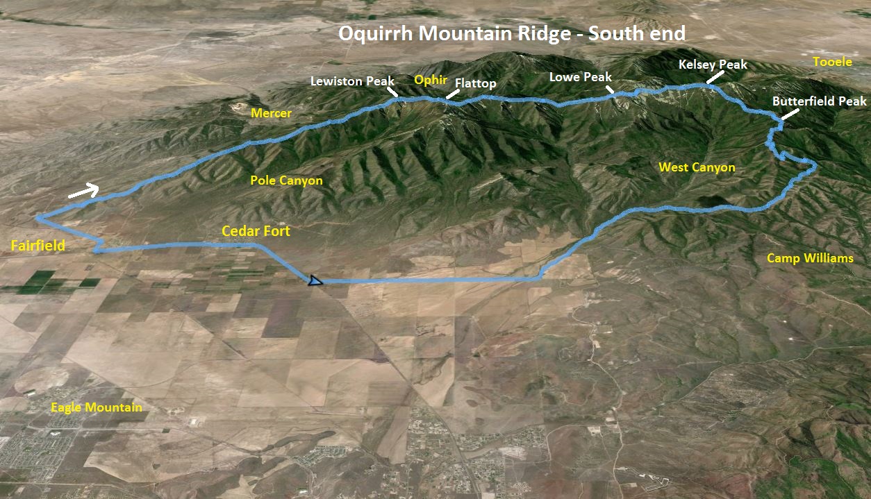
The Oquirrh Mountains is a mountain range that runs north-south for 30 miles on the west side of Salt Lake Valley and Utah County. The mountains have been mined in gold, silver, lead and copper including one of the largest open pit copper mines, Bingham Canyon (Kenicott) mine. I’ve climbed up to the ridge top in three spots and have always wondered if it was possible to traverse the entire southern portion of the range along the ridge top, starting from the desert floor at Fairfield to Butterfield Canyon. I knew it would be pretty rugged and slow at times, but for several years I had wanted to attempt it.
Timing for this adventure was critical because water needs. I had no desire to haul large quantities of water along the way and there are no convenient access points along the way to drop off supplies. The solution is to use snow fields, but the fields shouldn’t be deep enough to obscure the trails along the way. Thus the right time to try this would be late spring or late fall.
I considered running the entire mountain range all the way to I-80 and The Great Salt Lake. However, as I researched the northern section it would require trespassing on Kenicott-owned property and they have security. So I abandoned that idea for now and went back to my original plan to traverse the southern most rugged portion of the range.
Has any one accomplished this before? It appears the answer is no. During the winter two guys started at Flat Top (half way on the southern ridge) and using skis to traverse the Oquirrhs all the way to I-80. Another guy had hiked the northern half north to south. But no one had accomplished to entire traverse or the southern traverse in a day. A couple years ago I circumnavigated the southern Oquirrhs, running entirely around them, about 62 miles. I was ready to try something much more difficult and do the southern traverse.
In order to not burden anyone to pick me up when I was finished, I thought, “Why not make it a loop?” I enjoy running down a northern canyon back to Cedar Valley anyway, so I decided to run a loop. I positioned my car on the northern end of the town of Cedar Fort and began my run at 3:05 a.m. I ran the loop clockwise and for the first 6.1 miles ran a fast road run to reach the southern tip of the Oquirrh Mountain ridge that I wanted to ascend near the town of Fairfield.
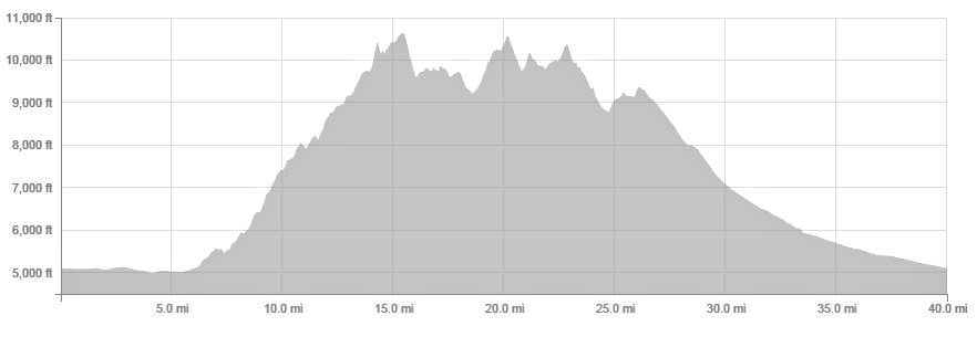
(Ridge mile 0, elevation 5119, time 0:0) In the dark, I left the desert floor and started to ascend up through scattered desert brush, staying close to the ridge line. I soon connected to an old faint road that helped me for a mile to avoid bushwhacking before it faded when two ridges came together.
I brought with me some notes to guide me along the way so I wouldn’t take the wrong ridges, especially in the dark. The notes had approximate mile marks and the elevation for each mark. But even with that, in the dark, I got confused once I reached a point during the second mile on the ridge where unexpectedly I had to descend a bit. But I quickly figured it out and continued on.
After an hour on the ridge I had only progressed about 2.5 miles up, climbing about 1,200 feet, but the early dawn light appeared, helping along the way. Following exactly on the ridge top became a rough chore because the ridge line was very rocky and slow, also probably with many rattlesnake dens.
I decided to set the rules for my traverse so this adventure wouldn’t take days. The objective was to traverse the length southern Oquirrhs end-to-end and I must summit all the named peaks along the way. But I could make use of deer trails that I knew existed along the west slopes usually within 100 feet of the ridge top.
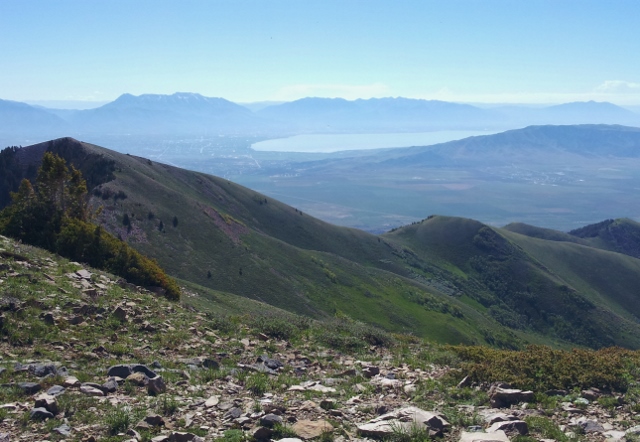
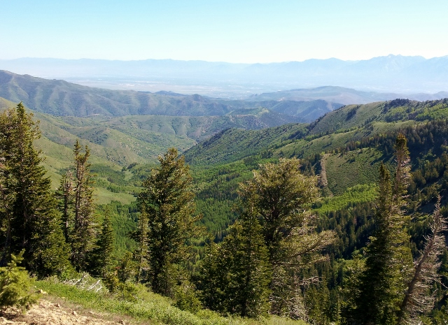
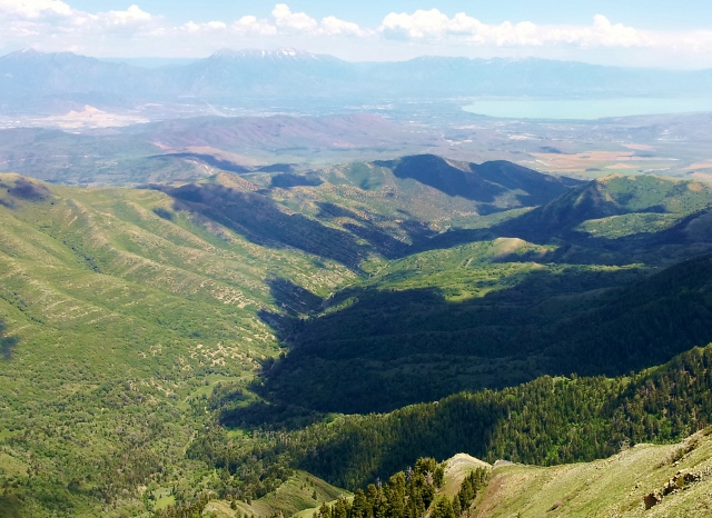
As dawn arrived, I looked down to the west into Manning Canyon, a place that I had run several times. I knew from one previous climb up to the ridge that I should keep my eye out for a deer trail that traversed the mountain range below the ridge on the western side.
At about ridge mile 5, I came upon the deer trail. The trail is impressive because it is so worn and distinct. Surely deer have traveled the trail for centuries. Perhaps horses have too at some point, but the only tracks I saw were deer. The trail would bypass minor knobs in the ridge but still stayed high not far from the ridge top.
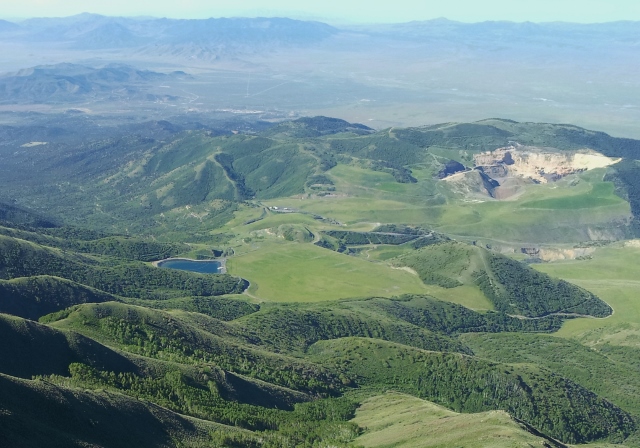
Now above the historic town site of Mercer, I looked down and thought about the busy city that once existed there during a gold boom.
As I climbed above 9,500 feet, snow fields appeared on the ridge. I had started my run with two full water bottles and about a water bottle’s worth in my camelback bladder. I had hoped that my fluids would hold out to this point and they did. I stopped and filled my bottles with snow. It would melt just fine for me to drink.
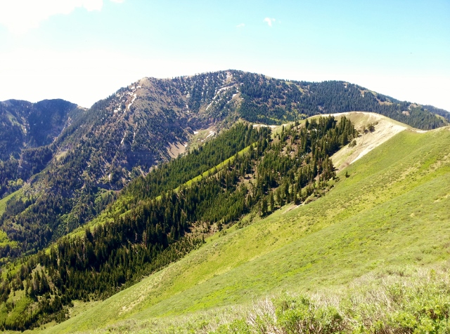
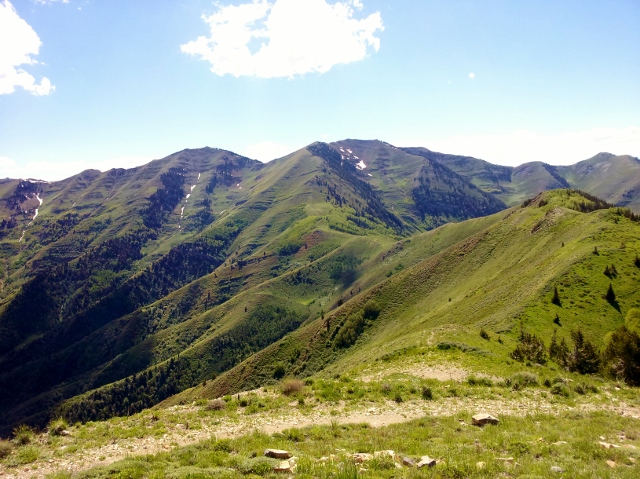
Looking ahead, I saw the first major climb, Lewiston Peak. I had never been up that peak before and it looked daunting and very vertical. But as I approached closer, the slope was steep but didn’t require hands to climb. The rocks were helpful for footing and I pushed my way up. I could still feel the after-effects of running 100 miles the previous Saturday so my pace slowed.
I reached Lewiston Peak (ridge mile 8.2, elevation 10,411, time 4:45). The morning views were exceptional. I stopped to take it all in and eat some. I signed the register and was surprised to see that someone had been up there the day before. I looked ahead toward my next peak, Flat Top, the high point in the mountain range and it didn’t look too bad.
Descending to the pass between the peaks was a challenge. Snow banks were deep going down and really slowed my pace. The trail I was using was lost. I struggled on the forested slope but eventually broke out of it and again found the trail along the ridge toward Flat Top. The trail would fade in an out and it took some good route-finding skills all day to relocate it. It made a huge difference in speed if I could run/hike along it. At times I would spot deer using the trail up ahead of me, one group of five. They would stop and watch me but eventually go up and over the ridge top.
I arrived at the top of Flat Top (ridge mile 9.5, elevation 10,620, time 5:33). My stop there was brief.
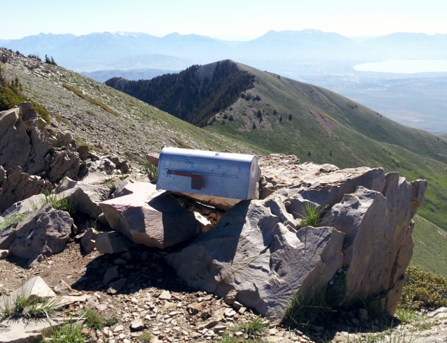
I signed the register there and again noticed that someone was on the summit the day before. I again couldn’t figure out which way to go down and pushed slowly through some snow-patch forest slopes, but eventually came upon the trail on the north side. This trail is actually maintained somewhat and gets some good use from those coming up from the Ophir side.
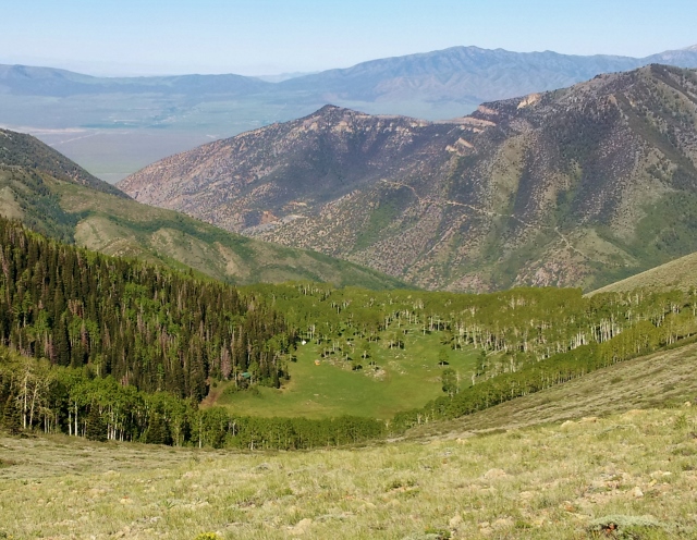
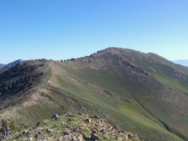
I reached the pass below and looked down at Halls Basin, an area I hiked up to more than ten years ago. It is private property and now no trespassing is enforced. I now had a long up and down ridge run to get to Lowe Peak. I tried pushing the pace, but it was still slow, 14-20-minute miles.
North of Flat Top, the deer trail was much more distinct, now being shared with occasional horses and hikers.
The climb up Lowe Peak was pretty huge, about 1,200 feet up. I got dizzy at times from low oxygen, but I kept pushing up that peak. I finally arrived at the summit of Lowe Peak (ridge mile 14.1, elevation 10,589, time 8:21). I took a long stop on the peak to eat lunch.
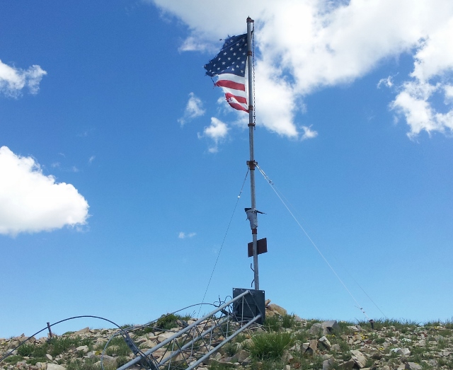
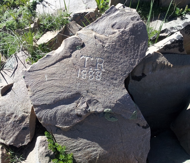
I signed the summit register and was surprised that I was the first to sign it this year. This peak is fairly remote with no easy way to get to it. Someone had put up a flag pole on the summit last year. The flag was in tatters.
I looked back at where I had come from and it brought to me the enormity of what I was accomplishing.
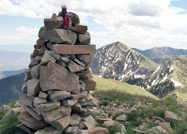
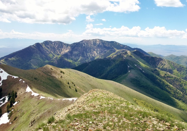
Continuing on, I knew that my next peak would be Kelsey Peak. The ridge was making its way around beautiful West Canyon below to the east. I had hoped to have some nice long rolling ridge sections, but the pattern continued with a big descent to a pass and then a steep climb to the next summit. The climb up Kelsey was nicer, only 500 feet to go up. I arrived at Kelsey Peak (ridge mile 16.8, elevation 10,373, time 10:14). There was a massive cairn at this summit. As I descended, I made sure that I filled my bottles and camelback with snow. This was my last chance for water.
I descended down to Piney Pass and then was confused. There was another peak ahead that was not in my notes. I could see Butterfield Peaks across the valley but my notes said nothing about another climb. (It turns out climbing up and over what is called White Pine Peak is probably the right way.) But I saw a very distinct trail going around this peak so I concluded that was the right way. I made my way to that trail but it was rough to get to, going across a steep slope. The trail turned out to be a deer trail. Should I trust it to take me the right way? I decided to. The trail wound its way around but was losing a bunch of elevation. I had nothing in my notes about a low pass ahead. Was this trail going to descend into the canyon? “Trust the deer,” I said. Sure enough as I wound my way around, I saw the trail took me exactly where I needed to go, a low pass before the Butterfield Peaks. Great luck.
Now the trail was very distinct with cairns. My final climb was another 500 feet and I reached the highest Butterfield Peak (ridge mile 20.1, elevation 9,370, time 12:00). Twelve hours on the ridge! I certainly took my sweet time and doing it again, now knowing the route, I could do it several hours faster if I pushed it hard.
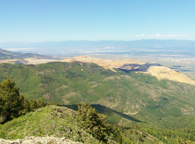
It was now time to head home and I was in very familiar territory where I have run many times. I descended down the Butterfield Peaks road to what on the maps is called “City Canyon.” I then ran City Canyon all the way to the West Canyon road that would lead me back into Cedar Valley. Upper City Canyon is probably the most wonderful place to run in the Oquirrhs. It is shady, cool, and the road down is perfect for running. I had a great time.
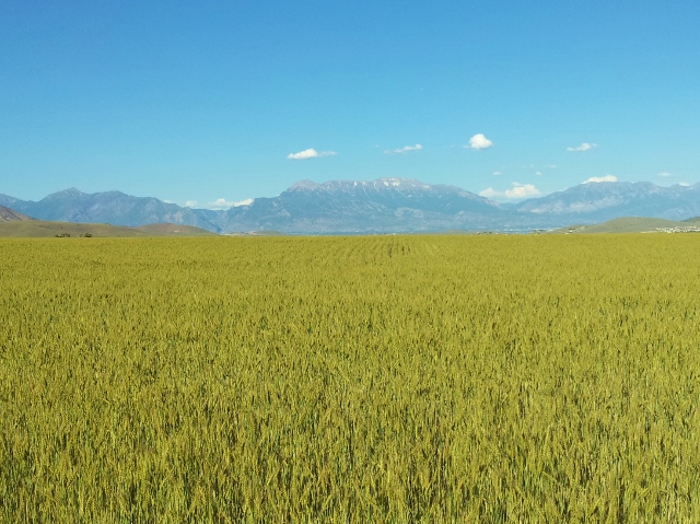
I reached West Canyon Road and was nearly out of water. With a few more hot miles to go, I had no choice but to dip my bottle into the questionable creek. Cattle graze in the area. Once back in Cedar Valley, the late afternoon was hot, in the 80s and a mile before reaching my car, I was out of water and getting badly dehydrated. But I made it, exactly 40 miles on my Garmin and about 11,000 feet of climbing along the way.
I had a great sense of accomplishment as I contemplated what I had just run. The difficulty felt like a tough 50-miler with all those steep climbs along the way. I checked off this bucket list run. I suspect that I will do it again someday soon, maybe in the fall.
I’ve been dreaming of doing this route (North to South, and minus the loop) for the past 6 months. Way to go! Glad to hear that the trails were run-able and it is as beautiful as I’m hoping it will be! Going for an attempt this spring/summer.
Awesome trip report, I’m looking to do Butterfield, Kelsey, Lowe, Flattop and back this weekend. Thanks for the info and pics.