

I enjoy running on high ridges. As I drive places in my car, my eyes are always drawn up to the tops of high flat ridges and I wonder if they can be run. When you drive through the Wasatch Back, there are many such ridges that indeed can be run and usually only get attention by hunters, ATVers, and snowmobilers. One such area had been on my list to explore — the ridges between Soldier Summit (Spanish Fork Canyon) and Strawberry Reservoir. Years ago I had run Strawberry Ridge but I knew there were many others to explore.
Early Saturday morning, I drove up Spanish Fork Canyon and parked just east of Soldier Summit at the first road on the north side. There is a Forest Service kiosk there but only a general map for information. I began my run at about 3:45 a.m., running up the road that follows the Left Fork of the White River, starting a clockwise loop, hoping for about a 50-mile run.
The road was initially paved, then oiled gravel, and finally smooth maintained dirt. The skies were clear and the stars were out, including shooting stars. The road climbed about 2,500 feet over the 9.5 miles to get me on top of high Willow Creek Ridge which is about fifteen miles long. As I climbed, I passed through a large area of privately owned land on either side of the road. The road is public use, but the valley and hills on either side was off limits. The signage was really annoying to see constant warnings and threats against anyone daring to leave the road to enjoy the valleys and hills.
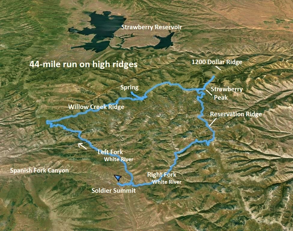
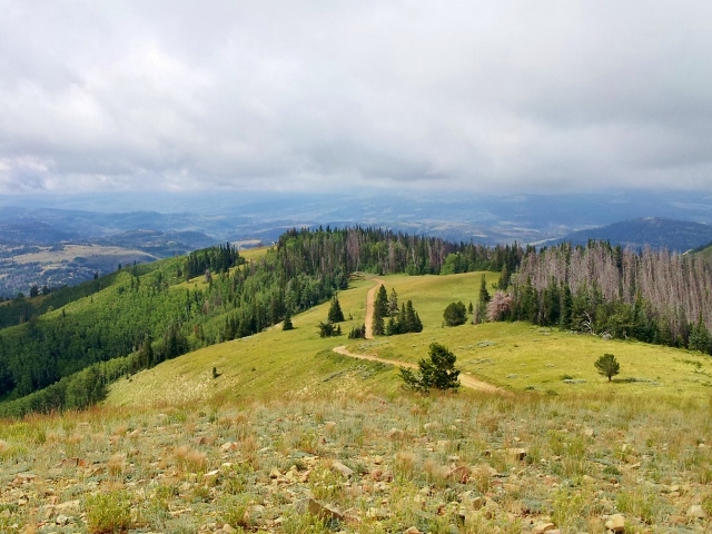
Dawn arrived as I reached Willow Creek Ridge, but everything above about 9,000 feet was covered with low clouds, so the early morning views were limited. I startled many large deer as I made my way up and down the road following the ridge line. This ridge wasn’t very flat, rolling between 8,800 and 9,800 feet but the road made it easy to run it.
At my mile 13, the first ATV came by for the day. I later figured out that the two guys in it were checking the road and side roads, clearing any downed trees from the storm the night before. I suspect they regularly maintain the Willow Creek Ridge so it can be enjoyed by ATVs and hunters scouting out game for the upcoming bow season. I would see these guys several times during the morning and I’m sure they were surprised to see me covering so much remote ground, so fast.
At about 16 miles into my run, still on Willow Creek Ridge I made a planned detour to descend to the north seeking to find a spring that was marked on the map, to top off my water bottles. On problem with running high ridges are water sources, which are usually below the ridges. I identified two nearby springs on my route. The run down the valley to the spring was great fun. I found a side single track trail that I guessed led to the spring and it did. The spring was trickling but I was able to top off my fluids for the continued run. As I ran back up the road, my two ATV friends drove down, checking this road and waved again.
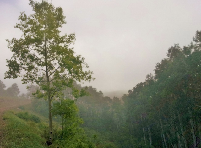
As I climbed up to my highest point of Willow Creek Ridge (9,800) at mile 21 and at about 9:15 a.m., the fog was finally starting to lift, the sunshine poking through, and a breeze blew across the ridge tops. I climbed above the tree line and enjoyed a flatter section up high.
I checked the clouds above, frequently wondering how long rain-free weather would hold. The roads that I was running on were damp and soft with occasional puddles to go around. After punishing my feet on technical trails for the past several weeks at Capitol Reef 100 and Tushars 93K, they were thankful for the smooth, fast roads to run on.
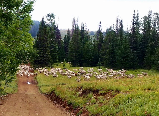
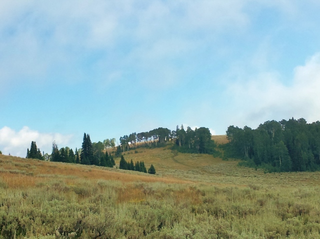
I descended into high valleys and left Willow Creek Ridge to continue my loop. As I ran through a beautiful valley, a lone horseman approached. He was a Latin sheepherder with three sheep dogs following him. He must have been out hunting for wandering sheep. There had been many Aspen trees carved into by Peruvian sheepherders who were up there in 1976. In about a half mile later, I came upon the main huge sheep herd. They saw me and immediately all started running, quite a sight to see.
I decided to next ascend and summit Strawberry Peak. (There are multiple peaks named Strawberry Peaks in this area, another one to the west near Strawberry Ridge.) This Strawberry Peak is located on Twelve Hundred Dollar Ridge. I followed the nice ridge road all the way to the summit at 10,335 feet. Many wonderful views were presented to me in all directions.
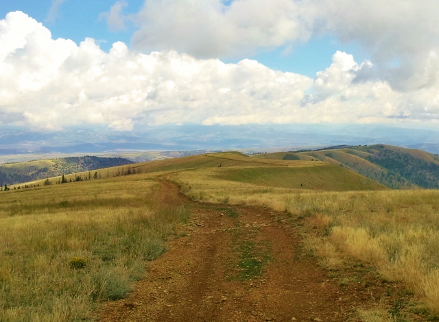
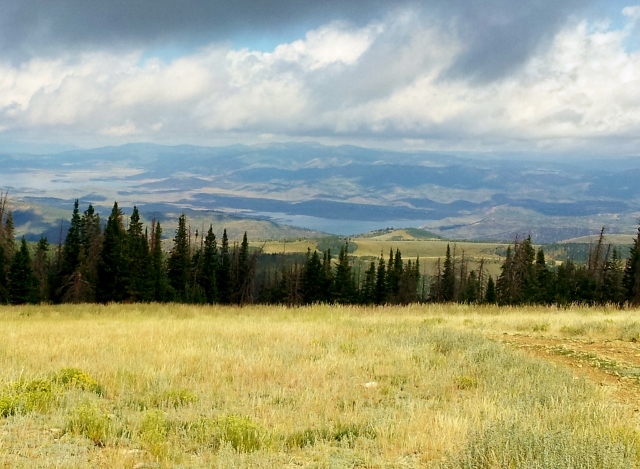
Above the tree line, the road on the ridge top continued to extend on the ridge to the northeast, gradually descending. I decided to continue to run on it for a couple miles and get in some nice views of Strawberry Reservoir to the north. I also passed by the sheepherder’s small camper which included a TV antenna. It must be a lonely but peaceful job tending the sheep.
Once I started to descend below 10,000 feet, I turned around heading back from my out and back on Twelve Hundred Dollar Ridge. I stopped along the way to sit and eat my lunch below the sheepherder camper, looking at the wonderful views from up high.
Back on the main road, (081), it made a fun fast 1,000 foot descent in about two miles and I cranked up the speed. A couple ATVs came by but they were very courteous and slowed down and waved. I only saw about 7-8 vehicles all day, so I mostly had my route all to myself.
I reached the 50K point (31 miles) at about the 8-hour mark, so my overall pace wasn’t terribly speedy with some long stops enjoying the views. This training run gave me some good altitude training benefits. I find that the more time I run above 9,000 feet, the better I do in the altitude races. During my last two races that were above 10,000 feet I never experienced any altitude difficulties because of the time I had spent this early summer above 9,000 feet.
I was now running on the very long Reservation Ridge which rolled up and down but had some nice flat sections to kick up the speed. This ridge road extends for 27 miles but I would only experience a few of those miles. At mile 35.5 I reached a road junction which was a decision point. I could continue on the ridge to make my loop bigger or I cut it short and take road 081 to return to my car using the Right Fork of the White River. The weather made the decision for me. It started to rain and I could see a massive thunder storm coming at me from the west.
I now would descend nearly 2,000 feet over the next ten miles to complete my loop. The initial rain storm was brief and the sun poked out again but the thunderstorm ahead looked bad. It looked like if I pushed the pace hard I could barely miss it as the road turned to the south. I cranked up the speed to sub-9:00 pace and indeed missed the lightning and pouring rain by only about ten minutes. I looked behind me and could see it pouring rain where I had recently run.
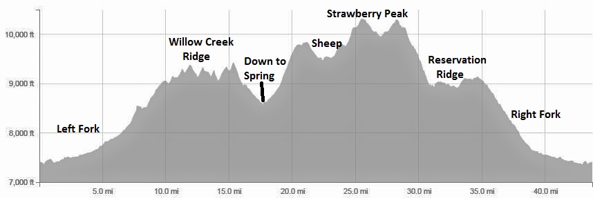
I continued to push on and descended through the valley which eventually connected to the Left Fork and my car came into sight. My distance came to 43.7 miles in almost 11 hours with 6,200 feet of climbing along the way. It had been a wonderful adventure. I had only experienced some of the ridges up there. I had passed by several others that certainly would be on my list to run in the future. Running ridges can be great training to put in some good miles at high altitude.