

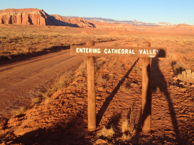
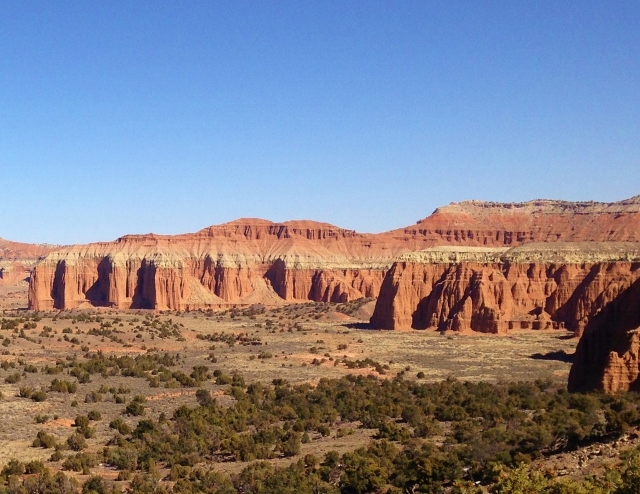
Cathedral Valley is one of the great remote areas of Utah that receives very few visitors. In 1945 the first superintendent of what was then Capitol Reef National Monument, christened this area of fantastically eroded cliffs, sandstone monoliths and panoramic views, as Cathedral Valley. To him, the scene seemed downright Gothic. Compared to the more popular Waterpocket Fold area to the south in Capitol Reef National Park, not many people choose to make this trip. It usually requires a high-clearance vehicle and at times a 4WD vehicle.
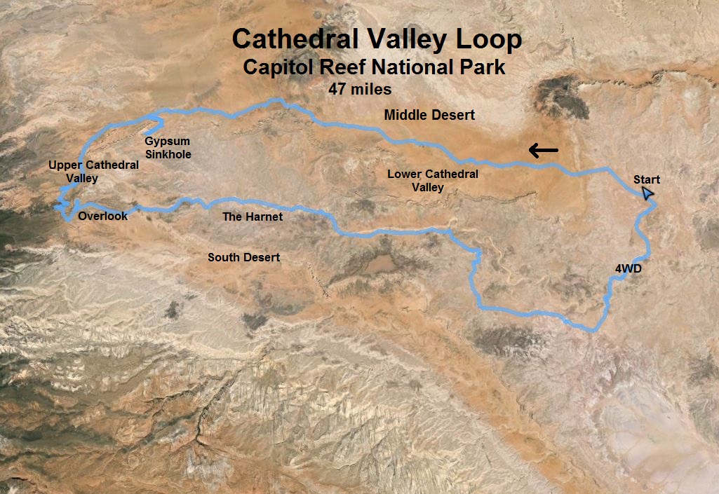
During most of the year, a 64-mile loop (including a paved-highway connector) can be driven to view this spectacular area. Last year (2015) I made a brief visit to Cathedral Valley and recorded this video. This year, I decided that I would try to run the entire loop. Instead of running the highway to connect the ends of the road, I would use a remote 4WD road (0146) to complete the loop. This would make a loop of about 43 miles, most of it on fast maintained dirt road. Surely no one had ever attempted this before and I would discover another epic long run. With some sight-seeing detours along the way, my run would be 47.2 miles.
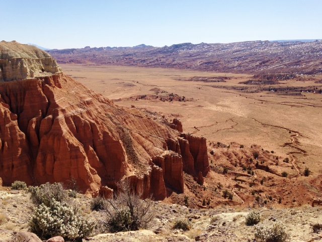
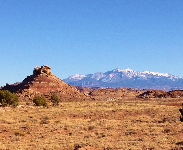
I drove out on Thursday afternoon in time to drop off some fluids at what would be my mile 32.5. I drove across the Freemont River at the ford (which usually discourages people from driving the east section), which was no problem, and previewed the east side of the loop. I found the intersection for the 4WD road that I would want to connect the loop. It was well-marked. I then drove 5 more miles to a trailhead sign to hike cross-country for a view over the lower Cathedral Valley. I decided to run up and see the views about a mile away and 300 feet up to the top of a ridge. There was no worn trail, so I just headed for a saddle, arriving as the sun was starting to set.
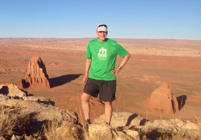
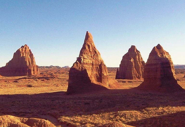
The views of the Temples of the Sun and Moon were spectacular from about 600 feet above the valley floor below. I watched hawks glide in the warm currents near the top of my ridge.
I ran along the ridge to get different photo angles and then descended
My last task for the day was to drop off fluids at mile 32.5. But I discovered that springs and some washes were flowing and that snow patches started appearing at about 6,000 feet, so dropping off fluids for this loop at this time of the year really isn’t needed if you bring a water filter. Because of all the cattle and elk in the area, a filter is needed.
I spent the night at a motel in the tiny town of Cainesville and arose early to start my adventure. I drove to the Cathedral Valley loop road (west side) that starts near Cainesville. In a little more than nine miles, I found the 4WD road (0146) and parked my car there to start my loop. It was 27 degrees at the start but I knew it would warm up quickly so I wouldn’t bring a jacket. (It would eventually warmed up to 57 degrees). I started at sunrise, about 7:00 a.m. I would be running the loop counter-clockwise to keep the sun mostly on my back, allowing for good pictures.
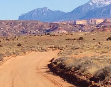
The dirt road was amazing this time of year for running. It was always soft, sometimes sandy, but a very fast surface. The road rolled up and down and I could already see Temple of the Sun rising up miles ahead. My early pace was strong, about 9:30-mile pace, keeping me warm.
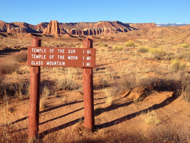
After an hour, at the 6.1 mile mark, I reached the turn-off for Temples of the Sun, Moon, and Stars. Since I visited that spectacular area last year, I decided to skip it this time and continue to run forward. I now entered an area I had never seen before.
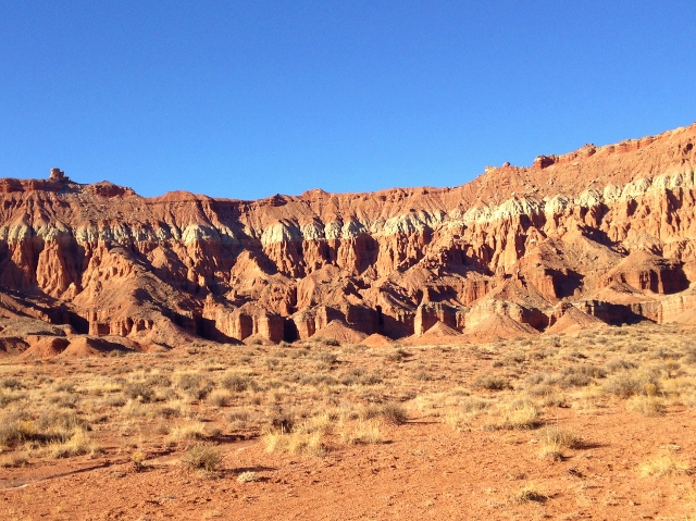
I ran past spectacular colored cliffs to my left that came alive in the rising sun. I was running it what was called “Middle Desert.” It seemed like I was running in some remote section of “Middle Earth.”
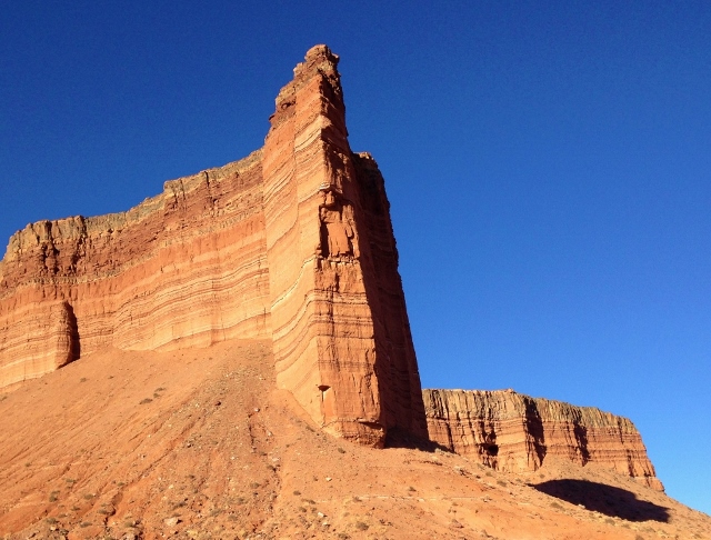
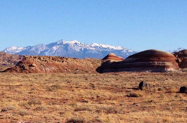
At about mile 10 I ran past a massive cathedral rising high above me in the sky.
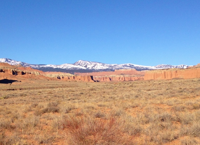
As the road turned to head west, I could see Upper Cathedral Valley about ten miles ahead with some amazing colors contracting the snow-covered mountains above.
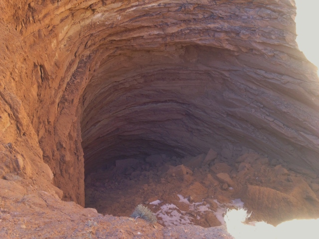
After about 3.5 hours of running and 15.5 miles, I reached the turnoff for the Gypsum Sinkhole. I decided to take the two-mile out-and-back detour to check it out. The Gypsum Sinkhole is an occurrence formed by a dissolving a buried gypsum plug. The cavity left behind has collapsed under the weight of overlying rock layers. This collapse has created a large sinkhole nearly 50 feet in diameter and 200 feet deep. Falling in there would be problem.
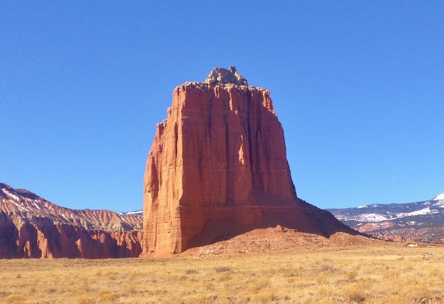
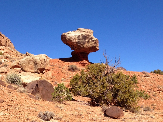
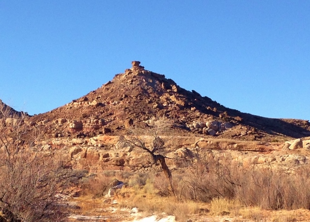
On my way again, I set my sights on arriving in Upper Cathedral Valley, passing by a stunning monolith.
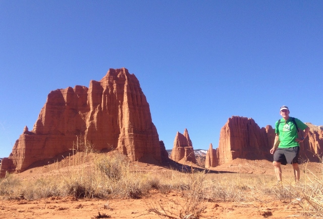
I arrived there at the 20.2 mile mark at about the 4-hour mark. I stopped to take some photo shoots of Needle and Cathedral Mountains rising above me. I was surprised to hear a vehicle approach. It would be my only human contact for the entire day. A truck with an ATV in it drove by. A half hour later they returned and again left the entire valley to myself.
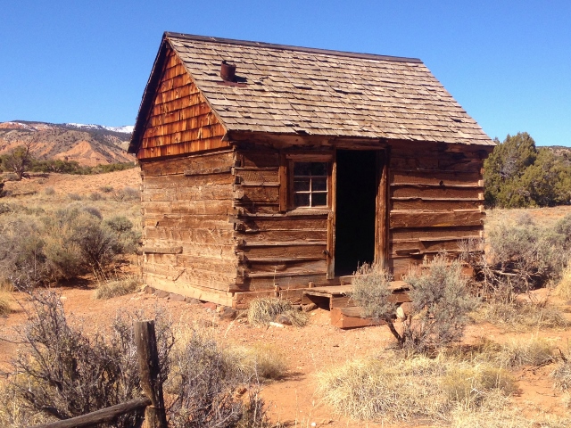
At mile 21.8, I decided to go visit historic Moore Cabin. Along the way, I slipped in the mud and fell to the ground, hitting my arm hard on a rock. Nothing was broken and I was fine. I was now at 6,400 feet, so snow patches and runoff were now seen. The cabin was built in the 1920s at a logging camp, and was the home of Paul Christensen’s family of eight. In 1932 it became a cabin for livestock operations. For years it was stocked with food for all that needed it. It became abandoned in 1970.
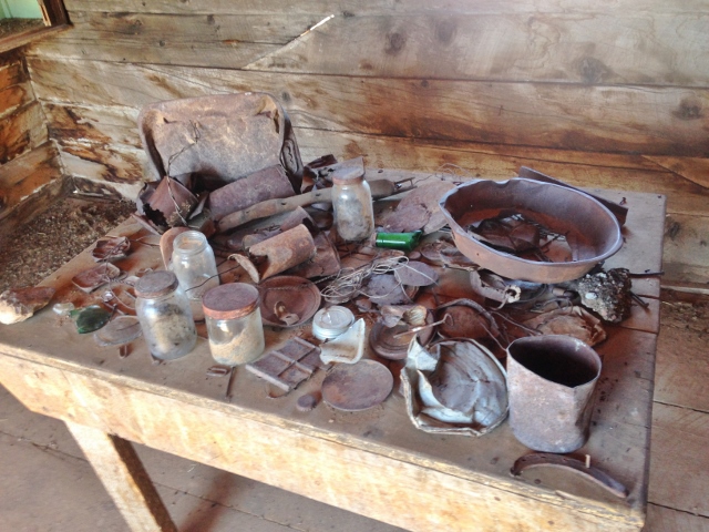
Inside the cabin was a collection of artifacts found there.
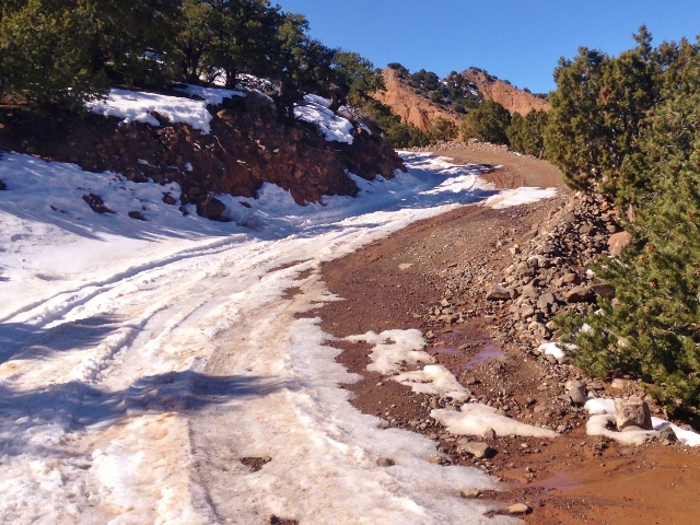
Continuing on, I now climbed up and out of the valley as the road switch backed up to the top. The running became slow as the road became snow-covered, slick, and muddy in spots.
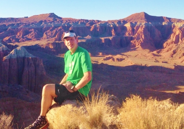
The views as I rose up were amazing looking down into the valley. Finally on top, at 7,000 feet, I was at mile 23.5 at about the 5.5 hour mark. I stopped for my lunch after a short detour to the valley overlook at mile 24.3 where these was a picnic table.
Feeling strong and refreshed I continue on for a fast descending run along the rim above the South Desert.
The road then entered a valley and winded its way through rock formations. At mile 29, at the 6:30 mark, I had descended down to 6,200 feet and was dumped out into the vast Hartnet Valley. I concentrated to keep my pace at a solid 12-mile pace with a goal to finish my loop run before sunset. I reached my cache of fluids at the 32.5-mile mark, at 7:05. With all my photo stops, my pace wasn’t speedy for 50K, but it still was pretty solid. After a five-minute stop to load up and pack away my empty bottles, I was on my way again.
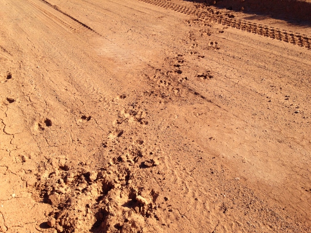
I now was in familiar valleys from my preview the day before. I passed by the trailhead I visited yesterday and at mile 39 saw an amazing site. I spied a herd of 12 elk, all running very close together to the left of me. They saw me and would run ahead, stop to look at me, and then run ahead again, repeating this over and over again.
Finally they wanted to cross the road ahead of me. They ran ahead, crossed the road and then went off toward the mountains to the west. Wow, what a cool thing to see.
The views of the Henry Mountains to the south were amazing in contrast to the desert that I was running in.
The colorful Bentonite Hills came in view with their stripes and colors. But I wouldn’t run through them as I reached my turnoff on the 4WD road at mile 41.6. It was now 4:15 p.m. and the sun was descending low in the sky. I needed to push ahead to finish before sunset.
Now the running turned into great fun. In contrast to the hours of running on graded soft, consistent dirt road, I was now running on a rougher, rolling 4WD road that felt like running on single-track. I winded left and right, up and down, and through some incredible valleys and drainages. I was having a blast and almost hated to think that I would soon be done.
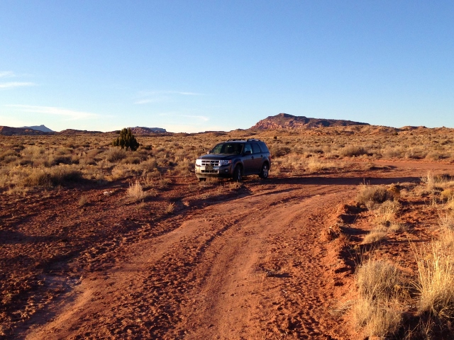
I always have uncomfortable worries when leaving my vehicle in remote areas, thinking that someone could have messed with it, or stolen it. But finally I was relieved as I saw it off in the distance, knowing that I wouldn’t be abandoned out there.
I finished my run in 10:24 after traveling 47.2 miles, climbing 2,416 feet along the way. Wow! What a great adventure. I’m sure that I will want to run it again. It had been an amazing, quiet, remote day all to myself with constant changing incredible views.
Beautiful recap of a wonderful adventure. Sure wish I were there.
This landscape is so cool! Where in the cathedral Valley would I find the spot you took the picture at the top of your post?