

For several years, I have dreamed about doing a very long run through the Grand Canyon. Many ultrarunners run ACROSS the Grand Canyon and back. I have also accomplished feat that many times. But I’ve had a dream to run the length of the Grand Canyon rather than across it.
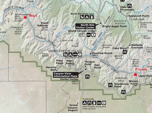
Conditions worked out, so I made plans to run the length of the Tonto Trail from South Bass to Hance Rapids, a distance of more than 87 miles in the canyon. I was also interested in establishing a fastest known time for this stretch. Through-hikers have accomplished this in several days, but I have yet to hear about runners accomplishing it without stopping and camping for the night. (Turns out that Scott Jurek and Joe Grant did it last year!) I wanted to give it a try and experience the beauty of the amazing Tonto Trail in one stretch.
Tonto Trail
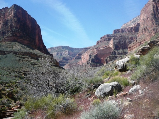
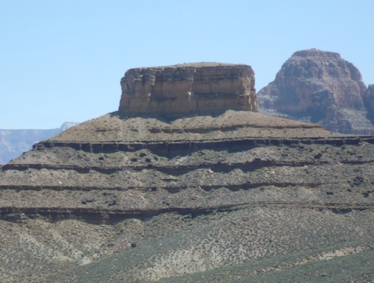
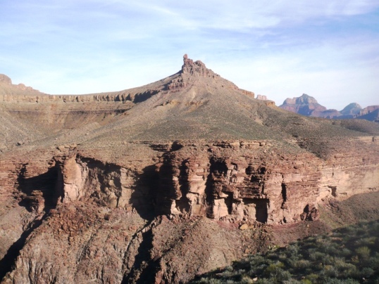
The Tonto Trail is the longest continuous stretch of trail in the Grand Canyon. It is arguably also the most scenic. The trail goes from Garnet Canyon on the West, to Red Canyon (Hance Rapids) on the East. Trails continue on either side but on each end they become remote “routes” instead of established trails. To avoid doing any out-and-backs, I decided to start my run where the South Bass Trail (coming down from the rim) intersects with the Tonto Trail. I would then head east (up-river).

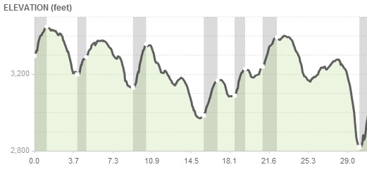
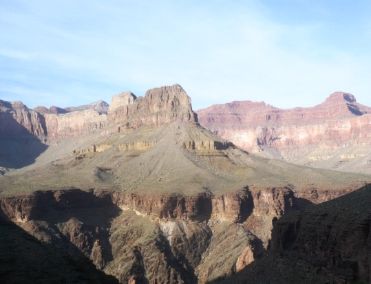
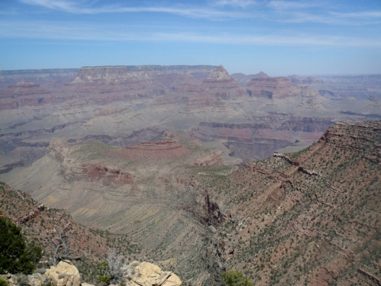
The Tonto Trail is like a contour line on your map. It weaves in and out of all the side canyons, attempting to stay up on the Tonto Platform about 500-1000 feet above the Colorado River. If you floated down the river from Red Canyon to South Bass Canyon, it would only be about 31 miles. But the Tonto Trail travels nearly three times that distance to reach the same point. Contour lines on maps stay level. The Tonto Trail is not level at all, but rolls and at times takes some tough descents and climbs to cross near the red walls of the side canyon. During this 87-mile stretch I estimate the Tonto Trail involves climbs of about 10,000 feet. Despite its length, the Tonto is the most efficient way along the landscape as it does attempt to maintain a consistent elevation. Short-cuts are always slower.
Over the years, the Tonto trail started as a game trail, then used by Native Americans, then by miners and now mostly by backpackers. Because of its remote nature, in some sections only a few hikers can be found on it during a week.
Warning
Running on the Tonto Trail is only for those with advanced Grand Canyon and desert running experience. Very fit runners and backpackers have died on the Tonto Trail. Before attempting this end-to-end run, I had already logged 192 miles on the Tonto Trail in segments, all in November. As part of that, I also spent about 55 hours running the trail at night. So I felt prepared, knowing what to expect, and pretty familiar with two-thirds of the trail I would be on. No one should attempt this through-run without logging some significant experience in the Canyon.
There is really only one time of the year to do this safely – April, and probably early April. That is the time of the year when temperatures are good for running AND the seasonal springs are flowing. It could be done in October and November but many of the springs and creeks are dry that time of year which would require hauling heavy water for long distances.
Running the Tonto Trail June-August could be a death sentence. Temperatures can reach 120 degrees in places and there is very little shade. If you thumb through the “Death in the Grand Canyon” book, you will find many entries of people losing their lives on the Tonto Trail in June-August. Do not take this trail lightly.
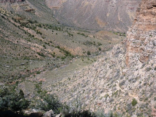
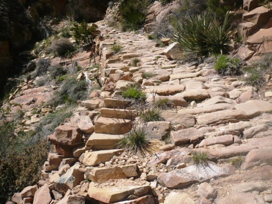
What is the trail like? Half of it is rugged and rocky, the other half is smooth but very crooked, widing around all the bushes and cactus. To make things hard, it constantly changes back and forth between smooth and rugged. Going between drainages on the ridges, it is smoother and when it goes in, or needs to cross drainages, it is rugged and reminds me of the tough Zane Grey 50 course. You would think that the smooth parts are easier and faster. Not so. These sections are out close to the Colorado River as it is going around to the next side canyon. The problem with these sections is that because of the vegetation and wind, signs of the trail can became much fainter. Without careful attention and experience with the trail it is very easy to lose the trail and end up in a cactus patch. You have to stop, study the surroundings, back up, and carefully find the trail again. Using a GPS can help, but is annoying to keep consulting. Taking any short-cuts always takes much longer than staying on the trail.
What dangers are there?
- Falling off cliffs. There are only a few short sections that exposed near huge cliffs. They don’t last very long. There is less exposure on the Tonto than on the corridor trails used by R2R2R runners. So falling off some cliff at night really isn’t much of a worry.
- Getting Lost. Getting lost for hours really isn’t possible because the trail stays on the Tonto Platform above the river. But, you certainly can lose the trail for many minutes which can be very frustrating. Skill needs to be developed how to find the trail by making circles or other such techniques.
- Getting injured. This is really the biggest thing I worry about. If I busted an ankle on the trail, it would be many hours or maybe a day or two before help would arrive.
- Running out of water. You don’t want to do this on the exposed Tonto Trail. You need to know where the water sources are. Once heat stroke starts setting in, hikers on the trail do stupid things like trying to go down canyons to reach the Colorado River for water. They end up getting stuck on a cliff and die.
- Exhaustion. This is the other realistic danger. 100-mile race fitness can teach you what to do. Along the way there are bail-out points to climb out of the canyon. Knowing when to bail out is the key. For my run I would be passing by five exit point opportunities to climb out of the canyon.
- Snakes. I have yet to run into a snake in the Grand Canyon.
.
Getting to the start
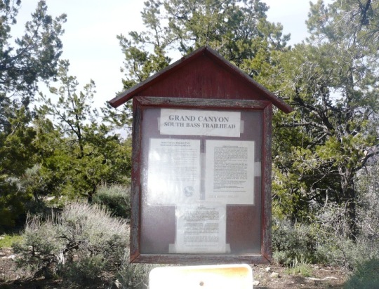
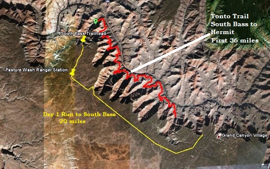 I chose to start at the most remote end and finish where I could hitch a ride back to Grand Canyon Village. So my starting point would be at South Bass. However, to reach that point requires a 2-hour long rough dirt road drive. If you shuttle a vehicle, that is 4 hours. So in my twisted logic, I concluded, Why not just run it in about five hours. That would be much more fun. I would run from Grand Canyon Village to South Bass Trailhead (20 miles) and then descend down to the Tonto Trail and camp for the first night.
I arrived at the Grand Canyon on Wednesday afternoon and went to the Backcountry office to get my permit. In order to camp down in the canyon, or even hike/run at night in the canyon, you are required to obtain a permit and pay a fee. Permits were available because South Bass is so rarely used.
Day 1: Getting to my starting point.
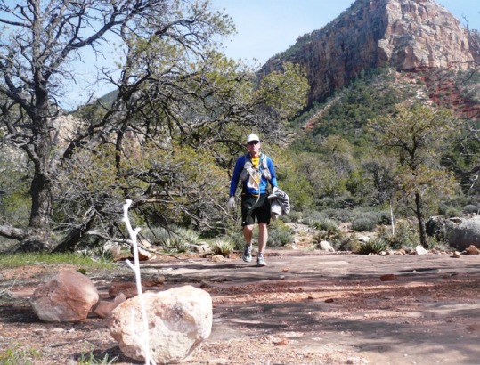
The past few days had been very windy. The evening before, there had been 50-mph winds at the South Rim and the Canyon below was very hazy with dust. I got a good night’s rest at a motel outside the South Rim, and waited until morning rim temperatures got above freezing. At 8:30 a.m., I was off, excited to start what would turn out to be a 110-mile running adventure.
I parked my car at the Bright Angel Trailhead and caught the Hermit Rest shuttle. In the shuttle a guy was looking at my crazy get-up with gaiters and a light backpack with a flashlight and small bivy bag hanging on it. I was a funny sight, not your usual tourist. I got off the shuttle at “the Abyss.” From there I started my run on a 4WD dirt road that runs straight, mostly along the Park Boundary.

It was so great to be out running in the cool morning. The road was fantastic. Because of all the snow the previous weekend, the road was moist and soft, very runnable without mud. I only filled two hand-held water bottles, hoping to refill from snow patches along the way, but I didn’t see any. The snow had already melted. Oh well, the morning was cool, and I was sure to find patches of snow just below the rim at the South Bass trail. Running through the forest was so peaceful and amazing. How great was this!
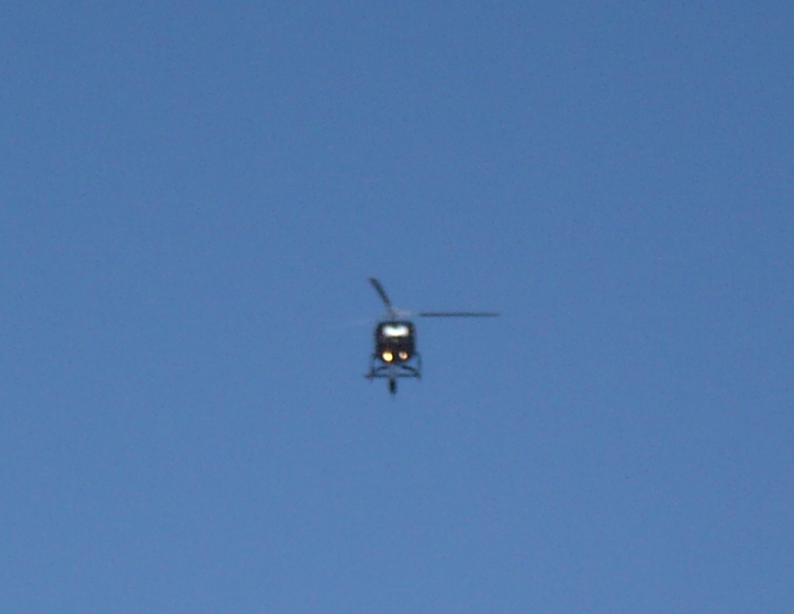
After a few miles, I heard buzzing that got louder and louder — helicopters. Only one section of the canyon is open for fly-overs, the section near Hermit and Boucher canyons. As I continued running west, I discovered that the road I was running was being used as a flight path for all the helicopters returning to the airport. They all flew toward me, about 20 per hour. It was quite a sight. Finally I got past all that activity and then only heard a dull buzzing behind me.
The road ahead was straight as could be and rolls up and over low ridges. At times I could see it several miles ahead. I came upon an unexpected sight, a car parked on the side of the road. There was a sign on the windshield that explained that they were parked there doing ecology research in the area. If needed, you could just honk for them. I guess I could have asked them to refill my water bottles, but they probably wouldn’t have liked that, so I went on.
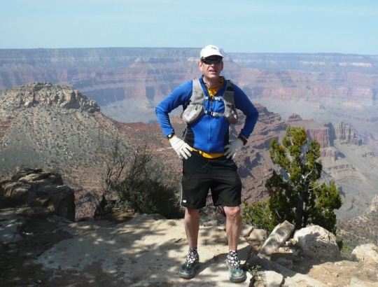
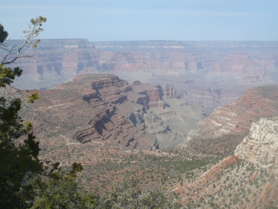
After about 13 miles, I decided to take a detour and run a half mile to peek over the rim of the Grand Canyon. The rim is easy to find, just can’t miss a big ditch like that. I stopped and took in the remarkable view of Turquoise Canyon below and thought with amazement that I would be running in and out of that canyon tomorrow morning.
I ran along the rim for another half mile. There was no trail, just tracks from elk and deer. I enjoyed blazing my own trail above this wonder of the world. After slow going for awhile, I continued cross-country back to the road.
After a couple more miles, I arrived at the Pasture Wash Ranger Station. This remote station has been abandoned for many years. I thought about spending the night there, but knew it would be a chilly night in the 20s up here. I needed to go down into the canyon where it would be warmer.
For the last three miles to South Bass, I ran on the main dirt road. I could see tracks of some hikers who several days ago walked this road in very deep mud. For me, it was dry. I’m glad I changed plans and didn’t come here last weekend after all. That is the problem with doing this adventure in early spring. This road could be impassible to vehicles. However, you could just do it like me, and run to the trail.
Finally I arrived at South Bass Trailhead. There were several cars parked there. I had run out of water a few miles earlier and noticed a gallon of water on a picnic table. How lucky is that? As I approached, I noticed there was a guy sitting there. I surprised him and asked if he might have some extra water. He was so kind and offered me the entire gallon. I filled up my bottles, and filled up a bladder. He had hiked down and up the South Bass Trail to the river and back today. He was amazed to hear that I had run all the way to the trailhead. He had given another guy a ride out here in the morning and I guess I could have hooked up with him too via the backcountry office. Oh well, I sure enjoyed that rim run.
I told him that I had planned to find snow below the rim and melt it for water. He told me there was no snow, so I felt very fortunate that he was there. (However, it turns out there were snow patches just below the rim in the trees that I could have used, so my plans were valid.)
I bid goodbye and continued my run, now steep downhill into the Grand Canyon on the South Bass Trail. This was the 6th trail on the South Rim that I have used to go down into the canyon.
I quickly discovered that despite some descriptions, this trail is probably the easiest of the unmaintained trails. The first couple miles of switchbacks were pleasant and were not covered with big rocks like on other trails.
As I was descending I came upon a sweatshirt on the side of the trail. It was pretty nasty, had been ripped by rodents, but I decided to take it with me. It could use it as a soft ground cover to sleep on. I soon reached the esplanade level of the canyon – a level plateau of red sand.
It was nice to get a break from the steep downhill for about a mile.
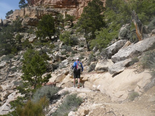
The next descent down to the Tonto was much more rugged. There was some boulder hopping, vegetation to work my way through, and another 1000 feet to go down.
I finally reached the junction of the Tonto Trail going west. I continued down toward the east junction, looking for a nice place to camp for the night.
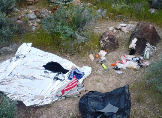
I soon found some level and soft ground and was ready for a rest. As I unpacked my things, I discovered with shock, that I had dropped my bivy bag somewhere on the trail coming down. (Looking at pictures I took of myself, I could see it working its way out. I probably lost it going through the rough boulder area). I had no idea how far up it was. Facing a chilly night in the 40s without it, didn’t sound fun. But I still had two emergency blankets. It took them out. One was very big and would work nicely. I also had a garbage bag that I could use for more warmth. So I would survive.
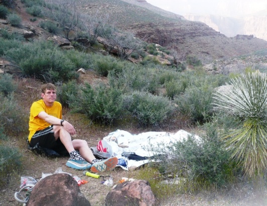
I was ready to explore a little before dinner, so I ran three miles out and back on section of the Tonto, west of my starting point, where I wouldn’t be running tomorrow. There was absolutely no one else in South Bass Canyon. The nearest person was camping the night in Ruby Canyon about nine miles away. It was both a peaceful and frightening feeling to be so very remote and on my own.
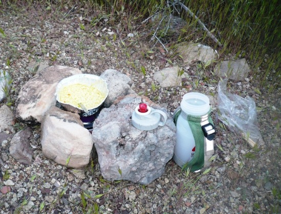
When I am out alone, I tend to worry. I worried that back at my camp, rodents would carry off my food. So I cut my late afternoon run short and returned, finding my camp undisturbed. For dinner, I opened a sterno can and used it to heat up some soup in an aluminum cup. I also chowed down on a bunch of quesadillas. It was a wonderful dinner. I had very excited feelings thinking about my epic run that would start in the morning.
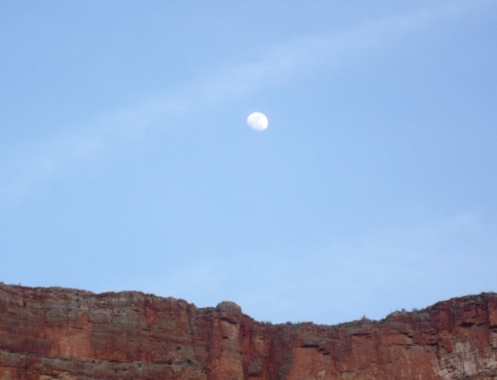
Dusk arrived quickly, at 7 p.m. A nearly full moon rose over the rim and was my bright companion for much of the night. There was nothing else to do, so I went to bed. I don’t know if sleep ever came. I don’t think it did, but I must have had a few cat naps because the time passed by fairly quickly as each hour I checked my watch. I spent the night trying to stay warm and comfortable on the hard ground. I wrestled and adjusted the silver blankets over and over again, blocking out the cold air (mid-40s). It mostly worked, but it sure would have been nice to have a sleeping bag. At about 3:30 a.m., I finally got up. It was much warmer moving around. I cooked up some more soup and felt much better.
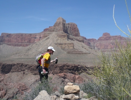
My feet were already a problem. With over 500 miles on my Hokas, I think they were at end of life for something as rugged as this. I spent time doing a better job taping my feet since blisters were already trying to form. As dawn approached, I packed up my things, and cleared up my campsite making it look like no one had ever been there.
South Bass to Boucher (Miles 0-30)
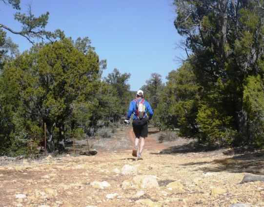
At about 5:15 a.m., my through-run of the Grand Canyon on the Tonto Trail began! I still had two full water bottles and I hoped they would last until my first good water at Ruby Canyon, at mile 8.7. My pack felt comfortable, less than ten pounds loaded with: Instant Breakfast, Heed, Reeses, Jelly Bellies, Beef Jerky, Five Hot Pockets, Hammer Gel, and all my other gear. I turned on two GPSs to track the miles and keep my pace up. I had over 400 waypoints in my GPS which would help keep me on the trail.
I had never run this first 30-mile section before. Its contour was the same as other sections of the Tonto but there was one huge difference. The trail was much, much fainter. It just doesn’t receive much boot traffic. I was surprised to see that there were little weeds growing right on the trail, sometimes making it indistinct from the surrounding terrain. I soon started a running pattern that would go on all day. I would try to run fast and then come to a screeching halt, realizing I wasn’t on the trail any more. I would then study the terrain, back up if needed, and get back on the trail, or in extreme cases, pull out the GPS and find the next waypoint. The further I went, the better my navigational skills developed. But still, every few minutes, I would have to stop
My pace was slow. I hoped for a 16:30-mile pace for the first 30 miles, but it just wasn’t going to happen. In addition to the tough trail, when you put a pack on my back, I slow down. Going fast, then slow, then fast, was so challenging. I would get lazy and forget to go fast again. Here is an example of my first few miles: 20:23, 16:28, 16:58, 24:55, 16:16, 28:41 (feet fixing), 24:20, 25:19, 37:11 (another stop), 21:05, 18:00, 18:11, etc. I really concentrated on trying to get my pace under 20 minutes. It felt like I was running pretty fast, so I was always surprised at the time on my Garmin. It is possible that I was actually going much further because of all the weaving around that wasn’t being picked up. My fastest mile was a 13:44 and I was very proud of that. But then I came into a rugged canyon and it slowed me back down.
Another thing that really slowed me down is the beauty of the canyon. One would be stupid to keep their head down looking at the trail. This is probably a once-in-a-lifetime experience, so I made sure I took in the sights along the way. This meant that I had to stop to take pictures, take some detours to peer down to the river, etc.
Yet one more factor to slow me down is the self-supporting nature of this run. There are no crews or aid stations to help. I had to stop many time to make adjustments to my gear, pull out more food, and stop to fill my bottles. All this takes time and you just can’t do it very fast.
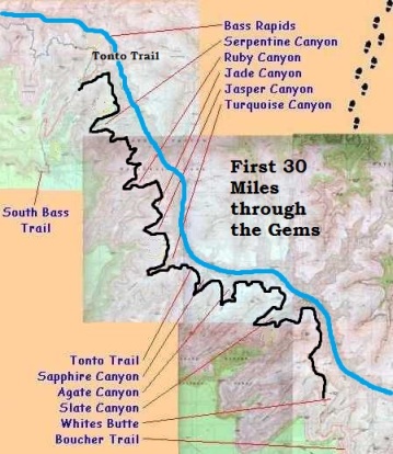 For the first 30 miles, I would be running through the “Gems” of the Grand Canyon. These are a series of huge side canyons that are named after gems, except for “Slate Canyon.” (I don’t think I would buy a ring for my wife with slate.) I crossed Serpentine canyon (mile 3.9) at 6:35 a.m. There is water in this canyon, but it is full of minerals and can give you the runs, so I skipped this water source. Next up was Emerald Canyon (mile 5.3) and Quartz Canyon (mile 7.3) at 7:38 a.m.
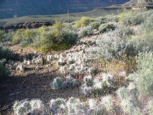
Before Quartz, as the trail extended back toward the Colorado River, the terrain was covered with prickly pear cactus. I knew from past experience, that this is the worst area to lose the trail. Sure enough I lost it. Foolishly, I decided to just bushwhack to the next GPS waypoint. Picky my way through the cactus was a terrible obstacle course. I had to pull some needles out of my shoe mesh. Soon I finally found the trail again and was on my way.
I was already getting warm and I wished I didn’t have to wear long tights. But once I ran the Tonto Trail in shorts and came away with bloody scratched legs and splinters to pick out for the next several days. The tights really protect the legs. Also, if you are in shorts, you really slow down as your try to dodge all the thorny bushes. With long pants, you don’t have to worry and can keep your lines straighter, brushing by the bushes without problems. Even going short sleeves is a problem. I did this in the afternoon, and came away with scratched arms.
At 8:15 a.m. I reached my first water source, Ruby Canyon (mile 8.7). I had run out of the water that I had brought down from the rim and was now very thirsty. I filled up and treated the water with iodine and was on my way again. I now noticed some recent foot prints, certainly the guy who camped at Ruby last night.
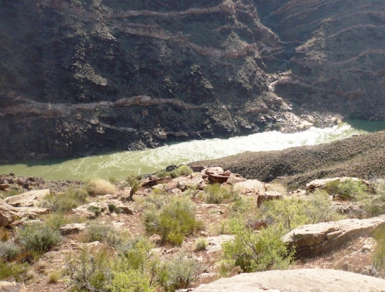
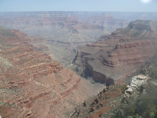
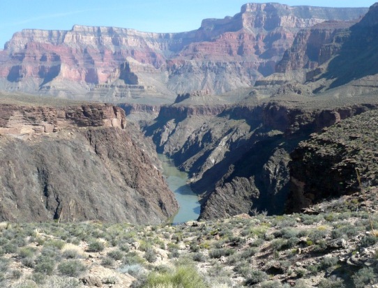
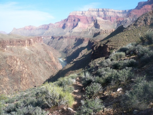
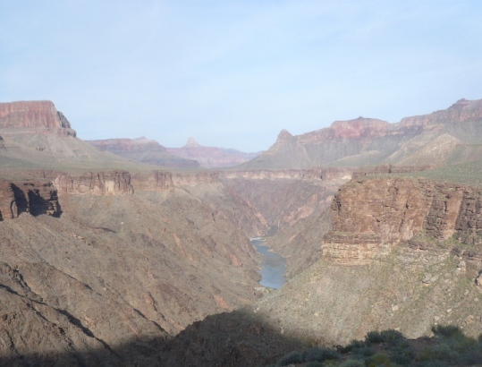
These first ten miles seems a little less impressive than other sections of the Tonto. The trail didn’t take you all the way out to the river gorge for spectacular views. Finally, I decided to take just a little detour and peer over the steep cliff down to the river about 800 feet below.
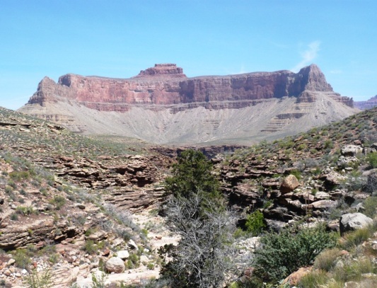
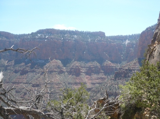
As the sun rose higher, it illuminated the cliffs, buttes, and peaks all around me. Viewing these from down in the canyon are even more spectacular than from the rim. I had a feeling of accomplishment come over me, knowing that on my own power, I had run all the way here to see this.
My feet became a real problem for me. My Hokas just were not keeping the blisters away. I had to stop several times to reapply tape, change socks, and do whatever I could to protect my feet. I know I still had a long way to go. It certainly was nice to always have whatever I needed with me in my aid station on my back. One thing I wished I would have had was a safety pin to lance blisters. It is pretty funny that I didn’t think about all the needles around me in the cacti.
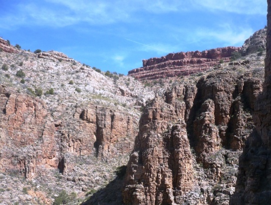
Going deep into each side canyon was always a challenging experience. The trail usually took a dive, and sometimes used switchbacks to descend down and climb back out of the heads of these canyons. Vegetation was always more abundant and greener in these canyons and this time of year, each had at least some water in them. I crossed Jade Canyon (mile 11.3) at 9:26 a.m. and Jasper Canyon (mile 12.3) at 9:47 a.m.
I ran into Turquoise Canyon and it was a beautiful sight.
I looked up and was able to pick out the area on the rim where I peered down on this canyon yesterday afternoon.
I crossed over the creek (mile 14.9) at 10:58 a.m. There I saw a guy setting up his tent. This was the guy who I had been told camped at Ruby Canyon last night. I had caught up with him. I approached him and called out a greeting. He jumped, really startled. You just don’t expect to hear a voice. I apologized. He said that he was already stopping for the day. Tomorrow night he hoped to camp at Slate Canyon if there was water there. He had only hiked about seven miles today. I chatted with him for about ten minutes explaining what I was attempting to do. He was shocked but understood and wished me luck. “Where’s your sleeping bag?” I explained that I would be running through the night.
I continued on. I knew that I was way behind my planned schedule, now two hours behind. I concentrated harder to keep my pace up and tried not to lose much more time. I always underestimate the difficulty of running fast on this trail.
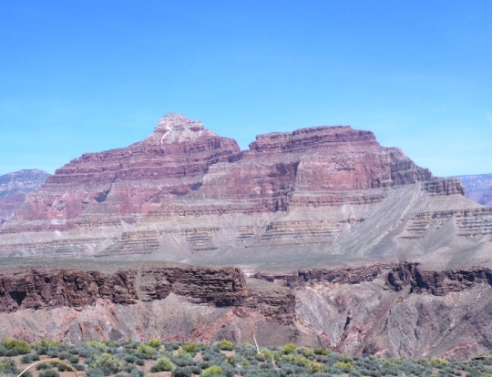
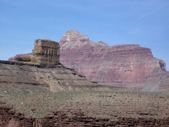
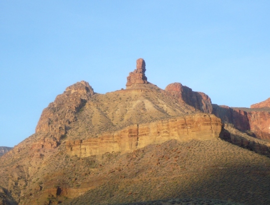
I crossed Sapphire Canyon (mile 17.8) at noon. Castor Temple towering above me looked very impressive.
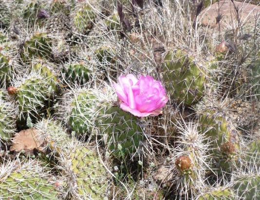
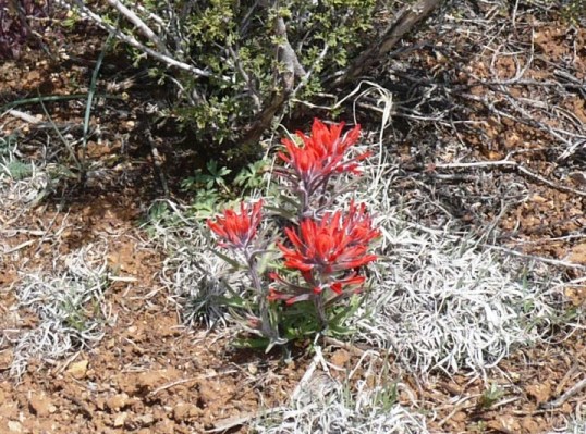
Back out toward the river, I came upon a cactus in bloom. As I looked closer, it looked like within a few days or a week that the entire desert would be in bloom. That would be an amazing sight.
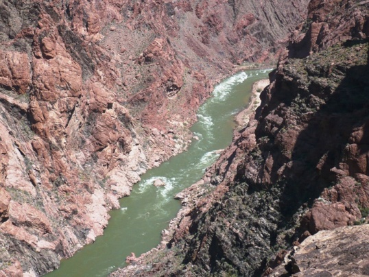
I reached Agate canyon (mile 19.9) at 12:30 p.m. and on the way to Slate again peered out down into the impressive Colorado River gorge.
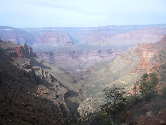
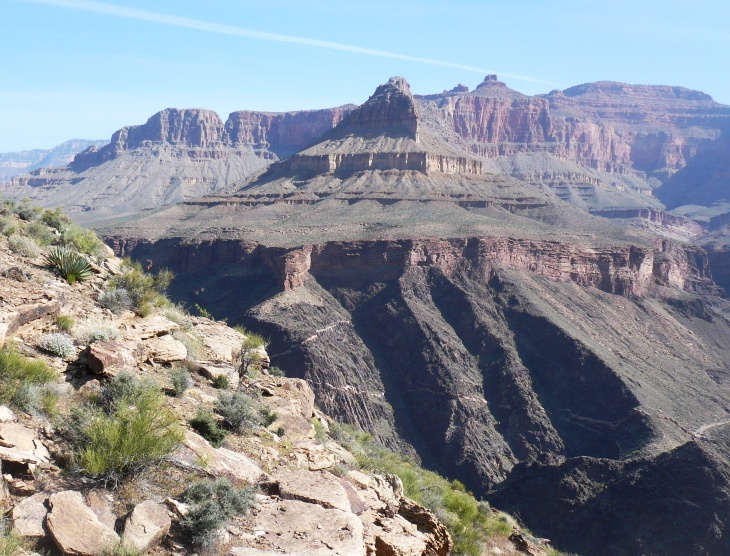
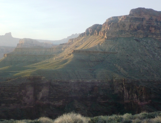
On my way toward Slate Canyon the Tonto Platform really opened up wide. I think this was the most impressive location on my run to see the buttes, peaks, etc.
I had to stop many times along the way just to gasp and the beauty and take pictures.
On the way into Slate Canyon, something happened that had never happened before in all my thousands of miles of running. I felt a very sharp pain in the ball of my foot that felt like I had been stabbed. What was that! Was it a rock? I limped on for another 100 feet trying to figure it out. Finally I just had to stop and take off my shoe. Wow! A thorn had gone all the way through the bottom of my shoe, through the insole, and deep into my foot. I took my foot out and spied a point sticking up from the insole. I couldn’t get it out of the shoe but with some effort broke it off and hoped that it didn’t leave a point deep in my foot. Feeling better I ran on and thought about minimalist runners trying to run down here, bonding with the ancients. “Good luck with that,” was my thought, “I’ll stay in my shoes.”
I reached Slate Canyon (mile 25.1) at 2:04 p.m. I was relieved to find water there. I was almost out and dreaded running the next hot five miles without water. The afternoon temperatures were in the 70s. Thankfully there was a breeze. Running into a side canyon was always hotter because the sun was in my face and the breeze at my back.
Now it was my turn to be startled. A ranger lady called out a greeting. I stopped for about 10 minutes to talk to her. She was very surprised to see me running and doing so with such a light pack. She had seen R2R2R runners before, but never a through-runner on the remote Tonto Trail. She quickly understood that I had good experience in the Canyon. She was from Moab and was out here doing trail patrol. She was very impressed with how far I had already gone. She noticed my Hokas and I explained all about them.
On the trail again, the next five miles to Boucher Canyon were long, exposed and getting hotter. I knew that my solitude would soon be over as I would start running into many backpackers setting up their camps. Views of the river could be seen with the rim far away that I have climbed up before.
I could also now again hear the familiar buzz of helicopters and planes as I reached the area that they could fly over. I noticed that they didn’t descend into the canyon, only flew over it. That brought to mind a tragedy many years ago when two planes collided over the canyon killing all aboard both planes.
View a 3D flyover of my route from South Bass to Boucher
Boucher to Indian Garden (miles 30-50)
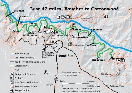
I reached Boucher (pronounced Bu-shay) (mile 30.1) at 3:50 p.m. It wasn’t quite a 50K and I had taken 10:35. Gee, I have run a 50K in half that time before. I was now in familiar surroundings, having visited this area twice before. However, still I took a wrong turn and went an extra 0.2 miles. Oh well.
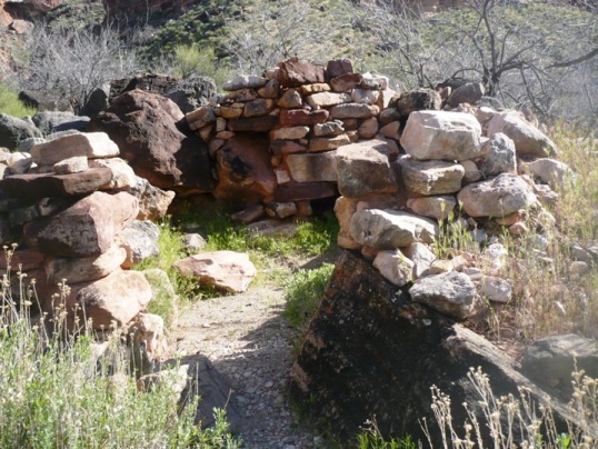
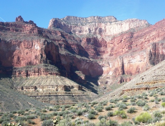
Boucher is a huge canyon and requires a massive climb to get out of it. There were several routes and I was confused about which trail was right. There was water flowing down Boucher Creek. It was dry when I had been there before so I started to wonder if I was going the right way. I passed by the ruins of the Hermit’s cabin which I had not noticed before. Another new thing was the amazing sounds. It sounded like a herd of sheep were in the canyon. But as I looked closer, I discovered the noise was coming from frogs. I would hear this sound at nearly every creek I would cross during the night. During the autumn, I would never hear these frogs in the canyon.
Still confused, I finally came upon a campsite of backpackers. I asked them if I was going the right way. They helped me find the right trail but then stopped me to try and figure out what I was doing and where I was going. One guy caught on fast and said he was very impressed with my pace, all the way from South Bass. I helped him understand just how far I was going. I think I left them with their jaws hanging open. I could hear them still talking about it as I left.
The climb was hot and tough. When I reached the Tonto Platform again, I could tell that I was already badly dehydrated, even though I had drank a full water bottle just 20 minutes before at the creek. I had early heat stroke symptoms, clammy skin, chills, dizzy, fast respiration, and my left ear was clogged (always does that as I get dehydrated.) I knew what to do and what to expect. I needed to back off my pace, drink a bunch, and take more electrolyes (S-caps). I then just needed to be patient and careful. I felt pretty rotten but continued on.
I didn’t look forward to the section ahead, the traverse into Travertine Canyon. It is pretty rugged.
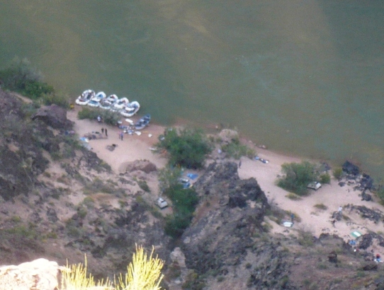
The trail extended toward the river gorge and I wondered if I would see any rafting companies. I peered over the side and sure enough there was a large company setting up their camp for the night a couple miles below Hermit Rapids. I wondered if they could see me above them
Travertine Canyon wasn’t that bad in this direction, mostly downhill and I made pretty good time. The sun was setting now. I just love to see the canyon as the sun is setting. The shadows come alive
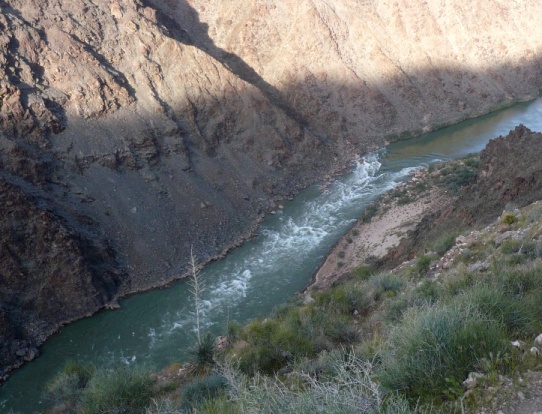
On the way to Hermit Creek, the trail extends very close to the Colorado River gorge, very exposed in places. I remember the first time I ran this section was at night. I could hear the roar of Hermit Rapids below me but could not see them down in the dark unknown. I carefully stayed away from the edge and continued on.
Before turning into Hermit, I took another look up the canyon and took in the beautiful sight of the canyon late in the day. As I descended into Hermit, the trail goes above the campsite area. There were many campers down there and they noticed me running and pointed up to me. When I reached the creek, I just filled up and went on my way. I arrived there (mile 35.9) at 6:11 p.m.
I had readjusted my pace goal during the day. I now hoped to get in 40 miles before dark and do 30 miles before dawn. (The day is two hours longer than the night). That still is slow, but would put me at Grapevine Creek at dawn. Well, I came close. I reached Monument Creek (mile 39.7) just after dark at 7:30 p.m. I had turned my lights on and the campers at Monument of course noticed my amazing green light. One guy talked to me for a few minutes and mentioned he had not seen anyone continue on today. He wanted to know how far I was going. I just explained that I was going a very long way and would be running all night. He didn’t ask any more questions. I expect he thought I was a crazy person.
It was now much cooler and finally after three hours, I recovered from my dehydration. In fact I felt fantastic. The campers all watched me do the steep climb out of Hermit. I put on a show for them and ran very quickly up the trail until my lights were out of view.
This time on the Tonto Trail, I used both a handheld and a bright headlamp spot light. This combination worked great. I used the headlamp to pick out the cairns far ahead and that really saved me a lot of time and kept me on the trail. But I couldn’t help but keep thinking about how this portion of the trail seemed like a super highway compared to the faint trail I had been on for the first 30 miles. This section of the trail receives traffic just about every day so it was much easier to follow.
I received my second wind and had a blast charging down the trail with my lights. I think at night it is even easier to run this trail fast because the lights do a better job casting shadows on the rocks, making it easier for you to see and avoid them. I reached Salt Creek (mile 43.1) at 9:07. In past years, I’ve had difficulty figuring out where the trail continues on the other side of the creek, but this time I knew what to expect. It isn’t directly across, you have to go up or down the creek a ways to pick it up.
I love running at night. The nearly full moon was out. Seeing the canyon in moonlight is a sight that fails words to describe. It is fantastic. It was great to see all the cliffs even at night. To keep me company at times I sing out my music and echo off the cliff walls. I quickly passed by Horn Creek (mile 47.9) at 10:43 p.m. You don’t want to drink the radioactive water here from the uranium mine above.
Next up was civilization! Indian Garden and the Bright Angel Trail below Grand Canyon Villiage. The lights of the lodges up on the South Rim came into view. Cell phone coverage had greatly improved on the South Rim last year and this year. I decided to make a try and pulled out my phone. Wow, I had a signal. I texted my wife to let her know that I was doing fine and that I would be taking longer than expected, that she shouldn’t worry. The message went through fine. That helped my stress go down. I don’t want people to worry about me if I don’t finish on time.
I was feeling amazing and ran very fast for a couple miles on the easy trail section. Looking up, I could see a lone hiker’s light going up or down the Bright Angel Trail. I’m sure they could see my crazy lights. My headlamp was on red, so I had the red light, green light effect going on.
Indian Garden to Cottonwood Creek (miles 50-77)
I reached Indian Garden (mile 50.4) at midnight. My thoughts were on many fellow ultrarunners who I knew were sleeping up on the rim, soon to start their R2R2R run in a few hours. I opened my pack to put more food in my pockets but was shocked when I discovered that there wasn’t as much food as I thought left.
As I ran on, I tried to figure out how I was going make it to the end on so little food. I thought I only had about 1200 calories left. If I went all the way, that would be only 100 per hour. I knew that I could be mistaken (I was) because I didn’t take the time for a careful inventory, but I decided to cut back my intake for the night. I reached South Kaibab trail (mile 55.4) at 1:20 a.m. On the way to Cremation Canyon, I was starving. I tried to suck on Beef Jerky and that helped for awhile, but my stomach was telling me that it wouldn’t let me run fast if I didn’t feed it. Finally I just had to bag the idea of holding back food and felt much better. I could always beg food off backpackers in the morning although I really wanted this to be a self-supported run.
I reached Cremation Canyon (mile 58.3) at 1:55 am. I hate going through that place because of the rugged climbs and thoughts of the Boston Marathon runner who died here. Out of water, in the summer heat above 100 degrees, she just couldn’t face the climbs to reach South Kaibab two miles away. She instead died trying to go down to the Colorado River. I was glad to get away from that place of death where the Indians used to also take their dead.
In the past two times I ran this section at night, I kept losing the trail between Cremation and Lonetree. So this time I concentrated more. It was very easy. I had no problems and remembered certain turns to take on top of ridges.
I reached Lonetree Canyon (mile 61.6) at 3:27 a.m. I could not find the continuation trail on the other side. I recalled having difficulty in the past, but couldn’t remember the solution. I kept going back over and over again to the last cairn, but could not figure things out. I even got all turned around once, thought I found the trail, but ended going up the trail I had just come down. What a waste of time! I struggled for over 15 minutes on this puzzle. My GPS didn’t help much. I knew what direction the next waypoint was, but couldn’t find a trail heading in that direction. Finally I just bushwhacked up out of the creek to the next level and then traveled the direction toward the Colorado River until I finally ran into the trail. I’m guessing I needed to go down the creek some more to find the continuing trail. That waste of time was frustrating.
I now had a long 9.5 miles until the next water source. I hoped that I could make it on two bottles. Using Heed and Instant Breakfast was getting the calories I needed along with some gels. I reached dry Boulder Creek (mile 64.8) at 4:54 a.m. I had now been running for almost 24 hours.
Dawn arrived as I approached the massive Grapevine Canyon, the longest side canyon that I would have to get around. I started to have terrible blister problems and decided to stop for awhile to work on my feet, put on sunscreen, and put away my lights.
As I rested, I readjusted my plans. I discovered that I had more food than I thought, but I only had a few S-caps left, not enough to face another hot afternoon down here. My feet were a mess. I taped the problem spots again but they were in terrible pain. This just wouldn’t work. I decided to cut my run short, skip the last ten miles of the Tonto, and climb out Grandview Trail. This was a disappointing thought, but if I did continue, the risk would be much higher and I probably wouldn’t get out until dusk. Instead, I could climb out before it got too hot and finish around 1 p.m.
With that new plan, my spirits improved. Instead of pushing hard, I enjoyed my remaining hours in the canyon. I love the mornings there as the light appears and brings the canyon to life.
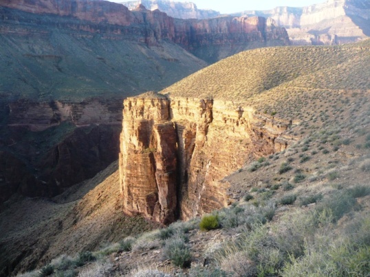
Cliffs could be seen glowing in the sunshine.
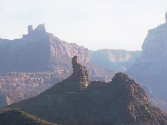
Eerie chimneys could be seen off in the distance.
I reached Grapevine Creek (mile 71.1) at 7:26 a.m. A group of backpackers were starting to break their camp and they all came out to greet me with excitement. They even took pictures of me. Among them were some knowledgeable runners and canyon hikers. They knew exactly what I was attempting and peppered me with questions. They offered me food and I couldn’t resist their dried mangos. They mentioned that they had also camped here last April and wondered if I was one of the guys who were also running that trail then. That was very interesting to me, the first time that I had heard of other runners trying to run the trail end-to-end. That really surprised me because I knew it would have to be a couple very good ultrarunners. (Turns out that those two guys were Scott Jurek and Joe Grant. I’m in very good company. It looks like they went from South Bass to New Hance in 32 hours. I’ll find out more.) I explained that I was cutting my run short and getting out at Grandview. They all wished me luck and were so friendly. It was nice to see people again. It had been 12 hours since I had seen anyone.
On my way again, I stopped a mile further at Grapevine Spring, filled up again and continued on the long traverse above the cliffs around toward Cottonwood Canyon.
I ran out of water by the time I reached Cottonwood (mile 76.9) at 9:41 a.m. I ran the last couple miles hard because I wanted to break 28 hours. My finishing time for this 77-mile segment of the Tonto Trail was 27:56:51. It was great to be done, but I still faced a grueling climb up the Grandview Trail. I have climbed that trail twice before so knew what to expect.
Not wanting to repeat my dehydration blunder from yesterday, I drank 2 ½ bottles right there at the creek. It was cold and tasted fantastic. I rested for quite awhile to bring my heart rate and respiration down. It was getting hot. I needed to start climbing to avoid the heat.
My climb began. My feet were it bad shape, but they did much better going uphill than down. When the trail had to go down a little it was so painful that I screamed out at times.
I just pushed on ahead. Right before reaching Horseshoe Mesa, I caught up with a guy and his son resting in the shade, doing a day hike from their camp below. He asked me if I ran ultras and could understand what I had just accomplished. It’s nice when people understand and don’t give you those blank looks wondering if you are a crazy person. Instead he asked me thoughtful questions about how I accomplished my 77-mile run on the Tonto Trail.
My climb continued. At times it was very slow, but I kept catching and passing hikers going up. Some couldn’t believe I was passing them after I had run all those miles. With a couple miles to go, I had another period of high energy. I could actually run up the steep trail. It was great fun as I left some hikers way behind me down the trail. My feet were in bad pain but my legs were feeling great.
Finally I hit the home stretch, the last few hundred feet below the rim. Day hikers from the rim above started to appear. “Looks like you have come a long way.” “Yes I have, I ran all night.” Before I knew it, the top arrived and I was done! Some backpackers I passed shortly arrived too and congratulated me.
Now my task was to get back to my car at Grand Canyon Village. The backpackers weren’t leaving for an hour, so I decided to just start walking out toward the road to hitch-hike. One couple picked me up to take me to the main road. I warned them that I really stunk badly. They said that they didn’t mind, but opened their windows all the way.
Out on the road, it took me ten minutes before a couple from Canada picked me up. I also warned them about my stinky state. They were very kind and even gave me a water bottle. They took my all the way to South Kaibab where I caught a shuttle into town. My car was still waiting for me at Bright Angel Trailhead and I quickly drove to take a shower at Mather Campground. After that, I felt much better.
Well, I came pretty close to my goal, and probably accomplished something no one has done before. I ran the Tonto Trail for 77 miles in the Grand Canyon in 27:56. I suspect Scott Jurek and Joe Grant covered this segment a couple hours faster in 2010, I’ll try to find out. However, I did it solo.
After all is said and done, it feels like I finished a tough mountain 100-miler similar to Wasatch. When I add up all the miles, I ran 110 miles over the two days at the canyon. Two days later I still feel drained similar to post 100-mile recovery. I estimate that along that way I climbed at least 13,000 feet. The self-support with a pack makes the entire run that much tougher.
It was an amazing experience and I am so very thankful for being able to experience this dream run. Will I try it again and try to make it all the way? It could happen. I enjoyed it enough that I can’t rule it out. But there are other sections of the canyon that I still haven’t explored. Those areas are also calling for me to run there.
| miles | my time | time of day | ||
| South Bass |
0.0 |
|||
| Serpentine |
3.9 |
1:11 |
6:35:00 AM |
|
| Emerald |
5.3 |
1:39 |
||
| Quartz |
7.3 |
2:33 |
7:38:00 AM |
|
| Ruby |
8.7 |
3:11 |
8:15:00 AM |
water |
| Jade |
11.3 |
4:21 |
9:26:00 AM |
|
| Jasper |
12.3 |
4:42 |
9:47:00 AM |
|
| Turquoise |
14.9 |
5:43 |
10:58:00 AM |
water |
| Sapphire |
17.8 |
12:00:00 PM |
water | |
| Agate |
19.9 |
12:30:00 PM |
||
| Slate |
25.1 |
8:49 |
2:04:00 PM |
water |
| Boucher |
30.1 |
10:35 |
3:50:00 PM |
water |
| Travertine |
33.2 |
|||
| Hermit |
35.9 |
12:56 |
6:11:00 PM |
water |
| Monument |
39.7 |
13:00 |
7:30:00 AM |
water |
| Salt Creek |
43.1 |
15:52 |
9:07:00 PM |
water |
| Horn Creek |
47.9 |
17:28 |
10:43:00 PM |
|
| Indian Garden |
50.4 |
18:40 |
11:55:00 PM |
water |
| Pipe Wash |
53.0 |
19:24 |
12:39:00 AM |
water |
| South Kaibab |
55.4 |
20:05 |
1:20:00 AM |
|
| Cremation |
58.3 |
20:40 |
1:55:00 AM |
|
| Lonetree |
61.6 |
22:12 |
3:27:00 AM |
water |
| Boulder |
64.8 |
23:39 |
4:54:00 AM |
|
| Grapevine |
71.1 |
26:11:00 |
7:26:00 AM |
water |
| Cottonwood |
76.9 |
27:56:51 |
9:41:00 AM |
water |
Nicely done, Davy! Great report. I always know where to go to learn the ins and outs of running the Canyon…your blog! I’ve just done R2R2R once, a year ago. If I ever get back there, I’ll be sure to consult your past reports for more info and insight.
Perhaps I’ll see you at Cascade Crest. My race calendar pales compared to yours, but we at least have that one in common.
-Steve
Great job and great report, Davy.
I enjoyed your report as I always do. I’m headed out for my first double crossing in two weeks. I’m very excited about it, and I appreciate all of the information that you have provided in your reports. Thanks!
Awesome adventure. I have only kayaked through the Canyon and hiked some of the popular side canyons. This is amazing.
I read on Scott Jurek’s Facebook page last year that he and Joe Grant ran from South Bass to New Hance trailhead in 32 hours, in April of 2010. They could be the runners that backpackers told you about. No write up, he only posted a few pictures.
Wow- of all your runs, I found this one most intriguing and unique, with good descriptions and lots of photos. Sounds like you had fun.
Mind blowing, as usually. When I got your text mid-canyon I was shocked and amazed. I was also very appreciative you’d think to consider adding me to that list of people. Thank you. I need to get back to the Grand, it is a very solemn place and one I truly felt home in. Thanks for the continued inspiration and good during race season.
Great write-up. And those folks who went to Boston thought they were having fun. When you had blisters at the beginning I knew you were in for it. Congrats on a courageous run.
incredible — truly another dimension to running the GC (other than rim to rim) — i’ll bet you’ve inspired many of us to add something similar to our bucket lists. thanks for this writeup!
My favorite line: “I ran on and thought about minimalist runners trying to run down here, bonding with the ancients. ‘Good luck with that,’ was my thought, ‘I’ll stay in my shoes.'”
Ha! Amen to that.
Great job, and good advice and cautions to others who might try Grand Canyon running.
Sounds like an epic adventure. I can’t believe you’ve never seen a snake in all your visits to the Grand Canyon. I encountered a rattlesnake near the silver bridge the first time you took me there.
Wow! Fantastic report with amazing pictures – all documenting an incredible adventure! Thanks for sharing!
Super impressed! You crushed…and I really, really enjoyed the detailed description of your effort. Great read and …GREAT JOB!!!
Congrats Davy. What a great adventure.
What an epic adventure! One day perhaps, one day! I’m definitely itching for another epic after last year’s Pinhoti Trail speed-hike… Anyhow I’d like to throw a small minimalist training argument in your direction. Not being critical, but I think doing some minimalist running in training really helps to toughen up your feet and lower leg muscles. I can attest to that. I totally agree that if you’re going long, ultra long, that absolutely you need better protection. However, there is a chance that by toughening up your feet in training you *might* not have had the blister issues you had… Who can say? Anyhow I like to mix it up, train minimally, run long and race strong and protected… Anyways awesome adventure that I hope to one day emulate!
Aww, man, that is some awesome trail out there! Thanks for bringing the attention to it!
Another awesome run and write-up. Thank you for sharing your adventures with us.
Way to go brotha……..
Nice run Davy! I’m usually hiking in the canyon about once every week…maybe one of these days I’ll see you there! I’ve never been into ultra-running, but do enjoy long day hikes, like the 24 miler down Hermit, across the Tonto and out Bright Angel. Good luck with your future plans!!
Hi Davy! I’m the guy you met on your way up Grandview (with my son). I thought you were pulling my chain when I asked your name! Nice job!
We were actually out for a day hike from the rim (down to the Tonto around the Mesa and back up).
I’ve backpacked almost all of the south side of the Canyon, done a R2R2R dayhike, and run one marathon…. but never thought much about ultra-running. Though NOW… I have to admit that meeting you has been nagging me a bit…. and I’m thinking about running the Tonto. I counted up my backpack days across that section… 6 days… hmmmmm.
Good going! Andy
I think I saw you on the Tonto between Cottonwood Creek and Grapevine the morning of April 16. We were dayhiking west while you were headed east. I was kicking myself for not asking you where you’d started, but would never have guessed South Bass!
Congratulations on your run.
Dave,
Congratulations on your thrilling adventure.
I enjoyed your report and photos.
Best Wishes for many fun and rewarding “runs”.
Take Care.
Steve
I enjoyed reading your great run on the Tonto trail, amazing feat! I learned a lot about this awesome trail!
We did Hermit to west tonto and up Bright Angel last week, it was amazing and a nice change from our rim to rim hikes we have done in the past. I would like to continue exploring new trails in the canyon in the future but can not run , just hike, so I might consider camping down for the night.
I lived at the Canyon for the better part of 28 years. Have been on every foot you described though not running. Your descriptions bring back a lot of memories. Worked at Phantom in the 70’s and 90’s between times on the rim. Thanks for posting.