

October 12-13, 2007
North Kaibab to Grandview Point and back
You are the first person I’ve seen in two days
— Comment from a backpacker on the Tonto Trail
It had almost been a year since I had run in the Grand Canyon. I was anxious to return and accomplish my 11th double crossing (rim-to-rim-to-rim). Now somewhat bored with the usual route using the mule-torn corridor trails, I wanted to do something new, something that probably nobody had accomplished before.
Planned Route
I planned to do a continuous double crossing from North Kaibab to Grandview Point and back. This would be an adventure of more than 83 miles. About forty of these miles would be on the primitive East Tonto trail. In the hiking guides, ten days would be recommended for this adventure. I would try to do it in a little bit more than one day. My climb up and down the South Rim would be along the unmaintained Grandview Trail. The Grandview Trail descends from the South Rim far to the east of South Kaibab (Yaki Point). This would be the fourth trail on the South Rim that I have used during a double crossing. In addition to using South Kaibab and Bright Angel trails, I accomplished a double crossing using the Hermits Rest Trail in 2006.
The risks are high for a solo adventure like this but I tried to take some reasonable precautions. The weather would be on the warm side with afternoon temperatures pushing toward 80. I carefully planned my run. This double-crossing would require obtaining water in springs, and I would have to carry all of my food. Usually I run doubles with just a waist pack, but this time I would add a 6-pound day pack. Included in the pack would be some emergency items: A satellite phone, a CD for signaling, a flint and knife for fire, and a whistle. I would take food/powder/gel enough to intake 4,000 calories. My food sources would be: Five burittos, lots of Instant Breakfast, Hammer Gel, and Resses cups. I decided not to bring any warm clothes for this run. The lowest temperature I should feel would be in the 40s at the top of the South Rim where I would not stay very long. I did bring more water containers than usual. There would be a 17-mile stretch without any water sources. I believed three hand-held water bottles and a 2-liter camelback should be enough. At the last minute, I decided to leave my heavy water filter behind. I would chance it and take water near the source of the springs. I would look silly having all my electronics hanging off me: Camera, MP3, GPS, mini recorder, and satellite phone.
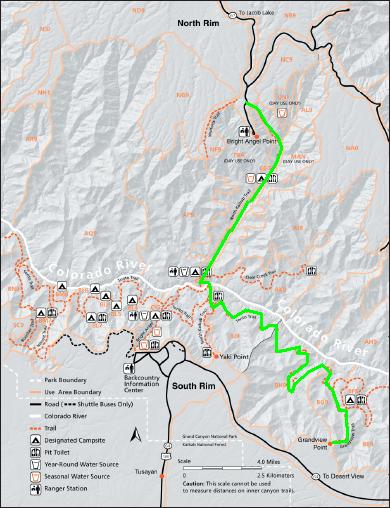
Planned route (in green)
Planning Chart
|
Location |
Miles |
Split |
Water |
|
North Kaibab |
0 |
0 |
No |
|
Cottonwood CG |
6.9 |
6.9 |
Yes |
|
Phantom Ranch |
14 |
7.1 |
Yes |
|
Tonto Trail Jct |
16.7 |
2.7 |
No |
|
Cremation Creek |
19.3 |
2.6 |
No |
|
Lonetree Canyon |
22.3 |
3.0 |
No |
|
Boulder Creek |
25.3 |
3.0 |
No |
|
Grapevine Creek |
31.0 |
5.5 |
Yes, at spring |
|
Cottonwood Creek |
36.5 |
5.5 |
Yes |
|
Horseshoe Mesa |
38.5 |
2.0 |
No |
|
Grandview Point |
41.6 |
3.1 |
No |
|
Horseshoe Mesa |
44.7 |
3.1 |
No |
|
Cottonwood Creek |
46.7 |
2.0 |
Yes |
|
Grapevine Creek |
52.2 |
5.5 |
Yes, at spring |
|
Boulder Creek |
57.2 |
5.5 |
No |
|
Lonetree Canyon |
60.9 |
3.0 |
No |
|
Cremation Creek |
63.9 |
3.0 |
No |
|
South Kaibab Jct |
66.5 |
2.6 |
No |
|
Phantom Ranch |
69.2 |
2.7 |
Yes |
|
Cottonwood CG |
76.3 |
7.1 |
Yes |
|
North Kaibab |
83.2 |
6.9 |
No |
If all worked at as planned, I should cover the East Tonto and Grandview trails in the light so I would know what to expect for the return trip in the dark.
Grandview and Tonto Trails History
The Grandview Trail was originally constructed by a prospector by the name of Peter Berry. Berry operated a copper mine called the “Last Chance Mine” at the end of the trail, out on Horseshoe Mesa starting in 1890. The cost of packing ore to the rim, then shipping it to be refined, doomed the operation. Berry and his partners sold the mine in 1901. Berry used some of the profits from the mine to build the Grandview Hotel in 1897 out on Grandview Point. He operated this for some years and since it was the only lodging available in the area, it proved to be a very successful venture. That is until the Santa Fe Railroad extended its reach up into the Canyon which sparked construction of what is now Grand Canyon Village.
The Tonto Trail is the longest continuous stretch of trail in the Grand Canyon. It runs some 70 miles or more from its eastern terminus at the Red Canyon/New Hance Trail to its western terminus at Elves Chasm near the Royal Arch Route.
Don’t try this at home kids
I worry that some unprepared readers may want to attempt this route too. This adventure requires rugged 100-mile ultra-level fitness and advanced experience in the Grand Canyon. Timing is critical. I would never attempt a long run on the Tonto trail in the heat. Springs and creeks need to be flowing. Late November to March would be the safest time. Attempting it in May and June would be foolish.
Recently, marathon runner Margaret Bradley died during a run on the East Tonto Trail where I would run, just east of South Kaibab Trail, in the Cremation Creek Drainage. This 24-year-old University of Chicago medical student attempted a 27-mile run down Grandview Trail, across Tonto Trail, and up South Kaibab. A few months earlier Bradley had placed 31st of all women at the Boston Marathon 3:04:54. She was ill-prepared and attempted it on July 9, 2004, in the heat of the summer. She only took with her two water bottles, some fruit, and three protein bars. At that time of the year all the seasonal water sources were dry. Temperatures in the Cremation Creek Drainage likely reached 120 degrees. Her coach later said, “I think growing up in New England and living in Chicago, she didn’t have an appreciation for the heat there.” Halfway into the run, she and her companion, Brian, ran low on water and decided to separate. Brian stayed in some shade and Margaret went on to get help. Apparently when she reached Cremation Creek, she decided to hike down the drainage toward the river instead continuing up the trail just a couple more miles to South Kaibab. After 14 hours, Brian made it out of the canyon, but Margaret, far off the trail was found dead two days later. A memorial 10K is now held in Chicago to remember her.
North Rim to Grandview Point and Back
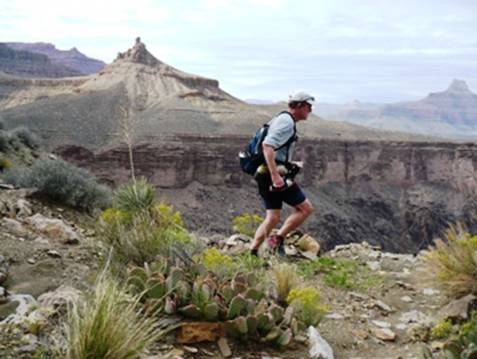
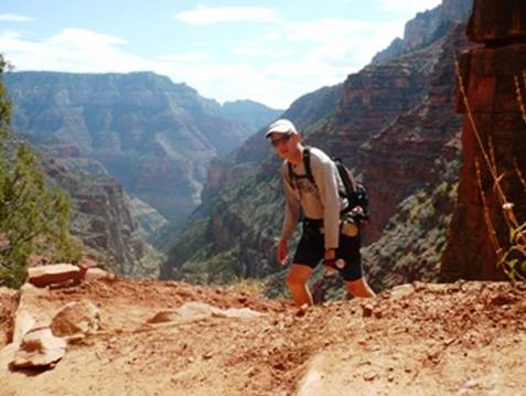
I started my adventure at 3:30 a.m. (AZ time). The temperature was brisk at the North Rim, North Kaibab trailhead, so I didn’t dawdle at the top as I started to shiver. This was my 21st time on this trail, so I knew it well. Each turn was very familiar. I took it easy on the descent because I was worried about a sore right inner quad muscle that has plagued me since Plain 100. Running in the Bear 100 two weeks ago further aggravated it. The soreness could still be felt with each jarring downhill step. I hoped that it would calm down in a few miles.
Above Supai Tunnel I could see a light of a hiker. We exchanged greetings as I cruised on by in the dark. Later, as Supai Tunnel as I taped my neck to avoid rubbing from my backpack, the hiker caught up to me. I found out that he was making a return trip to the South Rim. Two days earlier he had made the crossing to the North Rim.
The sky was clear and the stars were blazing as I ran back and forth down the steep switchbacks. At one point I saw brilliant Venus right above the Rim, blazing like crazy. As I descended, it disappeared below the rim. Once below the rim, the air temperature warmed up fast and I soon rolled up my sleeves. I was glad that I didn’t haul any warm clothes. I wouldn’t need them. On the other side of the bridge over Roaring Spring Canyon, I could look back up and could see the hiker’s light far up the trail.
At Aiken’s house, (Roaring Spring Pump house), they had a big cooler of Lemonade on the table. That was nice! There was also a log book. I took the time to sign the log book and explain what my crazy adventure was. Continuing on, I reached Cottonwood Campground (mile 6.9) at 5:07 a.m. Two large groups of campers were up breaking their camp. I still had plenty of water so I just ran through the campground without stopping.
Right before entering The Box (A narrow section of Bright Angel Canyon) I came across the first of several double-crossing runners. These two guys were from Eugene, Oregon. I explained that I was doing an 83-mile double crossing to Grandview Trail. “Where is that?” was the question that I would hear over and over again. We went on our way and I later found a copy of their pacing chart dropped in the middle of the trail. They had started at 3:00 a.m. at South Kaibab Trail, a half hour before I started. They were making very good time.
The glow in the sky increased and I soon turned out my light. At 6:15 a.m., I said into my recorder, “It is really peaceful. The glow of the early morning dawn brings to life this place with the red rock. This is a fascinating place in The Box when the light hits the rock formations.”
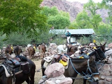
Mules waiting to haul up Phantom Ranch visitors
I arrived at Phantom Ranch (mile 14) at 6:43 a.m., much slower that usual. My leg was just sore enough to slow me down. I filled up all my water containers and mixed some Instant Breakfast in front of the Canteen (store). In the window, I could see all of the Phantom Ranch visitors eating a wonderful breakfast. They had pancakes and I chowed down on a bean burrito. After a pretty long stop, I continued on my way, looking forward to a climb. As I ran out of the ranch, I noticed a beautiful deer right on the trail in front of me.
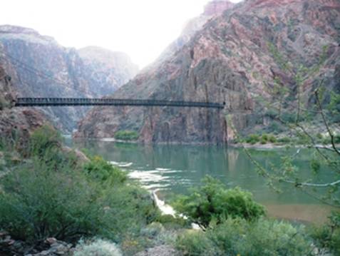
Black Bridge over the Colorado River
I met many hikers and some runners coming down from the South Rim as I continued on the trail along the Colorado River. Probably four were doing double crossings. I crossed over the river on the Black Bridge and started the tough climb up South Kaibab trail to get to the Tonto Trail.
Looking down on the Colorado River reflecting the morning light
My leg didn’t hurt at all on the uphill so I really pushed the pace and had fun running past stunned hikers. As I continued to climb, I could see the first mule train crossing over the Black Bridge.
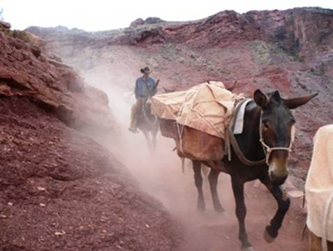
I soon came across a supply mule trail coming down that kicked up an amazing dust cloud.
On the South Kaibab Trail
I arrived at “Tip Off,” the junction with the Tonto Trail (mile 16.7) at 8:06 a.m. There were several groups of hikers resting there. Like some sort of big shot, I pulled out my satellite phone and called home. Afterwards, the hikers watched me run off into the desert alone on the primitive East Tonto trail. I’m sure they were wondering where that crazy guy was going.
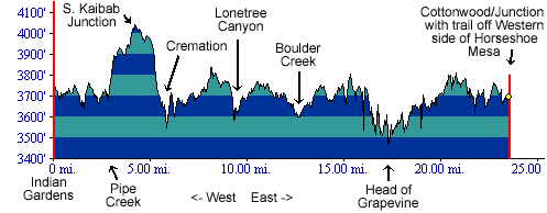
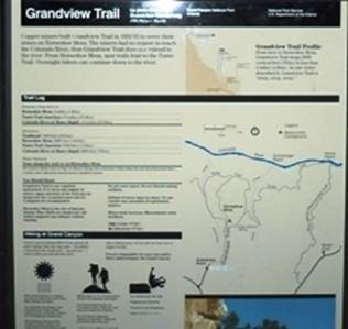
Profile of the East Tonto Trail
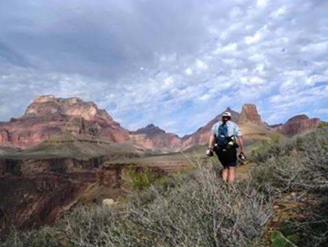
Civilization was now left behind. No noisy out-of-shape hikers would be seen on this trail. It would just be me and the amazing canyon.
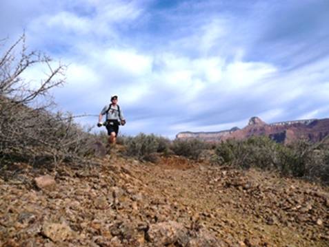
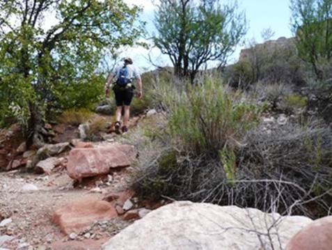
Running along the Tonto Trail
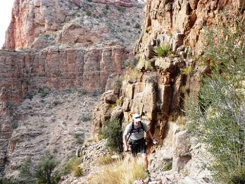
I quickly remembered why running with shorts on the Tonto Trail is a bad idea. The trail is an unmaintained single-track trail that winds its way across the Tonto Platform through very scratching bushes. My legs started to be scratched and I did my best to try to avoid the bushes. I knew my legs would be a bloody mess by the time this was over, but still with the warm day I wanted to be in shorts.
Running down into Cremation Creek
I descended down into the dry Cremation Creek area (mile 19.3) at 8:47 a.m. I thought again about Margaret Bradley, the runner who died here. I could see how the creek drainage looked like an inviting alternative instead of climbing up the ridges to South Kaibab. Later when I returned here many hours later, I really understood how difficult it would be for a seriously ill person to pull themselves up out of this place in 120 degrees. It is a tough climb and at some points even requires hands.
East of Cremation, looking back to the South Rim
Cremation Creek gets its name from Indian lore. Indians were said to scatter remains of their dead into the creek from a cliff. Knowing how hot it can get here in the summer, I think this creek area is hot enough to cremate the living.
On the Tonto Trail heading toward Lonetree Canyon
The trail took me up and out of Cremation and would now be a fairly level, rolling trail that would take me in and out of canyons for many miles as it made its way east. It was more difficult to follow on the level plateaus because the ground was rockier and foot prints fainter. At times I would run through patches of porcupine cactus. I kicked one and it sent a needle through my shoe into my little toe. I think I got it out but it bothered me for the next hour.
Checking my GPS in Lonetree Creek
As the trail turned into Lonetree Canyon, it became much more rugged and slowed my pace. I believe that the mileage from Cremation to Lonetree is about a mile longer than advertised, at least four miles instead of three. I also think the mileage doesn’t account for all the zig-zagging to avoid bushes. It was getting quite a bit warmer as the sun started to peek from behind the clouds. At Lonetree Creek (mile 22.3), I didn’t see any water. In the winter, the spring reappears. There was no sign of water today at Lonetree.
The only person I saw on the Tonto Trail
After climbing out of Lonetree, I was surprised to run into a lone lady hiker. I stopped to talk for a few minutes. She had a British accent and stated that I was the first person she had seen in two days. She had come down from Grandview with her husband, but he sprained is ankle and returned. She had gone on alone and planned to camp in one of the Cremation forks. She asked about the weather forecast and was pleased to hear it should be fine. She was amazed to hear about my long adventure plans. She asked three times, “So when will you make it back to the North Rim?” I think she just couldn’t comprehend that I would finish by tomorrow morning. I told her that I would probably pass by her camp very late at night on my return trip. I asked her about the water ahead and she confirmed that the next water was at Grapevine and then some at Cottonwood. She said both were easy to find, right on the trail. That gave me confidence and I saw no reason to ration water. I would drink all that I was carrying before reaching the next water source.
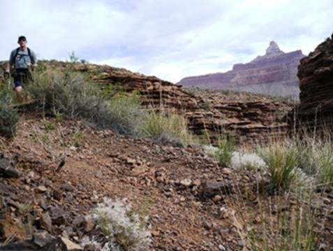
View of the Colorado River near Boulder Creek
I don’t think the view from the East Tonto Trail is not as impressive as the West Tonto near Hermits Rest. However, a view of the Colorado River finally came into view.
Climbing out of Boulder Creek
I arrived at Boulder Creek (mile 25.3) at 11:10 a.m. I had been at this for 7:40, a slow pace. But I was having fun taking pictures and taking in the view. At 11:14, I mentioned into my recorder: “I reached Boulder Creek. It is kind of the same old stuff – real rugged going down into the drainage and then some route finding to locate the trail on the other side. I’m going through some pretty rugged boulders. The clouds came in a bit. A breeze is keeping it bearable. I try to run fast, but every time I do, I lose the trail. The place to go fast is on the flat plateaus above the canyons. But up there, there is less definition to the trail and it is harder to see. I’m about 100 feet above Boulder Creek, heading north toward the Colorado River. Grapevine will be a very deep canyon, so I will swing around South for several miles.”
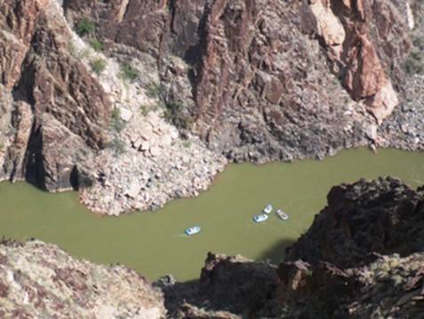
Rafters on the Colorado River
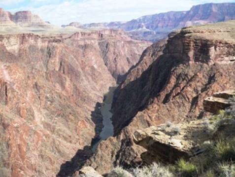
The trail swung north, very close to the deep Granite Gorge. I left the trail to get a good view and was surprised to see a river rafting group far below that had just gone through Grapevine Rapids. I let out a few whoops, hoping that they could hear me but not think I was a hiker in distress.
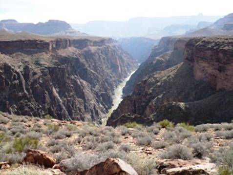
Above the confluence of Grapevine and the Colorado River
The trail next turned to the south for a long in-and-out of Grapevine Canyon. Across the canyon I could see the Tonto Trail only about a mile away, but to get there, I would have to swing around about five miles to get around the canyon.
Making a tough climb above Grapevine Creek
Later at night on the return, I lost the trail here for five minutes
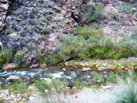
I started to really struggle for the next hour or so. It was a bad low point. My left foot started to hurt badly. The trail always had a slight slope to the left and this caused my left foot to pronate wrong. Also, my right quad was starting to ache very badly. The trail was much rougher in the Grapevine Canyon and I really looked forward to soaking my feet in the cool water of the spring. Thoughts of quitting at the South Rim started to enter into my mind. But all this was solved by eating and drinking more and taking a pain killer. I was also frustrated by my slow pace. If I tried to run fast, the bushes would tear up my legs. A slower pace made it possible to dodge the bushes. At one point a sharp cactus dug into my right shin. Blood flowed freely for several minutes. I was a mess. I finally arrived at Grapevine Creek (mile 31) at 1:13 p.m. I was disappointed to realize that spring was still another mile ahead.
Resting at Grapevine Spring
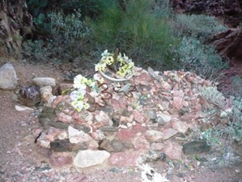
Finally, I reached Grapevine Spring. I drank a cool bottle of water and then took off my shoes to soak my feet. I was in heaven! I must have spent a half hour at the spring. I massaged my feet for about half of that time. It felt so good. This was a nice beautiful, cool oasis. I thought about a young couple, Paul and Karen Stryker, who met with tragedy along this trail in June, 1990. They didn’t bring enough water on their backpacking trip and the wife didn’t want to get water from the springs because of the “polliwogs.” By the time they reached Cremation Canyon, they were in terrible trouble. The wife went on to Phantom Ranch, but when help returned, her husband was dead. Today, I saw little “polliwogs” but didn’t care.
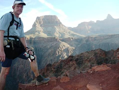
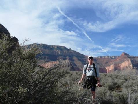
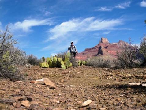
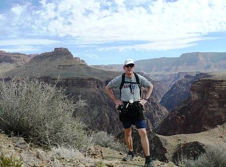
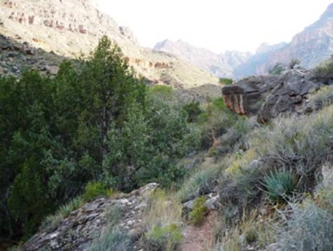
Running with Vishnu Temple in the background
Coming up out of the spring, I kicked another cactus and needles went into the same little toe. I pulled them out. Ouch! After that wonderful stop, I felt super and my pace really improved and I started to have fun again. Once out of Grapevine Canyon, the views really started to be impressive and the trail was easier. I wanted to keep up my pace in order to reach the top of the South Rim by dusk. If I didn’t, I would have to run an unfamiliar trail in the dark.
Wotan’s Throne on left, Vishnu Temple poking up at my head
The wind really started to kick up with gusts over 30 m.p.h. I watched bushes flying up into the air, being carried out and down over the canyon. I held on to my hat to avoid losing it.
At 3:00 p.m., the afternoon shade started to cover the deep canyon below. The trail again turned to the south, this time into Cottonwood Canyon toward the Grandview Trail.
Cottonwood Canyon
I arrived at Cottonwood Creek (mile 38.5) at 3:45 p.m. My adventure had now reached over 12 hours. Water was flowing and I filled my bottles. I would later regret that I didn’t fully refill my camelback.
Climbing up to Horseshoe Mesa. Cottowood Canyon below
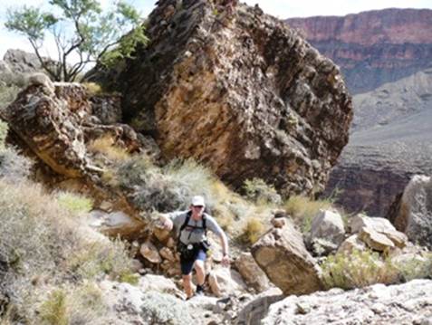
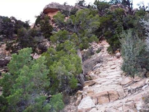
The trail now turned up, climbing to the east up to Horseshoe Mesa. It was an old primitive unmaintained trail. There weren’t enough switchbacks, so it was pretty steep in places.
Climbing along the cliffs below the mesa.
The trail made its way into a canyon and I saw signs of the old mining activity over a hundred years ago. I passed by a cave, The Cave of Domes, that I understand is pretty cool. I didn’t have time today to explore. I went right by a couple of open mines.
Mess hall ruins
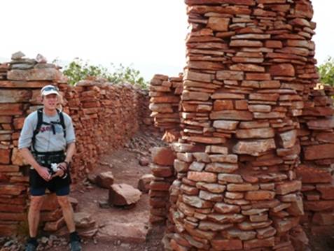
Finally I arrived at Horseshoe Mesa (mile 38.5) at 4:38 p.m. I explored the ruins of the miner’s mess hall. As I ran along the mesa, I spotted my first human in eight hours, a guy setting up a tent. As I continued on, the trails became confusing but my GPS helped me figure out which way to go at an unmarked junction.
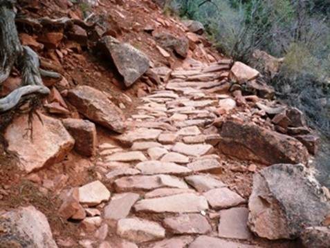
Trail paved with stones
The trail wound its way around some hills and then started to make a steep ascent on switchbacks that at times were paved with rocks put there by the miners over 100 years ago. I ran into several backpackers making their way down the trail to camp for the night. They asked me if I was coming from Horseshoe Mesa. I explained that I came from the North Rim, 40 miles away, since this morning. One lady with a heavy backpack was making her way up the trail very slowly. She assured me that she was fine, but I never saw her again. She must have camped somewhere for the night.
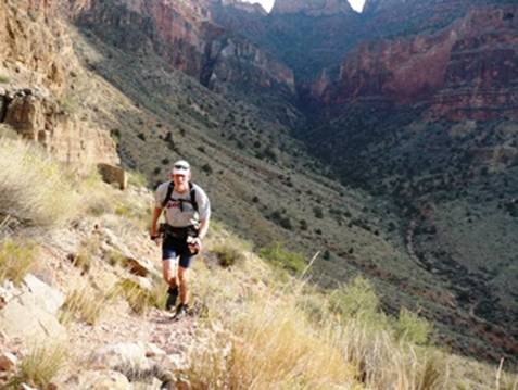
Steep rough trail heading toward the top of a false summit
The trail continued to go up and up toward the rim far above. At times I would hope that I was almost at the top, only to see a higher rim behind a ridge I had just climbed to. It was disappointing, but expected.
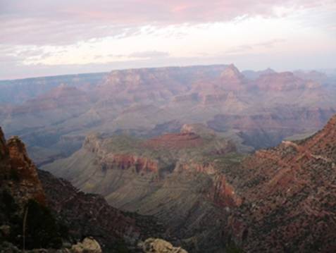
View of the Grand Canyon far below, looking toward North Rim
The sun continued to descend casting more shadows down into the Grand Canyon below. I soon discovered that I was becoming seriously dehydrated. Although I didn’t feel very thirsty, I noticed that my left ear was clogging and the veins were popping out more than normal on my hands. I quickly drank a liter of water and started to feel better. However, I was very concerned about my water supply. I needed to keep drinking to solve this dehydration problem, but if I did, I would be left with only about 10 oz. of water for the return 5-mile trip back to Cottonwood Creek. This just would not work. I knew that I needed to reach the rim before dusk while there still were some tourists there who I could beg for water.
I finally reached the top at Grandview Point (mile 41.6) at 6:40 p.m. I didn’t have to turn on my flashlight until reaching to top. Some guys from Oklahoma were trying to take sunset pictures. I followed them back to their van and asked them if they had extra water. They handed me a half gallon that I gratefully used to feel my bottles. I told them about my adventure and thanked them from “saving my bacon.”
I pulled out my satellite phone from my pack and called my wife to let her know I made it OK to the South Rim. I didn’t want to stay too long because it was cold and breezy. I started to shiver. I decided that I would start heading back down and stop for a food break at Horseshoe Mesa where it would be warm.
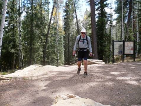
Grandview Trailhead sign
Well, 41.6 miles done, 41.6 miles to go. I turned right around and started descending down into the dark canyon again. I had not experienced any feelings about quitting for hours. My descent went well on the steep, rough trail. I arrived back at Horseshoe Mesa (mile 44.7) at 8:04 p.m. I stopped for a well-needed rest. My left foot was throbbing in pain. I took off the shoe and noticed a bad hole in the sock. I cleaned the foot, lubed the toes, and put on a clean sock. I chowed down another buritto and realized that I probably didn’t have quite enough food for the return trip. I would just have to do my best with what I had. My stop was about 20 minutes.
Dragging myself back to me feet, I continued the steep descent toward Cottonwood Creek. Soon, I started to feel much revived. The food and cool temperatures did wonders for me. The bats were very noisy. At first I thought the squeaks from my pack, but they continued when I stopped. It started to drive me “batty.” I put on my MP3 music, but still I could hear them all around me. Feeling great, I started to sing to my MP3 loudly. As I descended toward Cottonwood Creek, I heard a shout out in the dark. Obviously they were some fans of my singing. I shouted back a greeting and continued on. They must have been the man and kids camping who I had seen coming down.
I arrived back at Cottonwood Creek (mile 46.5) at 9:11 p.m. I filled my bottles again and continued on toward Grapevine Canyon. At 9:13 p.m. I said into my recorder, “It is amazing, I feel so much better.” The wind started to kick up again, this time from the southeast. During the day it had been from the north, south, and west. At 10:50 p.m., before reaching Grapevine Spring, I recorded: “It is amazing how much easier it is to navigate at night with a light. The big difference is that the light held low can pick out the footprints in the sand. In the day the sunlight washes out the footprints.” A few hours later I would be recounting that thought. I stopped at Grapevine Spring to fill all my water containers to the brim and to mix some more Instant Breakfast. I reached Grapevine Creek (mile 52.2) at 11:27 p.m.
I had a blast running for the next hour. I continued to feel super. During the day this section had been painful work. Now at night, it was pain-free fun. I was even having fun with the navigation challenges. I noticed a consistent pattern with the Tonto Trail. When it reached a drainage, it almost always continued straight across. It rarely follows the drainage up or down. Still the temptation is to follow it up and footprints would mislead me. I would chastise myself each time I made this mistake.
My split times were better than during the day. At 12:13 p.m. I recorded: “I’m doing good. Orion is in the sky straight ahead on its side. I see blinking planes going by. It is a beautiful cloudless night. I feel so much better than during the day when it was warm. Also my pack is lighter. I think my leg is better in this direction because the trail slopes to the right putting less stress on my inner right quad.” Making the turn out of Grapevine Canyon, I lost the trail and wasted about five minutes or so hunting for the trail
My pace continued to go well. I reached Boulder Creek (mile 57.9) at 12:51 a.m. Once out of the canyon, I became frustrated with my poor efforts at staying on the trail. I had so much fresh energy and wanted to run very fast, but when I did, I would lose the trail. At 2:10 a.m. I recorded a funny message. During my recording I lost the trail three times. Finally I let out a big sigh and turned off the recorder so I could hunt again for the trail. The GPS was helpful to point me in the right direction, and for short periods I would bushwhack until I came upon the trail again. At one point I lost the trail big time. I hunted for more than ten minutes. Finally I made a huge circle and found the trail again. I was never in any danger. The difficult sections to navigate were on the Tonto Platform, far away from any cliffs.
After a couple hours of this frustration, I thought that I had gone through the Cremation Creek drainage and was approaching the South Kaibab trail. I turned on my GPS and was flabbergasted to realize that I was three miles back from where I thought I was. I still had two miles before reaching Cremation! I remembered that the mileage seemed off in this section but I was shocked at how long it was taking me. It just was impossible to run fast and stay on the trail. Also, the trail seemed to go wherever it wanted, not using the usual Tonto Trail pattern of crossing drainages. I also finally realized that it had been easier to navigate during the day because the worn trail was a different color than the undisturbed soil around it. My green flashlight made this impossible to detect. I should have taken the time to get out my white headlamp.
When I finally did go through Cremation Creek again, I saw a light from someone camping. It must have been the lady I saw on the trail earlier in the day. The climb out of Cremation Creek drainage was grueling. It was very tough and I now understood why heatstroke hikers didn’t want to make this climb. At 5:09 a.m. I recorded: “It’s been hard. I’ve been off trail about 20 times. The GPS helps. Sometimes I had to go back to the last marker and try again. Now I’m ready for the Tonto to be over. It’s been too hard in the dark, at least the last five miles.” I estimated that route-finding probably cost me about two hours during the night.
Finally, at 5:42 a.m., I reached the South Kaibab Trail (mile 66.5). I could see lights of early morning hikers or runners on the trail ahead and behind. I started to chase a set of lights and almost caught them before they turned onto the River Trail. I again became badly dehydrated and concentrated on drinking as much water as possible. I would drain my last bottle before arriving back at Phantom Ranch.
Grave of a Rees B. Griffith, trail construction foreman
While running along the Colorado River, I stopped to see the grave of Rees B. Griffith, who died while constructing the South Kaibab Trail in 1922. A mammoth boulder loosened by a blast rolled down on top of him. He was carried to Camp Roosevelt (Phantom Ranch) and died six hours later. I returned to Phantom Ranch (mile 69.2) at 6:45 a.m. It was amusing to think that I was at this same spot almost 24 hours ago. Again I looked in the Canteen window and saw Phantom Ranch visitors eating their breakfast. Not much had changed in a day except that I had traveled to Grandview Point and back. Only 14 more miles to go!
I made a long stop at Phantom Ranch in efforts to revive my terribly sore left foot. A hiker watched me and wondered where I had come from. I tried to explain, but was just too tired to make things clear to him. I was pooped.
Three deer watching me from Bright Angel Creek
Can you find them?
I finally gathered my things after more than a half hour and pushed myself back up the trail. I found a decent pace and jogged up through The Box. Soon I greeted many hikers coming down from the North Rim and a few double crossing runners coming from the South Rim. One of those runners was Jeff Jones from the Phoenix area. When I mentioned my name, he knew who I was from my online writings. Jeff had recently finished his first 50-miler and had been training with several Phoenix-area ultrarunners. We had a good talk at Cottonwood Campground (mile 76.3) at about 9:30 a.m. I called my wife again to let her know I was on the way out, but would take my sweet time.
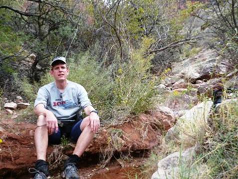
I left before Jeff did and he finally caught up to me about a mile later when I stopped to rest for five minutes. My heart rate was soaring because of the warmer temperature and my lack of sleep. I felt better sitting in the shade for a few minutes. Jeff went on and about fifteen minutes later I decided to really push the steep climb above Roaring Spring. My leg strength was still there and I could climb very fast, but soon I felt crummy. I saw no reason to race and didn’t want to end the adventure feeling sick, so I slowed down to a hiker’s pace and took plenty of rests for the rest of the climb. At 11:05 a.m. I recorded, “Well, I’m going up slow but sure. I’m being careful — stopping when my heart rate gets too high.” I wasn’t eating or drinking enough, just going in death-march mode to the finish.
Grinding my way up to the North Rim
It seemed like hundreds of hikers were coming down the trail. Because I was such a mess, they could tell that I had come a very long way. I explained to a few that I had come over 80 miles. Sometimes I just didn’t have the energy to explain.
Near the top, my thoughts turned toward all the yummy things I had in my car to eat. I avoided looking up to the rim, not wanting to evoke disappointed feelings of how much further I had to go. I tried to just look down to the trail and go forward. When I reached the last switchback, I knew I was close. Just one step in front of the other.
Stumbling my last few steps at the North Rim
Finally the end came in sight. I had done it! I had accomplished the first known double crossing from North Kaibab to Grandview Point. My finishing time was a long 34:07, at 1:07 p.m.
I quickly took off my shoes, massaged my feet, put them on the cool air conditioning vents, and enjoyed eating potato chips dipped in Ranch dressing. After I somewhat recovered, I drove toward Kanab and stopped at a side forest road to wash all the filth off of me. I felt much better. At Kanab, I checked into a motel and fell asleep by 7:30 p.m., sleeping soundly for 12 hours.
It had been a fun adventure. I really enjoyed it but was happy it was over. The energy expended felt equivalent to a pretty tough 100-miler. Two days later, fully hydrated again, I discovered that I had lost four pounds. Clearly I did not eat enough.
“Obviously they were some fans of my singing.”
NOT!
You should embed the audio in the blog. Send me the one from 2:10am or 5:09 a.m and I will see what it takes. Or is your voice recorder not computer capable?
“I wasn’t eating or drinking enough, just going in death-march mode to the finish. ”
I know this feeling. But I usually hit mine after 8 miles on the first day of climbing the four passes trail wondering where snowmass lake is!
Sounds like you pushed yourself to the limits and got a good understanding of what it might be like to be a chapter in the Death book. Glad you made it out and still want to do another one of these sometime soon.
I don’t think I have the mental toughness to ever do one of these….not to mention the physical conditioning. But it sure is fun reading about your experiences.
Great write-up.
-Carl
Hi Davy,
I really enjoyed your story. Awesome photos! It’s especially interesting to a handful of friends and me from Canada who are planning our first R2R2R this weekend. I suspect the 24-hour drive in each direction will be as tough as the 50-mile run.
We are planning to run south (Grand Canyon Village to South Kaibab) to north to south (Bright Angel). Any thoughts on were we might find a good steak in or around Grand Canyon Village when we finish?
We will share our adventure and photos at: http://www.clubfatass.com/events/flash-rim-to-rim-to-rim-r2r2r-grand-canyon-sep-2007
Congrats to you. 11 times is incredible!
Ean Jackson
Hi,
Wow, what a great run. Thanks for sharing. Some members of our running club are driving south from Vancouver on Thursday to run Rim to Rim to Rim (see last comment).
I was wondering if it is ok with you if I provide a feed to your blog on our website at http://www.clubfatass.com (see existing feeds in the right lower sidebar under Endurance on the Web) The feeds show the captions of new entries and link directly back to your blog.
Happy Trails
Sibylle
Hey Crockett:
Another great adventure with a great write-up. I’m glad all went well and search and rescue didn’t have to come down and try to find you! Looking forward to hearing about your next adventure…
DavidH
There are several good places to eat on the South Rim. (Note, the North Rim closes this week). Two cafeteries are nice: Maswik Lodge (at Rim) and Yavapai Lodge (near campground)
OK, if you can do a R2R2R 11 times maybe I can add another 5 minutes a day to my treadmilling! Good Work! Thanks for keeping us all motivated! LindaH
Pingback: Grand Canyon Grandview Double Crossing « Planet Ultramarathon
I am impressed, very impressed. I might comment that I myself did a 48 mile R – R – R as well in under 16 hours; oh, wait a minute, that was with you and you had to carry my pack for the last 2000 feet. Never mind.
Bob
“No noisy out-of-shape hikers would be seen on this trail.” — So this was quite different from when you were hiking with us last summer!
That last comment resembled me, Brad! I get it. :-)
Davy crockett rox…….>