Menu Close

The Bear 100

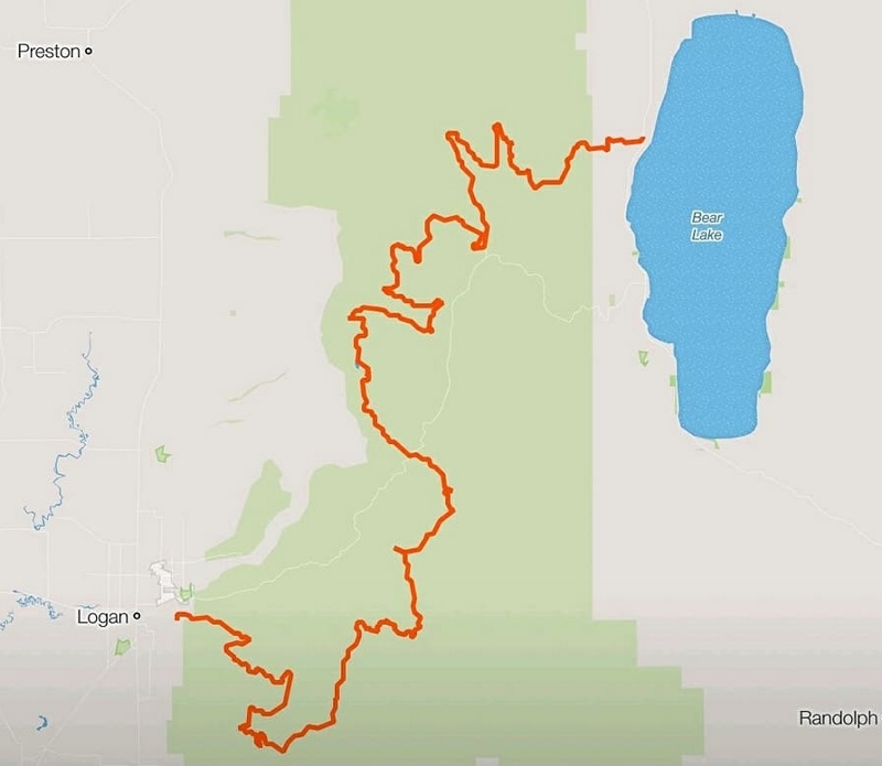
map (800x695)

The Bear 100 was the first 100-miler I attempted back in 2004.  It was a small event that year with 51 starters and you wouldn’t see other runners for many hours.  I didn’t quite finish that year, but it started my long association running The Bear. Since then I had finished it seven times and hoped to accomplish it eight times, which would make it the only 100-mile race that I have finished that many times. During the early years the course was a loop format in the mountains above Preston, Idaho, but in 2008, it changed to a point-to-point course from Logan to Bear Lake.

My summer mountain 100s had been a struggle.  Starting in July I discovered that I was having great difficulty keeping my speed up during races with steep sustained uphills. This led to DNFs at both Cascade Crest 100 and Wasatch 100 where my progress was significantly slower than any previous years. This became discouraging during both races. For the first time since my rookie year I had to keep my eye on cutoff times.  This was disheartening and both times and I mentally quit as I realized I would need to run well over 30 hours to finish. Leading up to the The Bear 100 I put in more effort with hill training and believed I would be fine early on, but probably would still struggle later in the race.

My best Bear finish was back in 2010 with a solid time of 26:30. I always hope to beat my best times, but this year I set realistic expectations based on my recent elderly results and put together a pace chart to finish in 32:30.  I hate running 100 miles in more than 30 hours because of the toll it takes on my body being out there for so long.  But if I wanted to finish Bear this year, I decided to expect slowness and just focus on finishing.

True end-to-end Uinta Highline Trail attempt

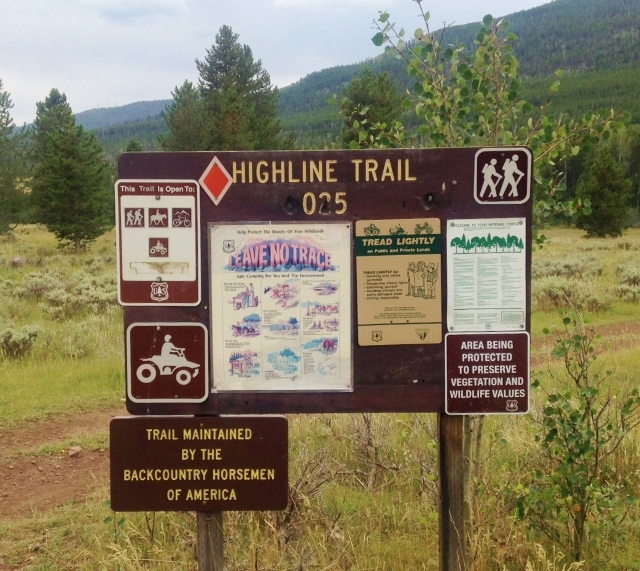
My favorite mountain range is the Uinta Mountains in Utah. There are other ranges more beautiful, but the Uintas are so remote and challenging to run and has its own special beauty. It is one of the few ranges in North America that runs east to west. The Highline Trail (#025, #083) runs nearly the length of the mountain range. In its entirety, the Highline Trail is about 107 miles long. (mileage will vary because long sections are routes with no trail wear and the trail splits at times giving alternate routes.)

Eastern Trailhead
Eastern Trailhead

Many runners and hikers have considered the eastern trailhead of the Highline Trail to be the Leidy Peak trailhead, resulting in about 82 miles for the Highline Trail. I too considered that to be an end-to-end run when I ran it in 2010, the first to run it solo, unsupported. These runners and hikers are too quickly discarding the eastern portions of that trail to give themselves credit for an end-to-end Highline Trail run or hike. They are skipping 25.5 miles to the east that for decades has been documented as being part of the Highline Trail.

Soggy Uinta Highline Trail Run


The Uinta mountain range in Utah is one of the few ranges in North America that runs east to west. This mountain range contains all of the Utah peaks higher than 13,000 feet and it is the most remote mountain range in the state. The highest continuous established trail in the Uintas is the Highline Trail (#025) that runs the length of the mountain range. This very remote trail is one of the most remarkable trails in the nation. In its entirety, the trail is more than 100 miles long.  An 82-mile stretch from Leidy Peak on the east to Hayden Pass on the west is generally recognized as the end-to-end expanse of the trail. The rest of the trail is through mostly forest outside the wilderness area.

Previously in 2007 and 2010 I had successfully ran the Highline Trail (the first to run it solo), documented that experience, and shared my GPS data and waypoints for others to follow. Others have tried and succeeded in running the trail, but many have failed. This is a difficult, rugged experience that should not be taken lightly. The effort is very similar to running a tough 100-miler with no support. The reasons for difficulty are:

  • Thunderstorms are frequent in the high Uintas. If the trail gets wet, if becomes very slow and difficult.
  • The Uintas are known for its boulders. Much of the trail goes up and down boulder-strewn drainages between passes. Trail maintenance is performed infrequently because it is so remote and they don’t try to divert all the streams from going down the trail.
  • High Altitude. Much of the trail is above 10,000 feet.
  • Bail out. Once you get into the heart of the mountain range, any trailhead is about 15 miles away down rugged, difficult trails.
  • If you go in a group, there is a very, very high probability that at least one of you will need to bail out.
  • You need to take everything you need with you. The trailheads are too far away to go in and drop things off.
  • For long stretches the trail is faint or non-existant, only marked by occasional cairns. If you don’t know the way, you will get off trail, especially at night. That really slows things down. Following a GPS track or waypoints can help. Getting lost is pretty impossible for ultrarunners. All the trails heading down valleys eventually get to a trailhead with campers.

Pahvant Mountains Traverse


rangeFor years as I would drive south on I-15 by Fillmore, I would gaze up at a particular mountain range after passing the small town of Scipio, Utah. This range presents a peculiar flat horizon on top and I would wonder and dream of running along the top of that mountain range end to end. In 2016 I accomplished this run from Scipio to Richfield, a journey of about 58 mies. This mountain range is named the Pahvant Mountains, after the Pahvant tribe, a branch of the Ute Indians. The Pahvant Range merges into the Tushar Mountains on the south.

The Pahvants are rarely visited, mostly by ATV or horseback riders. A section of The Pauite ATV trail runs along a portion of the range. The range is about 44 miles long and 10 miles across. There are a number of peaks along the range over 10,000 feet high. In 2009, an ancient high-altitude Indian village site, named Pharo Heights, was discovered on the range top at 9,465 feet. The village was occupied between years 450-1300 A.D. It was likely a summer residence when the ridge was snow-free.

Double Squaw Peak 50

doubl

Squaw Peak 50 is a classic and tough 50-mile race held in the mountains above Provo, UT. During the early miles, the course climbs the slopes of Squaw Mountain (aka Squaw Peak) a prominent peak that rises above Rock Canyon, frequented by day hikers and rock climbers. It received its name back in the 1800s for “Big Elk’s squaw” who died in the canyon following a battle with pioneer settlers.

For years I had wondered if running a double Squaw Peak 50 would be possible and how tough that might be. I succeeded in 2015, running a double Squaw Peak in 29:32. I ran the first 50 loop solo and then joined the race for the second 50 with a couple hours head start. It all went very well and I was able to run with my son during portions of the second 50. that year was a mild year temperature-wise with no snow. Last year, I again attempted to run a double, but the weather was very hot and I wisely aborted after finishing the first 50.

A week before the 2017 race, I finished Pigtails 100 near Seattle, Washington. I recovered fast, so a couple days before Squaw Peak 50, I contacted John Bozung, the race director, and again received permission to run a double. Why, I’m asked? Why not? Back in 1981 I hiked up to the course for the first time and it deeply inspired me to one day explore that Wasatch back country. Little did I know. . . 

Pigtails Challenge 100

logo

I returned for the third time to run the Pigtails Challenge, a lesser-known ultra, near Seattle, Washington. There were five distances, 50K, 100K, 100 miles, 150 miles, and 200 miles. I ran the 150 in 2014 and finished the 100-mile race last year. Each time I had a great first 100-mile time of around 21 hours so I looked forward to try again.

trailhead

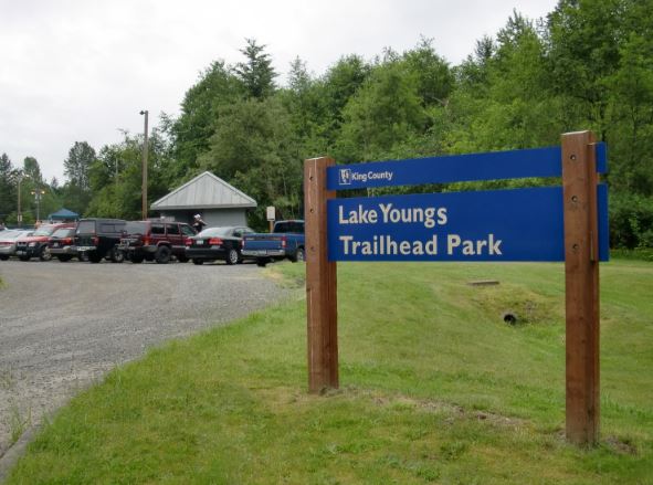
The Pigtails Challenge is held at the Lake Youngs watershed in Renton, Washington, which is only about 15 miles from where I grew up and went to high school. The 9.4-mile loop trail runs around the perimeter of a very protected reservoir that supplies drinking water for Seattle. Along the trail, there is only one place where you can get a glimpse of the lake. The course is very easy to follow because you simply run on the outside of the high fence that guards the property. It always reminds me of the movie, “The Village” where a society lives secretly in the woods behind high walls.

Buffalo Run 100

banner (580x226)

I ran the Antelope Island Buffalo Run 100 for the 4th time. Antelope Island is the largest island in the Great Salt Lake, covering 28,022 acres. It is home to bison, bighorn sheep, pronghorn, mule deer, coyotes, bobcats, upland game birds, and waterfowl. In 2006 Jim Skaggs established the first ultramarathons held on the island and in 2011 introduced a 100-miler.

In 1848, Fielding Garr established permanent residency on the island. He grazed his own herds there as well of massive herds for the Mormon Church. At times there were nearly 1,000 wild horses roaming the island. In the 1890’s, John E Dooley owned land on Antelope Island. He bought buffalo and transported them to the Island. By 1900, the small herd had multiplied to over 100 head. Recognizing the recreation potential of the island, the north 2,000 acres were acquired by the state in 1969. In 1981 the state purchased most of the rest of the island thus preserving it as a state park for all the people to enjoy. Today the number of bison on the island number about 750.

Negative 100-mile Splits

splits
In running, a negative race split is when the second half of a race is faster than the first half. Runners generally strive for negative splits in road races — marathon or shorter.  Most world records at these “shorter” distances have been achieved with negative splits.  Galen Rupp set the American record in the indoor 5K of 13:01:26.  His mile splits were 4:14, 4:12, and 4:04.  Some coaches feel that negative splits should be achieved not only by elite runners, but also by the recreation runner.

Achieving a negative split doesn’t mean that at the halfway point you need to speed up, but at some point in the second half of the race you do speed up.

A Runner’s World article stated, “Anyone can and should run negative splits.  Unfortunately, most runners don’t. Instead they start in a near sprint, hang on through the middle and resort to a survivor’s shuffle at the end.”

Should you try to achieve negative splits during a 100-miler?  I’ve seen many do that survivor’s shuffle at the end and in a few races I’ve done it too. Certainly it is possible to do a negative split 100, but I have never come very close to achieving it in all my 89 100-mile finishes.  I believe I could do it if I purposely held back significantly during the first 50, but I believe my overall time would end up much slower.

Click here to continue reading

Miles and Miles

milesIn 2002, I started to keep track of the number of miles I ran, starting with my very first Mount Timpanogos hike in Utah. That kicked off my desire to stay fit and run on trails. At first when recording miles, I was somewhat of a trail snob, only keeping track of miles run on trails. Somehow I put in my mind the thought that unless the miles were on trails, they didn’t count. But I soon came to my senses and kept track of all my miles. For that first year I ran 691 miles. As I strived to lose weight, I also kept track of swimming miles and over the first three years swam 333 miles.

People have attempted to find the person who has run the most lifetime miles. Because proof with running logs are not very good, the best documented record probably is held by Dr. Herbert Fred of Houston, with more than 250,000 miles by the age of 85 in 2014. He kept many logbooks. His biggest year was in 1966 when he ran 7,661.5 miles. In 2011 he ran 2,886 miles at the age of 82. In April 2014, he surpassed 250,000 miles. That is further than running all the way to the moon (238,900 miles).

Click here to continue reading

Trail Trashed 100

logo

I ran the Trail Trashed 100, put on by Triple Dare Running Company, held in foothills of the McCollough Range above Henderson, Nevada, near Las Vegas. This was the first time a 100-mile race was put on as a part of this running event. Other distances included 50 miles, marathon, half-marathon, 10K and 5K. I discovered the race only ten days before and decided to register. The course was only four miles from my son’s apartment in Henderson. I would be attempting to finish three 100-milers in a four-week period.

The Trail Trashed 100-mile course consists of four 25-mile loops. As I researched the course and pieced together Strava segments, I discovered that this would not be an easy 100-miler, with about 16,000 feet of climbing. “Not easy” turned out to be an understatement. This turned out to be one of the toughest 100-milers I had run in several years.

Jackpot 100

logoI ran Jackpot 100 again, held at Cornerstone Park near Las Vegas, in Henderson, Nevada. This race is a loop-format race on a 2.38-mile course through the park. Various races are held concurrently, 48-hour, 24-hour, 100-mile, 12-hour, six-hour, and marathon. I chose to run the 100-miler. Last year I finished in 6th, with a time of 20:51, my best 100-mile time of the year. I looked forward to another possible fast race.

But this year a terrible rain storm was forecast and the rain would pour for hours. I came prepared with rain gear and mentally prepared myself for potentially miserable race conditions. My goal was to finish in the top-five and hopefully run faster than my time last year. But I didn’t have firm, high expectations. Two weeks ago I finished Rocky Raccoon 100 and I had been sick with a sinus infection ever since, with very little training.