Menu Close

Category: Adventure Runs

Eight highest peaks in Utah County

peaks

Early on during my running career (12 years as of 2015), the activity of “Peak Bagging” got my attention.  Usually that involves attempting to summit a large set of peaks over time, months or years. But my approach somehow evolved into something different – trying to bag a set of peaks in one day or close to one day, in one stretch.

Double Ruby Crest

20150627_055227 (640x479)

The Ruby Mountains are a range 80 miles long in Nevada above the small cities of Wells and Elko.  They can be seen prominently from I-80 and usually are snow-covered late into the summer.  As I’ve driven by, I’ve wondered about this range rising above the desert floor and whether or not there were any good trails up there.  The range was named after garnets found by explorers. Some of the valleys were formed by glaciers.

When a Facebook friend recently went to run the mountains I discovered the existence of the Ruby Crest National Recreation Trail, most of which runs through the Ruby Mountains Wilderness area between 8,000 and 11,000 feet elevation.  Much of the trail was constructed by the CCC, probably in the 1950s. Recorded distances for the trail vary.  A sign at the northern Lamoille trailhead states that the trail is 43 miles long, but according to my GPS watches, and considering not cutting switchbacks, trailhead to trailhead is about 33.7 miles. If you use the shorter pack trail alternative on the north end, the distance is about 33.3 miles.

Oquirrh Mountain Traverse

Flat Top mountain and the Oquirrh mountains

The Oquirrh Mountains is a mountain range that runs north-south for 30 miles on the west side of Salt Lake Valley and Utah County. The mountains have been mined in gold, silver, lead and copper including one of the largest open pit copper mines, Bingham Canyon (Kenicott) mine. I’ve climbed up to the ridge top in three spots and have always wondered if it was possible to traverse the entire southern portion of the range along the ridge top, starting from the desert floor at Fairfield to Butterfield Canyon.  I knew it would be pretty rugged and slow at times, but for several years I had wanted to attempt it.

Timing for this adventure was critical because water needs.  I had no desire to haul large quantities of water along the way and there are no convenient access points along the way to drop off supplies.  The solution is to use snow fields, but the fields shouldn’t be deep enough to obscure the trails along the way. Thus the right time to try this would be late spring or late fall.

Repeats: Quad top of Y mountain

Y-Mountain-Provo (1024x768) (640x480)

Periodically I like to insert “repeats” into my training.  I will select a difficult day hike and see how many times in a row I can do it in, at a much faster pace than hikers.  Not only is this a good physical challenge, but it is a significant mental challenge.  My theory is that if I can toughen up myself mentally too, when times get tough during a long race, I will be less likely to quit.  Instead of quitting, you figure out how to continue on with a memory and assurance that with adjustments things will improve.  With “repeats” it is easy to quit because you come back to your starting point, which is a way out toward rest and comfort.

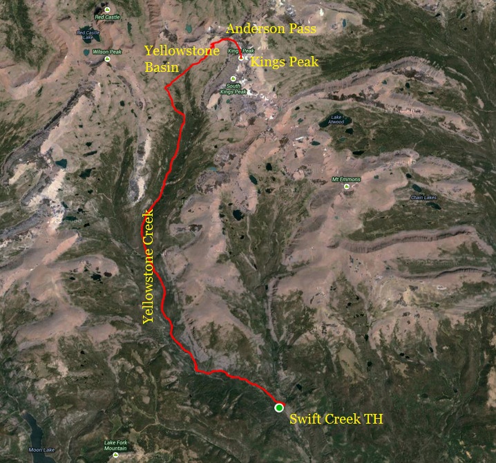
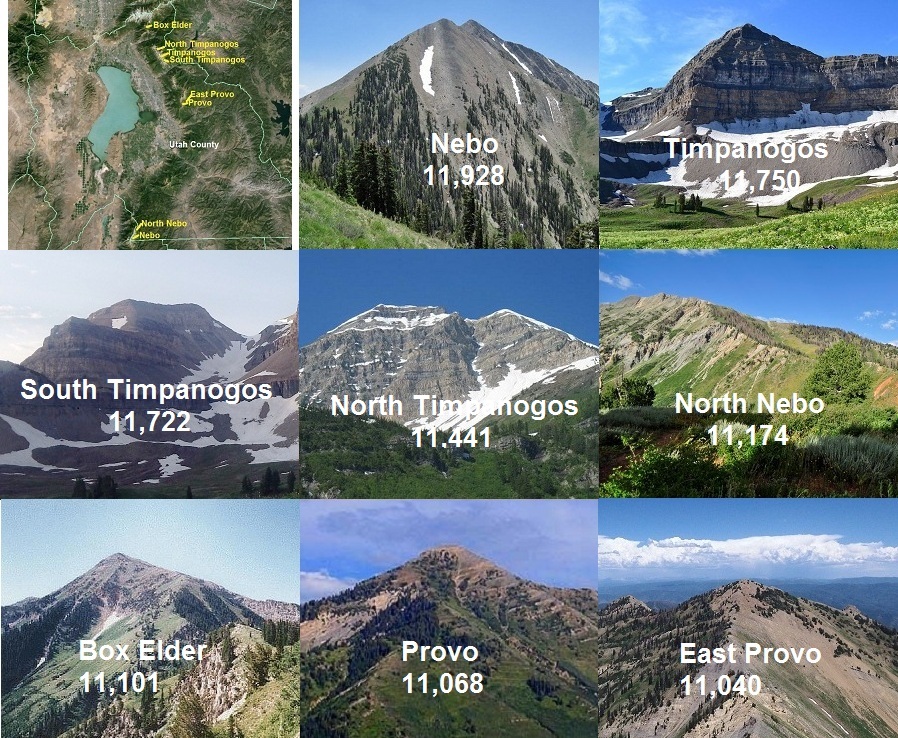
For me, the rules for summit repeats include starting at an established trailhead, climb to the summit and then return to the trailhead.  Then do it again, and again. Past repeats I’ve accomplished have included my repeats on Mount Timpanogos, the most consisting of five consecutive summits (24,000 feet of climbing in 70 miles).  I’ve also accomplished Kings Peak (highest peak in Utah) repeats, accomplishing two consecutive summits, which I have done on three different occasions (9,000 feet in 52 miles).  All three times I hoped to do three summits, but just didn’t have the mental push to run it one more time.  Behind my house, I did four consecutive summits of Lake Mountain (12,000 feet of climbing in 36 miles).  Others have tried to match or beat some of these accomplishments, but so far the records are safe.

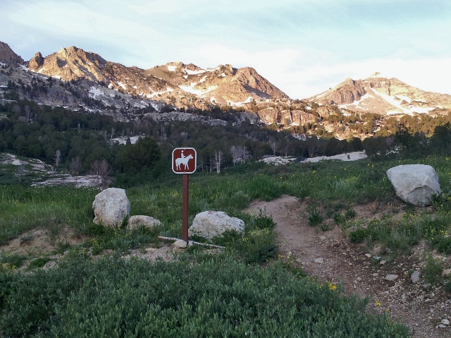
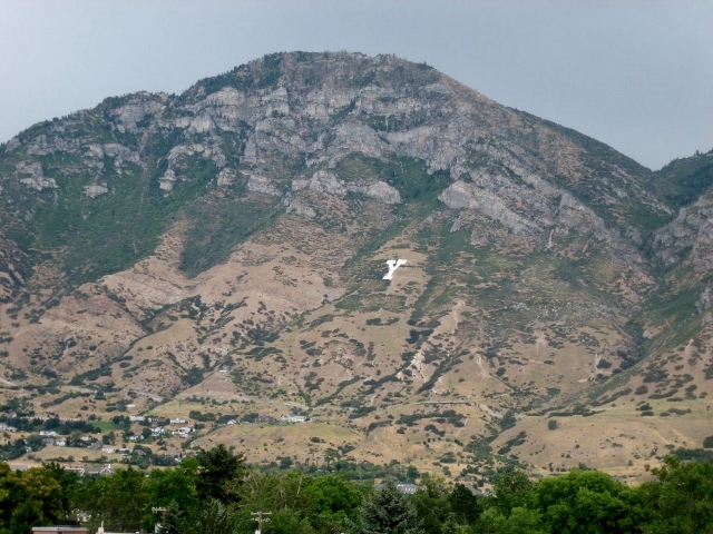
As the snow melts from the tops of the mountain and late spring arrives, I shift my training from long runs on lowland terrain to climbs into the mountains.  This Saturday I was interested to start doing some serious vertical training and I selected Y Mountain above Provo, Utah, as my destination for doing repeats.  See good article on the Y mountain trail.

End to end Lake Mountain run on the spine (top ridge)

20150502_110351 (200x152)

Lake Mountain rises 3,200 feet behind my home.  Much of my training takes place in its foothills.  A week ago I finished Salt Flats 100 which was a good race for me. I recovered very fast and by Thursday was itching to run again.  On Friday I tested things out and did a tough run from the Utah Lake shoreline to the top of Lake Mountain, a 12-mile round trip that climbs 3,200 feet.  I felt recovered and again ready for a long run this weekend.

I decided to do some unfinished business.  I wanted to run the entire Lake Mountain ridge line all the way from Eagle Mountain Ranches to the Soldier Pass road, about 16 miles.  I once did this, but not quite right, I skipped the last two miles of ridges and descended into a valley and didn’t run all the way back around to my starting point.  I wanted to go the entire distance without using any valleys to go up or down, something I’m sure no one has accomplished before.  Yes, it would be pretty crazy and required some careful study and planning, but it would be possible.

Tour de Cedar Valley – 54 miles

With recent cold spring storms, I chose this weekend to stay in the lowlands for a long run. The day before I got the idea of running all the way around massive Cedar Valley which lies about five miles west of my home. It is mostly flat, 23×7 miles and surrounded on all sides by mountains.  Because my wife was gone for the evening, I decided to make this a night training run that mentally should help me in my 100 milers as I have had increased difficulty running the entire night without problems.

Cedar Valley
Cedar Valley

I’ve run in this valley many, many times but the planned a route would take me on a few roads and trails I haven’t explored before.  I would run a giant loop in the clockwise direction. I parked my car on the east end of Eagle Mountain city center and took off running south at about 8:00 p.m.

Run around Saratoga Springs – 38.7 miles

ss

My favorite time to run is early on Saturday mornings when I have more time to run, can get up earlier and don’t have the time pressure to get into work.  Usually I have a general plan of where and how far I want to run.  At times this evolves into a somewhat random run where I explore new trails, new sights, but generally know where I am so getting lost is not possible.  Other times my long run on Saturday morning is carefully planned with an exact route and time allowed.  For me, to keep my interest in running, I rarely do the same routes over and over again.  I used to run up Mount Timpanogos multiple Saturdays in a row, but I just can’t anymore because I know the trail so well. This summer I didn’t reach the summit at all. I know every turn, almost every rock and unfortunately I now have feelings of boredom when I run up that trail. So, my quest on my long runs is usually to find something unique, challenging, perhaps something no one has accomplished before, and even better, something that no one has even considered doing.

Kings Peak, the long way – 41 miles

map

I summited Kings Peak, the highest peak in Utah for the 15th time. But this time, I did it from a trailhead on the south slope, instead of from the north. The challenge is that this route is a 41-mile round trip with 6,580 feet of climbing instead of 26 miles and 4,300 feet of climbing. I believe I’m the first person to accomplish this in a day. Typically this longer route is a four-day backpack trip.

Highest peaks in Utah County

peaks

Last year I set a crazy goal to attempt summiting the eight highest peaks (300+ feet prominence) in Utah County, all more than 11,000 feet, in a single adventure run.    The peaks in order are:

  • Mount Nebo 11,928
  • Mount Timpanogos 11,750
  • South Timpanogos 11,722
  • North Timpanogos 11,441
  • North Peak (“North Nebo”) 11,174
  • Box Elder Peak 11,101
  • Provo Peak 11,068
  • East Peak (“East Provo”) 11,040

37 miles in Capital Reef NP – Spring Canyon, Cathedral Valley

For this adventure run, I again traveled to Capital Reef National Park, only three hours from my home.  I had always wanted to run Spring Canyon, which is a hidden deep and narrow canyon that runs west to east.  It starts near Thousand Lakes Mountain and ends at the Fremont River.   Towering above the canyon are Wingate cliffs and Navajo domes.  To run Spring Canyon downstream, there are two trailheads to access it.  Upper Spring Canyon is accessed via Holt Draw/Sulphur Creek.   Lower Spring Canyon is accessed via Chimney Rock Trailhead.   The entire length of the canyon from the entry point above Sulphur Creek is about 18 miles.  Add on to that about 5 miles to reach the entry point.  In my case, I added on another seven miles for side trips and wrong turns for a rugged 30-mile adventure.   It turned out to be an amazing all-day adventure.   I was able to quickly hitch a ride back 13 miles to my starting point. This video tells the story

Cathedral Valley is a spectacular desert valley on the North end of the park that does not see many visitors because of the long dirt road access.   I visited Lower Cathedral Valley containing the Temples of the Sun, Moon, and Stars.   These spectacular monoliths are made of pink Entrada Sandstone.  Before returning home, I did a quick seven-mile morning run around these remarkable monuments.  With no trails, I did a random run up and down dry washes and across sandy desert mounds. This video tells the story

My Path to Ultrarunning – Part 18: Adventure running in Capitol Reef National Park

Back to Table of Contents

Even more fun than running 100-mile races for me is doing solo adventure runs.  My first long solo adventure run was in 2002, to Kings Peak in Utah.  Over the years I gained more and more experience and learned how run with minimal weight on my back, but enough food and emergency items to keep me out of trouble.  I’ve now run thousands of miles solo in the back country in Utah and Arizona.  I’ll routinely do runs of 50K to 50 miles and at times up to 100 miles. 

Appendix A – My running “firsts”

Back to Table of Contents

My greatest running love is doing long solo adventure runs.  To make them even more interesting, I enjoy doing “firsts.” These are tough runs that as far as I know, no one has ever attempted or accomplished before.  By publishing these “firsts” I hope that others attempt these and even run them faster, establishing fastest known times.

My “firsts” described below were all solo and either unsupported or self-supported.  If anyone knows of someone who has accomplished these runs before or after me, I welcome the information.  When I do these runs, I don’t try for “fastest known times” because I enjoy sight-seeing and taking pictures.  My aim is to just finish. My motivation for documenting these are not to boast of “records” but to inspire others to do the same and find creative “firsts” to push the limits of what is possible.